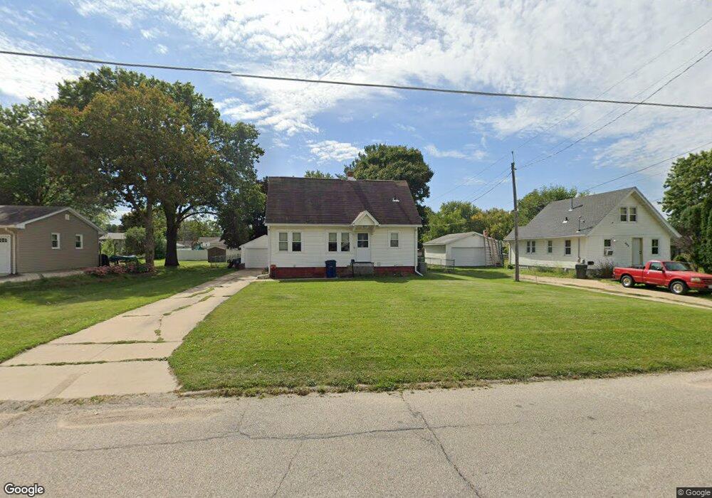
601 Martin Rd Waterloo, IA 50701
Estimated Value: $157,564 - $195,000
3
Beds
1
Bath
1,139
Sq Ft
$156/Sq Ft
Est. Value
About This Home
This home is located at 601 Martin Rd, Waterloo, IA 50701 and is currently estimated at $177,141, approximately $155 per square foot. 601 Martin Rd is a home located in Black Hawk County with nearby schools including Kingsley Elementary School, Hoover Middle School, and West High School.
Ownership History
Date
Name
Owned For
Owner Type
Purchase Details
Closed on
Jun 10, 2015
Sold by
Webber Elise M
Bought by
Deest Kimberly W Van
Current Estimated Value
Purchase Details
Closed on
Oct 13, 2011
Sold by
Vandeest Kimberly W
Bought by
Vandeest Kimberly W and Webber Elise M
Home Financials for this Owner
Home Financials are based on the most recent Mortgage that was taken out on this home.
Original Mortgage
$88,000
Interest Rate
4.22%
Mortgage Type
New Conventional
Purchase Details
Closed on
Jul 24, 2006
Sold by
Dolic Zlatko and Dolic Nisveta
Bought by
Vandeest Kimberly W
Home Financials for this Owner
Home Financials are based on the most recent Mortgage that was taken out on this home.
Original Mortgage
$18,105
Interest Rate
8.25%
Mortgage Type
Adjustable Rate Mortgage/ARM
Create a Home Valuation Report for This Property
The Home Valuation Report is an in-depth analysis detailing your home's value as well as a comparison with similar homes in the area
Home Values in the Area
Average Home Value in this Area
Purchase History
| Date | Buyer | Sale Price | Title Company |
|---|---|---|---|
| Deest Kimberly W Van | -- | None Available | |
| Vandeest Kimberly W | -- | None Available | |
| Vandeest Kimberly W | $94,000 | Cedar Valley Settlement & Es |
Source: Public Records
Mortgage History
| Date | Status | Borrower | Loan Amount |
|---|---|---|---|
| Previous Owner | Vandeest Kimberly W | $88,000 | |
| Previous Owner | Vandeest Kimberly W | $18,105 |
Source: Public Records
Tax History Compared to Growth
Tax History
| Year | Tax Paid | Tax Assessment Tax Assessment Total Assessment is a certain percentage of the fair market value that is determined by local assessors to be the total taxable value of land and additions on the property. | Land | Improvement |
|---|---|---|---|---|
| 2025 | $2,346 | $130,790 | $32,400 | $98,390 |
| 2024 | $2,346 | $118,350 | $32,400 | $85,950 |
| 2023 | $2,130 | $118,350 | $32,400 | $85,950 |
| 2022 | $2,072 | $105,840 | $32,400 | $73,440 |
| 2021 | $1,904 | $105,840 | $32,400 | $73,440 |
| 2020 | $1,870 | $92,680 | $25,920 | $66,760 |
| 2019 | $1,870 | $92,680 | $25,920 | $66,760 |
| 2018 | $1,872 | $92,680 | $25,920 | $66,760 |
| 2017 | $1,932 | $92,680 | $25,920 | $66,760 |
| 2016 | $1,904 | $92,680 | $25,920 | $66,760 |
| 2015 | $1,904 | $92,680 | $25,920 | $66,760 |
| 2014 | $1,942 | $92,680 | $25,920 | $66,760 |
Source: Public Records
Map
Nearby Homes
- 608-610 Martin Rd
- 2564 Kate St
- 0 Provision Pkwy
- 3024 W 4th St
- 3105 Ansborough Ave
- Village West 2nd Addn Lot 2
- 0 Hwy 63 Land Unit NBR20254281
- 0 Hwy 63 Land Unit NBR20255994
- 1132 W Ridgeway Ave
- 250 Sheridan Rd
- 3329 Lincolnshire Rd
- 3335 Lincolnshire Rd
- 3325 Lincolnshire Rd
- LOT W W Ridgeway Ave
- 3508 Monticello Ave
- 1022 Hilltop Rd
- 3446 Kingswood Place
- Lot 4 Marnie Ave
- Lot 1 Marnie Ave
- Lot 3 Marnie Ave
- 603 Martin Rd
- 600 Martin Rd
- 571 Martin Rd
- 2405 Delane Ave
- 608 Martin Rd Unit 610
- 2411 Delane Ave
- 551 Martin Rd
- 2368 Muncy Ave
- 558 Martin Rd
- 2419 Delane Ave
- 570 Pioneer Rd
- 576 Pioneer Rd
- 443 Meadowbrook Ln
- 564 Pioneer Rd
- 703 Martin Rd
- 549 Martin Rd
- 2362 Muncy Ave
- 552 Martin Rd
- 2423 Delane Ave
- 435 Meadowbrook Ln