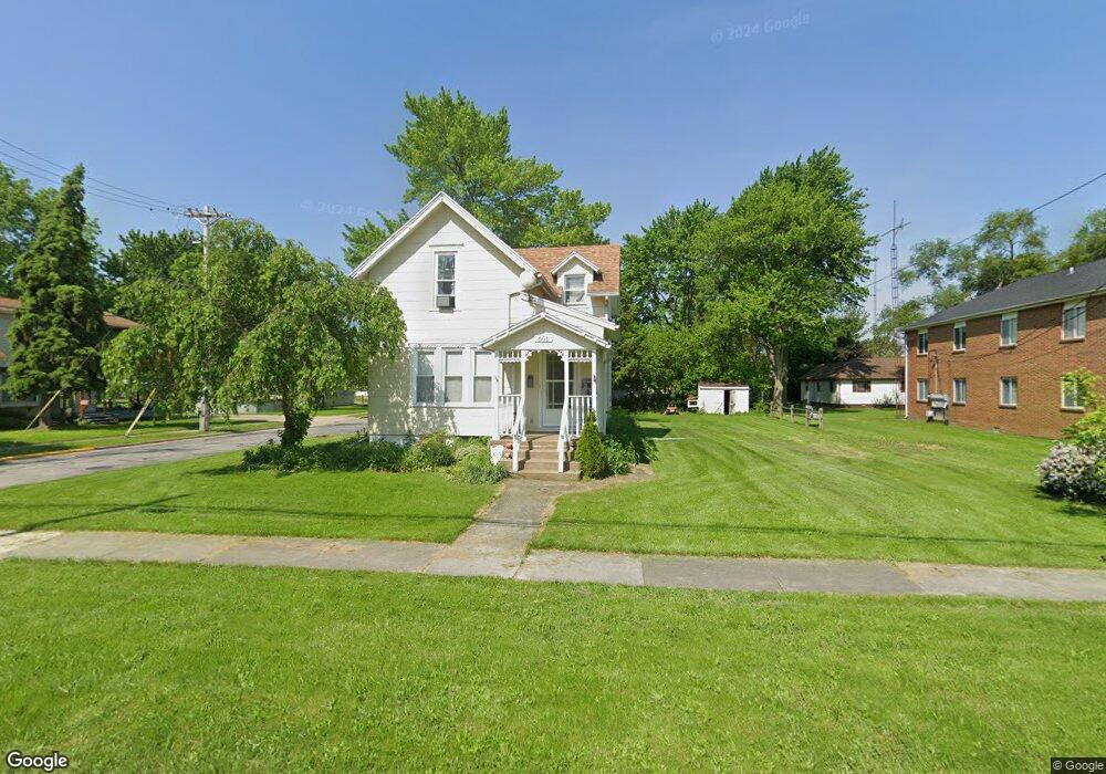
601 N Locust St Oak Harbor, OH 43449
Estimated Value: $144,000 - $208,000
3
Beds
2
Baths
900
Sq Ft
$191/Sq Ft
Est. Value
About This Home
This home is located at 601 N Locust St, Oak Harbor, OH 43449 and is currently estimated at $171,864, approximately $190 per square foot. 601 N Locust St is a home located in Ottawa County with nearby schools including Oak Harbor High School, St. Boniface Catholic School and Preschool, and Ottawa County Christian Academy.
Ownership History
Date
Name
Owned For
Owner Type
Purchase Details
Closed on
Feb 20, 2019
Sold by
Deluca Philip J and Deluca Tina A
Bought by
Sarty Paul E and Sarty Kristina M
Current Estimated Value
Home Financials for this Owner
Home Financials are based on the most recent Mortgage that was taken out on this home.
Original Mortgage
$107,516
Outstanding Balance
$94,999
Interest Rate
4.75%
Mortgage Type
FHA
Estimated Equity
$76,865
Purchase Details
Closed on
Jan 23, 2017
Sold by
Kerbel Robin L and United State Of America
Bought by
Deluca Philip J
Purchase Details
Closed on
Dec 21, 2016
Sold by
Kerbel Robin L and United State Of America
Bought by
Deluca Philip J
Purchase Details
Closed on
Jul 31, 2000
Sold by
Foust Ted A
Bought by
Mary Beth Goetz and Mary Apling
Create a Home Valuation Report for This Property
The Home Valuation Report is an in-depth analysis detailing your home's value as well as a comparison with similar homes in the area
Home Values in the Area
Average Home Value in this Area
Purchase History
| Date | Buyer | Sale Price | Title Company |
|---|---|---|---|
| Sarty Paul E | $109,500 | Hartung Title Order | |
| Deluca Philip J | $10,000 | Attorney | |
| Deluca Philip J | $10,000 | None Available | |
| Mary Beth Goetz | $69,000 | -- |
Source: Public Records
Mortgage History
| Date | Status | Borrower | Loan Amount |
|---|---|---|---|
| Open | Sarty Paul E | $107,516 |
Source: Public Records
Tax History Compared to Growth
Tax History
| Year | Tax Paid | Tax Assessment Tax Assessment Total Assessment is a certain percentage of the fair market value that is determined by local assessors to be the total taxable value of land and additions on the property. | Land | Improvement |
|---|---|---|---|---|
| 2024 | $1,640 | $36,446 | $8,859 | $27,587 |
| 2023 | $1,640 | $30,125 | $7,375 | $22,750 |
| 2022 | $1,499 | $30,124 | $7,374 | $22,750 |
| 2021 | $1,831 | $30,120 | $7,370 | $22,750 |
| 2020 | $1,672 | $27,150 | $5,270 | $21,880 |
| 2019 | $1,643 | $27,150 | $5,270 | $21,880 |
| 2018 | $1,547 | $27,150 | $5,270 | $21,880 |
| 2017 | $1,301 | $22,790 | $5,270 | $17,520 |
| 2016 | $1,302 | $22,790 | $5,270 | $17,520 |
| 2015 | $1,237 | $22,790 | $5,270 | $17,520 |
| 2014 | $608 | $22,790 | $5,270 | $17,520 |
| 2013 | $1,195 | $22,790 | $5,270 | $17,520 |
Source: Public Records
Map
Nearby Homes
- 336 N Church St
- 214 N Church St
- 236 W Main St
- 130 E Water St
- 14328 W State Route 163
- 147 E Water St
- 506 W Water St
- 328 E Water St
- 162 Oak Ridge Dr
- 12342 W State Route 105
- 11968 W Michael Dr
- 9238 W State Route 163
- 12672 W Portage River Rd S
- 2020 S Mud Creek Rd
- 2424 Stephanie Ln
- 10148 W Elmore Eastern Rd
- 14046 3rd St
- 14339 & 14363 W 3rd St
- 141 N Wexford Dr E
- 14339 3rd St
- 559 N Locust St
- 555 N Locust St
- 111 S Railroad St
- 114 Bank St
- 113 Bank St
- 549 N Locust St
- 608 N Locust St
- 117 Bank St
- 602 N Locust St
- 545 N Locust St
- 121 Bank St
- 541 N Locust St
- 540 N Locust St
- 123 S Railroad St
- 112 Houghton St
- 112 Houghton St
- 537 N Locust St
- 131 S Railroad St
- 558 N Church St
- 554 N Church St