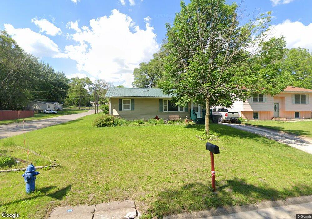
601 Nicholas St Evansdale, IA 50707
Cityview NeighborhoodEstimated Value: $100,000 - $128,690
4
Beds
1
Bath
912
Sq Ft
$124/Sq Ft
Est. Value
About This Home
This home is located at 601 Nicholas St, Evansdale, IA 50707 and is currently estimated at $112,923, approximately $123 per square foot. 601 Nicholas St is a home located in Black Hawk County with nearby schools including Highland Elementary School, George Washington Carver Academy, and West High School.
Ownership History
Date
Name
Owned For
Owner Type
Purchase Details
Closed on
Aug 15, 2024
Sold by
Rooff Jessica
Bought by
Rooff Michael
Current Estimated Value
Purchase Details
Closed on
Apr 2, 2014
Sold by
Borel James
Bought by
Rooff Michael and Rooff Jessica
Home Financials for this Owner
Home Financials are based on the most recent Mortgage that was taken out on this home.
Original Mortgage
$68,136
Interest Rate
4.31%
Mortgage Type
FHA
Purchase Details
Closed on
Oct 6, 2010
Sold by
Finke Christopher J and Finke Jennifer
Bought by
Roff Michael and Borel James
Home Financials for this Owner
Home Financials are based on the most recent Mortgage that was taken out on this home.
Original Mortgage
$66,207
Interest Rate
4.87%
Mortgage Type
FHA
Create a Home Valuation Report for This Property
The Home Valuation Report is an in-depth analysis detailing your home's value as well as a comparison with similar homes in the area
Home Values in the Area
Average Home Value in this Area
Purchase History
| Date | Buyer | Sale Price | Title Company |
|---|---|---|---|
| Rooff Michael | -- | None Listed On Document | |
| Rooff Michael | -- | Black Hawk County Abstract & | |
| Roff Michael | $67,500 | Black Hawk County Abstract |
Source: Public Records
Mortgage History
| Date | Status | Borrower | Loan Amount |
|---|---|---|---|
| Previous Owner | Rooff Michael | $68,136 | |
| Previous Owner | Roff Michael | $66,207 |
Source: Public Records
Tax History Compared to Growth
Tax History
| Year | Tax Paid | Tax Assessment Tax Assessment Total Assessment is a certain percentage of the fair market value that is determined by local assessors to be the total taxable value of land and additions on the property. | Land | Improvement |
|---|---|---|---|---|
| 2024 | $1,610 | $84,400 | $7,200 | $77,200 |
| 2023 | $982 | $84,400 | $7,200 | $77,200 |
| 2022 | $954 | $53,620 | $7,200 | $46,420 |
| 2021 | $1,060 | $53,620 | $7,200 | $46,420 |
| 2020 | $1,038 | $55,390 | $4,320 | $51,070 |
| 2019 | $1,038 | $55,390 | $4,320 | $51,070 |
| 2018 | $1,034 | $55,390 | $4,320 | $51,070 |
| 2017 | $1,070 | $55,140 | $4,320 | $50,820 |
| 2016 | $1,250 | $55,140 | $4,320 | $50,820 |
| 2015 | $1,250 | $55,140 | $4,320 | $50,820 |
| 2014 | $1,168 | $50,520 | $4,320 | $46,200 |
Source: Public Records
Map
Nearby Homes
- 600 S View Dr
- 1900 Clearview St
- 0 Plainview & Shirley St Unit NBR20254115
- 701 Shirley St
- 1446 Ruth St
- 326 Highland Blvd
- 1865 Independence Ave
- 1235 Independence Ave
- 1127 Independence Ave
- 0 Madison Monroe Unit NBR20253026
- 211 Madison St
- 823 Glenwood St
- 1002 Mobile St
- 0 Bates St
- 225 Halstead St
- 616 Fowler St
- 235 Jackson St
- 510 Courtland St
- 307 Oneida St
- Lot 11 & 12 Webster St
- 607 Nicholas St
- 535 Nicholas St
- 613 Nicholas St
- 529 Nicholas St
- 1823 City View St
- 621 Nicholas St
- 610 Southview Dr
- 600 Southview Dr
- 523 Nicholas St
- 530 Nicholas St
- 524 Nicholas St
- 510 Southview Dr
- 626 Southview Dr
- 517 Nicholas St
- 518 Nicholas St
- 511 Nicholas St
- 512 Nicholas St
- 1906 City View St
- 500 Southview Dr
- 1910 City View St