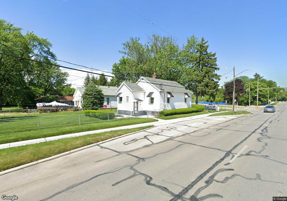
601 Parkside Blvd Toledo, OH 43607
Scott Park NeighborhoodEstimated Value: $67,022 - $94,000
2
Beds
1
Bath
756
Sq Ft
$106/Sq Ft
Est. Value
About This Home
This home is located at 601 Parkside Blvd, Toledo, OH 43607 and is currently estimated at $80,256, approximately $106 per square foot. 601 Parkside Blvd is a home located in Lucas County with nearby schools including Jesup W. Scott High School, Explorers Academy, and Explorers Academy of Science and Technology.
Ownership History
Date
Name
Owned For
Owner Type
Purchase Details
Closed on
Feb 9, 1996
Sold by
Wolniewicz Stephen J
Bought by
Whittineon Emore G
Current Estimated Value
Create a Home Valuation Report for This Property
The Home Valuation Report is an in-depth analysis detailing your home's value as well as a comparison with similar homes in the area
Home Values in the Area
Average Home Value in this Area
Purchase History
| Date | Buyer | Sale Price | Title Company |
|---|---|---|---|
| Whittineon Emore G | $28,650 | -- |
Source: Public Records
Tax History Compared to Growth
Tax History
| Year | Tax Paid | Tax Assessment Tax Assessment Total Assessment is a certain percentage of the fair market value that is determined by local assessors to be the total taxable value of land and additions on the property. | Land | Improvement |
|---|---|---|---|---|
| 2024 | $606 | $11,270 | $4,200 | $7,070 |
| 2023 | $1,062 | $8,610 | $3,290 | $5,320 |
| 2022 | $1,032 | $8,610 | $3,290 | $5,320 |
| 2021 | $979 | $8,610 | $3,290 | $5,320 |
| 2020 | $1,035 | $7,175 | $2,730 | $4,445 |
| 2019 | $987 | $7,175 | $2,730 | $4,445 |
| 2018 | $879 | $7,175 | $2,730 | $4,445 |
| 2017 | $844 | $4,550 | $2,800 | $1,750 |
| 2016 | $836 | $13,000 | $8,000 | $5,000 |
| 2015 | $785 | $13,000 | $8,000 | $5,000 |
| 2014 | $286 | $4,550 | $2,800 | $1,750 |
| 2013 | $286 | $4,550 | $2,800 | $1,750 |
Source: Public Records
Map
Nearby Homes
- 811 N University Ave
- 908 Coventry Ave
- 913 Coventry Ave
- 726 Marmion Ave
- 605 Waverly Ave
- 742 Marmion Ave
- 1114 Parkside Blvd
- 1026 Marmion Ave
- 1116 Woodstock Ave
- 1004 Waverly Ave
- 1215 Woodstock Ave
- 2145 Dorr St
- 1318 Addington Rd
- 2033 Crosswell Place
- 1310 Waverly Ave
- 1427 Potomac Dr
- 1429 Potomac Dr
- 1211 Manila St
- 1408 Roosevelt Ave
- 635 N Detroit Ave
- 603 Parkside Blvd
- 607 Parkside Blvd
- 609 Parkside Blvd
- 615 Parkside Blvd
- 619 Parkside Blvd
- 610 N University Ave
- 616 N University Ave
- 623 Parkside Blvd
- 622 N University Ave
- 2100 Nebraska Ave
- 503 N University Ave
- 621 N University Ave
- 626 Parkside Blvd
- 643 Parkside Blvd
- 631 N University Ave
- 632 Parkside Blvd
- 619 Evesham Ave
- 615 Evesham Ave
- 609 Evesham Ave
- 634 Parkside Blvd