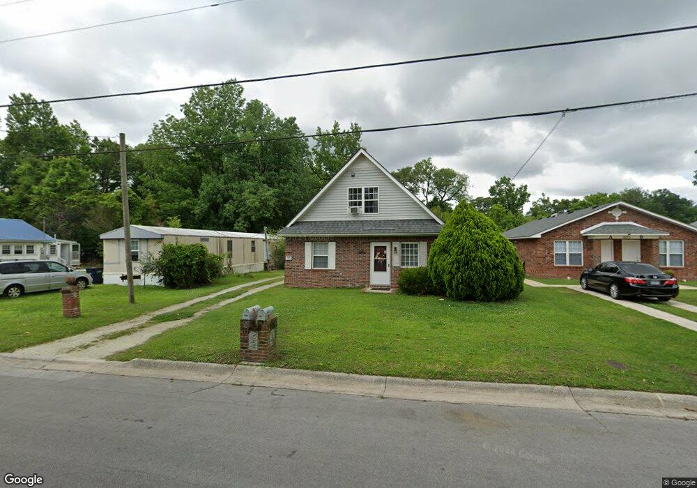
601 S Shore Dr Unit A And B Jacksonville, NC 28540
Estimated Value: $187,000 - $219,000
1
Bed
2
Baths
1,560
Sq Ft
$129/Sq Ft
Est. Value
About This Home
This home is located at 601 S Shore Dr Unit A And B, Jacksonville, NC 28540 and is currently estimated at $201,667, approximately $129 per square foot. 601 S Shore Dr Unit A And B is a home located in Onslow County with nearby schools including Clyde Erwin Elementary School, Northwoods Park Middle School, and Jacksonville High School.
Ownership History
Date
Name
Owned For
Owner Type
Purchase Details
Closed on
Oct 4, 2023
Sold by
Crumpler Development And Building Constr
Bought by
Rovner Aaron and Rovner Christiana
Current Estimated Value
Home Financials for this Owner
Home Financials are based on the most recent Mortgage that was taken out on this home.
Original Mortgage
$141,600
Outstanding Balance
$138,873
Interest Rate
7.23%
Mortgage Type
New Conventional
Estimated Equity
$62,794
Purchase Details
Closed on
Sep 16, 2019
Sold by
Gill Gary Gene
Bought by
Crumpler Development And Building Const
Home Financials for this Owner
Home Financials are based on the most recent Mortgage that was taken out on this home.
Original Mortgage
$89,250
Interest Rate
3.5%
Mortgage Type
Commercial
Purchase Details
Closed on
May 23, 2005
Sold by
Gill Delores K
Bought by
Gill Gary Gene
Create a Home Valuation Report for This Property
The Home Valuation Report is an in-depth analysis detailing your home's value as well as a comparison with similar homes in the area
Home Values in the Area
Average Home Value in this Area
Purchase History
| Date | Buyer | Sale Price | Title Company |
|---|---|---|---|
| Rovner Aaron | $190,000 | None Listed On Document | |
| Crumpler Development And Building Const | $105,000 | None Available | |
| Gill Gary Gene | -- | None Available |
Source: Public Records
Mortgage History
| Date | Status | Borrower | Loan Amount |
|---|---|---|---|
| Open | Rovner Aaron | $141,600 | |
| Previous Owner | Crumpler Development And Building Const | $89,250 |
Source: Public Records
Tax History Compared to Growth
Tax History
| Year | Tax Paid | Tax Assessment Tax Assessment Total Assessment is a certain percentage of the fair market value that is determined by local assessors to be the total taxable value of land and additions on the property. | Land | Improvement |
|---|---|---|---|---|
| 2025 | $1,515 | $120,680 | $25,000 | $95,680 |
| 2024 | $1,515 | $120,680 | $25,000 | $95,680 |
| 2023 | $1,515 | $120,680 | $25,000 | $95,680 |
| 2022 | $1,515 | $120,680 | $25,000 | $95,680 |
| 2021 | $1,323 | $98,250 | $20,000 | $78,250 |
| 2020 | $1,323 | $98,250 | $20,000 | $78,250 |
| 2019 | $1,323 | $98,250 | $20,000 | $78,250 |
| 2018 | $1,323 | $98,250 | $20,000 | $78,250 |
| 2017 | $1,432 | $108,730 | $22,500 | $86,230 |
| 2016 | $1,432 | $108,730 | $0 | $0 |
| 2015 | $1,432 | $108,730 | $0 | $0 |
| 2014 | $1,432 | $108,730 | $0 | $0 |
Source: Public Records
Map
Nearby Homes
- 302 White Oak St
- 131 Cox Ave
- 117 Puller Dr
- 209 Red Oak St
- 702 Forest Grove Ave
- 39 Sophia Dr
- 200 S Shore Dr
- 107 Marion Ct
- 119 Preston Rd
- 104 King Richard Ct
- 11A Dewitt St
- 407 Hickory Ct
- 500 Nelson Dr
- 101 Robin Rd
- 158 Settlers Cir
- 215 Nottingham Rd
- 122 Settlers Cir
- 121 Bryan St
- 200 Banks St
- 1003 River St
- 601 S Shore Dr
- 603 S Shore Dr
- 511 S Shore Dr
- 134 Sanders St
- 605 S Shore Dr
- 509 S Shore Dr
- 609 S Shore Dr
- 507 S Shore Dr
- 510 S Shore Dr
- 132 Sanders St
- 133 Moosehart Ave
- 611 S Shore Dr
- 133 Sanders St
- 130 Sanders St
- 131 Sanders St
- 503 S Shore Dr
- 129 Moosehart Ave
- 128 Sanders St
- 613 S Shore Dr
- 314 White Oak St