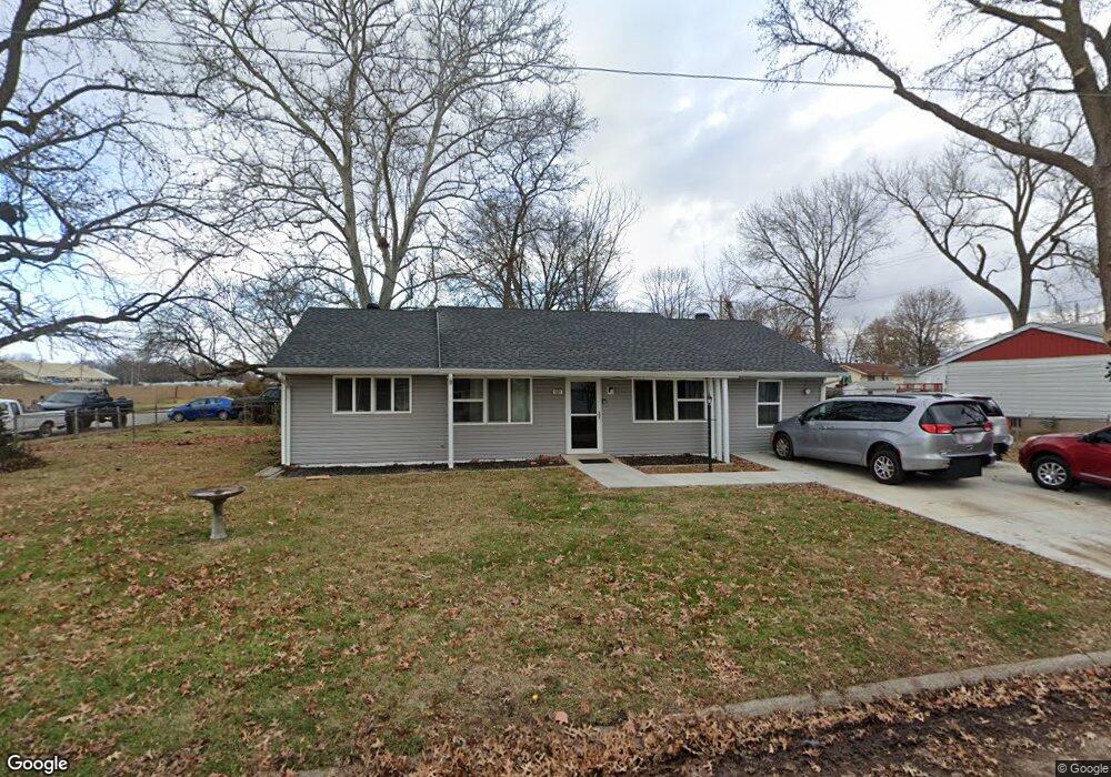
601 Saint Peter Dr Godfrey, IL 62035
Estimated Value: $127,000 - $189,000
3
Beds
2
Baths
1,323
Sq Ft
$122/Sq Ft
Est. Value
About This Home
This home is located at 601 Saint Peter Dr, Godfrey, IL 62035 and is currently estimated at $161,298, approximately $121 per square foot. 601 Saint Peter Dr is a home located in Madison County with nearby schools including Lewis & Clark Elementary School, Alton Middle School, and Alton High School.
Ownership History
Date
Name
Owned For
Owner Type
Purchase Details
Closed on
Jan 31, 2017
Sold by
C And T Rentals
Bought by
Gurteen Properties Llc
Current Estimated Value
Home Financials for this Owner
Home Financials are based on the most recent Mortgage that was taken out on this home.
Original Mortgage
$680,000
Outstanding Balance
$563,012
Interest Rate
4.2%
Mortgage Type
Purchase Money Mortgage
Estimated Equity
-$401,714
Create a Home Valuation Report for This Property
The Home Valuation Report is an in-depth analysis detailing your home's value as well as a comparison with similar homes in the area
Home Values in the Area
Average Home Value in this Area
Purchase History
| Date | Buyer | Sale Price | Title Company |
|---|---|---|---|
| Gurteen Properties Llc | -- | Attorney |
Source: Public Records
Mortgage History
| Date | Status | Borrower | Loan Amount |
|---|---|---|---|
| Open | Gurteen Properties Llc | $680,000 |
Source: Public Records
Tax History Compared to Growth
Tax History
| Year | Tax Paid | Tax Assessment Tax Assessment Total Assessment is a certain percentage of the fair market value that is determined by local assessors to be the total taxable value of land and additions on the property. | Land | Improvement |
|---|---|---|---|---|
| 2024 | $2,967 | $44,000 | $5,750 | $38,250 |
| 2023 | $2,967 | $40,620 | $5,310 | $35,310 |
| 2022 | $2,834 | $37,150 | $4,860 | $32,290 |
| 2021 | $2,601 | $34,940 | $4,570 | $30,370 |
| 2020 | $2,555 | $34,180 | $4,470 | $29,710 |
| 2019 | $2,617 | $33,280 | $4,350 | $28,930 |
| 2018 | $2,579 | $31,870 | $4,170 | $27,700 |
| 2017 | $2,468 | $31,870 | $4,170 | $27,700 |
| 2016 | $2,397 | $31,870 | $4,170 | $27,700 |
| 2015 | -- | $30,870 | $4,040 | $26,830 |
| 2014 | -- | $30,870 | $4,040 | $26,830 |
Source: Public Records
Map
Nearby Homes
- 223 Bachman Ln
- 123 Tolle Ln
- 5707 Humbert Rd
- 421 Saint John Dr
- 410 Chelsea Ct
- 504 Elm St
- 607 Mulberry St
- 5667 Humbert Rd
- 5661 Humbert Rd
- 5775 Roach Rd
- 0 Humbert Rd Unit MIS25052876
- 00 Pine Ridge Lot#52 Dr
- 212 Pine Ridge Dr
- 709 Stamper Ln
- 709 Pardee Rd
- 4805 Wick Mor Dr
- 5510 Lamotte Ln
- 5310 Godfrey Rd Unit 2
- 5504 Ladue Dr
- Tbd Godfrey Rd
- 304 Saint Thomas Dr
- 605 Saint Peter Dr
- 602 Saint Peter Dr
- 306 Saint Thomas Dr
- 505 Saint Peter Dr
- 607 Saint Peter Dr
- 604 Saint Rose Dr
- 604 Saint Peter Dr
- 606 Saint Rose Dr
- 204 Saint Thomas Dr
- 606 St Rose Dr
- 606 Saint Peter Dr
- 207 Saint Thomas Dr
- 207 St Thomas Dr
- 204 St Thomas Dr
- 609 Saint Peter Dr
- 300 Saint Joseph Dr
- 200 Saint Thomas Dr
- 605 Saint Paul Dr
- 205 Saint Thomas Dr