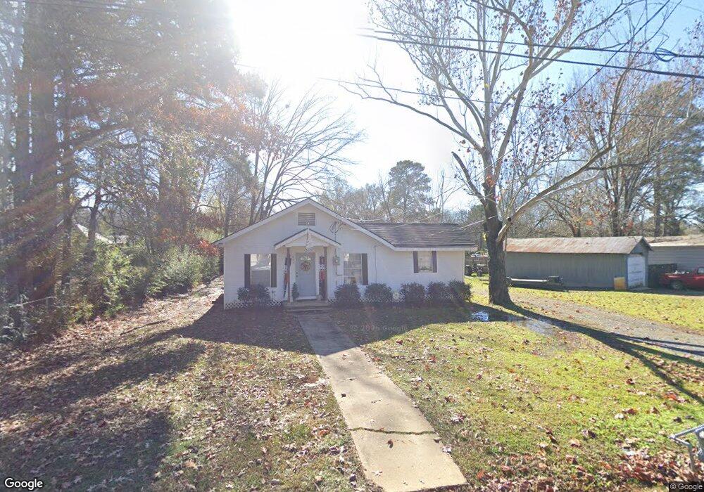
601 Simpson St Benton, LA 71006
Estimated Value: $95,000 - $140,000
2
Beds
1
Bath
976
Sq Ft
$121/Sq Ft
Est. Value
About This Home
This home is located at 601 Simpson St, Benton, LA 71006 and is currently estimated at $118,333, approximately $121 per square foot. 601 Simpson St is a home located in Bossier Parish with nearby schools including Benton Elementary School, Benton Middle School, and Benton High School.
Ownership History
Date
Name
Owned For
Owner Type
Purchase Details
Closed on
May 5, 2022
Sold by
Robert Sheppard Justin and Robert Toni
Bought by
Adams Gary Joseph and Adams Debra Jeanne
Current Estimated Value
Purchase Details
Closed on
Dec 27, 2018
Sold by
Adams Aaron M
Bought by
Sheppard Justin R
Home Financials for this Owner
Home Financials are based on the most recent Mortgage that was taken out on this home.
Original Mortgage
$83,838
Interest Rate
4.8%
Mortgage Type
Purchase Money Mortgage
Purchase Details
Closed on
Mar 11, 2011
Sold by
Cockrell Catherine Anne Hadden
Bought by
Adams Aaron M
Home Financials for this Owner
Home Financials are based on the most recent Mortgage that was taken out on this home.
Original Mortgage
$56,000
Interest Rate
4.78%
Mortgage Type
Unknown
Purchase Details
Closed on
Apr 30, 2008
Sold by
Pope Sanders Bobby Jean
Bought by
Rankin Fred Allen and Rankin Margaret L
Create a Home Valuation Report for This Property
The Home Valuation Report is an in-depth analysis detailing your home's value as well as a comparison with similar homes in the area
Home Values in the Area
Average Home Value in this Area
Purchase History
| Date | Buyer | Sale Price | Title Company |
|---|---|---|---|
| Adams Gary Joseph | $120,000 | None Listed On Document | |
| Sheppard Justin R | $83,000 | -- | |
| Adams Aaron M | $70,000 | None Available | |
| Rankin Fred Allen | $5,000 | None Available |
Source: Public Records
Mortgage History
| Date | Status | Borrower | Loan Amount |
|---|---|---|---|
| Previous Owner | Sheppard Justin R | $83,838 | |
| Previous Owner | Adams Aaron M | $56,000 |
Source: Public Records
Tax History
| Year | Tax Paid | Tax Assessment Tax Assessment Total Assessment is a certain percentage of the fair market value that is determined by local assessors to be the total taxable value of land and additions on the property. | Land | Improvement |
|---|---|---|---|---|
| 2024 | $976 | $7,202 | $940 | $6,262 |
| 2023 | $890 | $6,140 | $940 | $5,200 |
| 2022 | $886 | $6,140 | $940 | $5,200 |
| 2021 | $95 | $4,820 | $940 | $3,880 |
| 2020 | $36 | $4,820 | $940 | $3,880 |
| 2019 | $36 | $4,820 | $940 | $3,880 |
| 2018 | $36 | $4,820 | $940 | $3,880 |
| 2017 | $72 | $4,820 | $940 | $3,880 |
| 2016 | $72 | $4,820 | $940 | $3,880 |
| 2015 | $92 | $4,470 | $940 | $3,530 |
| 2014 | $92 | $4,470 | $940 | $3,530 |
Source: Public Records
Map
Nearby Homes
- 0 Pine
- 900 5th St
- 510 Lee St
- 701 Palmetto Rd
- 155 Lola Cir
- 4950 Benton Rd
- 814 Lee St
- 00 Old Plain Dealing Rd
- 0000 Old Plain Dealing Rd
- 1228 Old Plain Dealing Rd
- 326 Montgomery Ln
- 0 Lincoln Lots 5 + 6 Unit 21049903
- 0 Lincoln Lots 14 15 + 16 Unit 21049972
- 157 1st St
- 323 Caddo Ave
- 110 Seger Cir
- 106 Mildred St
- 204 Silver Leaf Dr
- 147 Silver Leaf Dr
- 1211 Lee St
- 515 Simpson St
- 607 Simpson St
- 519 Cabeen St
- 606 Simpson St
- 507 Simpson St
- 505 Simpson St
- 514 Simpson St
- 613 Simpson St
- 510 Simpson St
- 706 Simpson St
- 705 Simpson St
- 0 Simpson St Unit 231324NL
- 0 Simpson St Unit 2
- 713 Simpson St
- 714 Simpson St
- 504 Simpson St
- 615 5th St
- 402 Simpson St
- 601 5th St
- 611 5th St
Your Personal Tour Guide
Ask me questions while you tour the home.