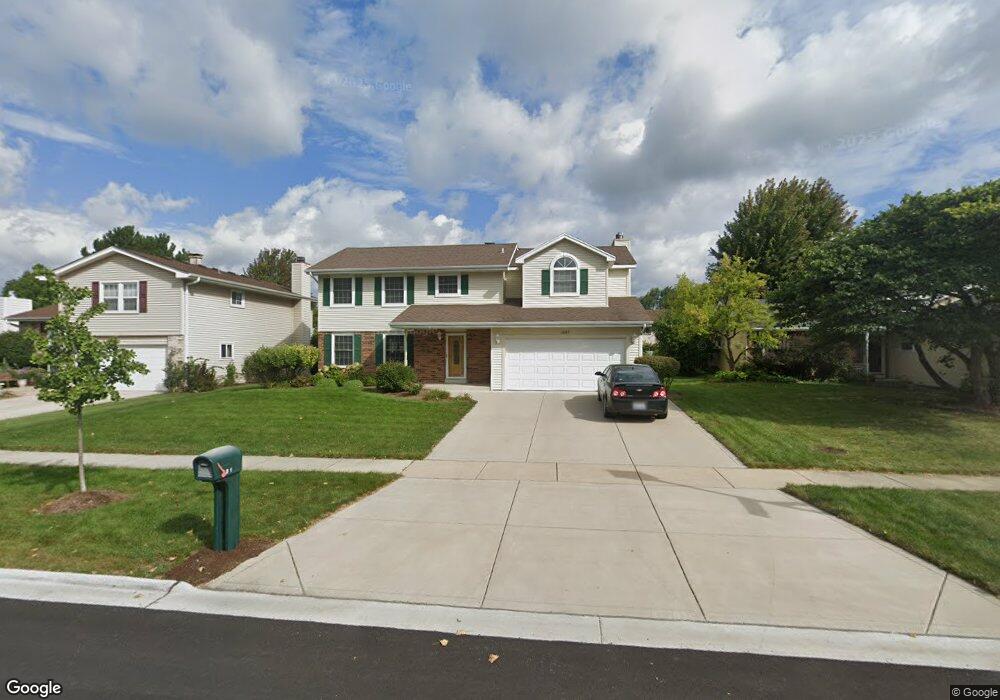
601 Tennyson Dr Wheaton, IL 60189
Southeast Wheaton NeighborhoodEstimated Value: $589,713 - $657,000
3
Beds
2
Baths
2,392
Sq Ft
$262/Sq Ft
Est. Value
About This Home
This home is located at 601 Tennyson Dr, Wheaton, IL 60189 and is currently estimated at $625,678, approximately $261 per square foot. 601 Tennyson Dr is a home located in DuPage County with nearby schools including Lincoln Elementary School, Edison Middle School, and Wheaton Warrenville South High School.
Ownership History
Date
Name
Owned For
Owner Type
Purchase Details
Closed on
Apr 28, 2025
Sold by
Lewis Robert M and Lewis Patricia M
Bought by
Lewis Family Trust and Lewis
Current Estimated Value
Purchase Details
Closed on
Jun 3, 2010
Sold by
Lewis Robert M and Lewis Patricia M
Bought by
Lewis Robert M and Lewis Patricia M
Purchase Details
Closed on
Oct 2, 1995
Sold by
Leensvaart William J and Leensvaart Sherrill L
Bought by
Lewis Robert M and Lewis Patricia
Home Financials for this Owner
Home Financials are based on the most recent Mortgage that was taken out on this home.
Original Mortgage
$142,000
Interest Rate
7.91%
Create a Home Valuation Report for This Property
The Home Valuation Report is an in-depth analysis detailing your home's value as well as a comparison with similar homes in the area
Home Values in the Area
Average Home Value in this Area
Purchase History
| Date | Buyer | Sale Price | Title Company |
|---|---|---|---|
| Lewis Family Trust | -- | None Listed On Document | |
| Lewis Robert M | -- | None Available | |
| Lewis Robert M | $177,500 | -- |
Source: Public Records
Mortgage History
| Date | Status | Borrower | Loan Amount |
|---|---|---|---|
| Previous Owner | Lewis Robert M | $142,000 |
Source: Public Records
Tax History
| Year | Tax Paid | Tax Assessment Tax Assessment Total Assessment is a certain percentage of the fair market value that is determined by local assessors to be the total taxable value of land and additions on the property. | Land | Improvement |
|---|---|---|---|---|
| 2024 | -- | $172,282 | $35,493 | $136,789 |
| 2023 | $10,176 | $158,580 | $32,670 | $125,910 |
| 2022 | $9,963 | $149,860 | $30,870 | $118,990 |
| 2021 | $9,930 | $146,310 | $30,140 | $116,170 |
| 2020 | $9,900 | $144,950 | $29,860 | $115,090 |
| 2019 | $9,673 | $141,120 | $29,070 | $112,050 |
| 2018 | $9,977 | $143,750 | $27,400 | $116,350 |
| 2017 | $9,830 | $138,450 | $26,390 | $112,060 |
| 2016 | $9,701 | $132,920 | $25,340 | $107,580 |
| 2015 | $9,628 | $126,800 | $24,170 | $102,630 |
| 2014 | $7,606 | $99,800 | $19,110 | $80,690 |
| 2013 | $7,410 | $100,100 | $19,170 | $80,930 |
Source: Public Records
Map
Nearby Homes
- 570 Riva Ct
- 840 Sheldon Ct Unit B
- 1129 Rhodes Ct
- 953 Cordova Ct
- 1315 Underwood Terrace
- 1581 Groton Ln
- 1678 Groton Ct
- 1216 E Elm St
- 1601 Castbourne Ct
- 1019 Pershing Ave
- 715 S Naperville Rd
- 1720 Lakecliffe Dr Unit A
- 1219 Golf Ln
- 1000 S Lorraine Rd Unit 214
- 510 S President St
- 30 Danada Dr
- 325 W Park Ave
- 1265 Windsor Dr
- 850 S Lorraine Rd Unit 3B
- 141 Loretto Ct
- 617 Tennyson Dr
- 587 Tennyson Dr
- 573 Tennyson Dr
- 633 Tennyson Dr
- 618 Devonshire Ln
- 588 Devonshire Ln
- 634 Devonshire Ln
- 574 Devonshire Ln
- 602 Tennyson Dr
- 559 Tennyson Dr
- 588 Tennyson Dr
- 649 Tennyson Dr
- 650 Devonshire Ln
- 574 Tennyson Dr
- 560 Devonshire Ln
- 634 Tennyson Dr
- 665 Tennyson Dr
- 546 Devonshire Ln Unit 3
- 650 Tennyson Dr
- 617 Devonshire Ln
Your Personal Tour Guide
Ask me questions while you tour the home.