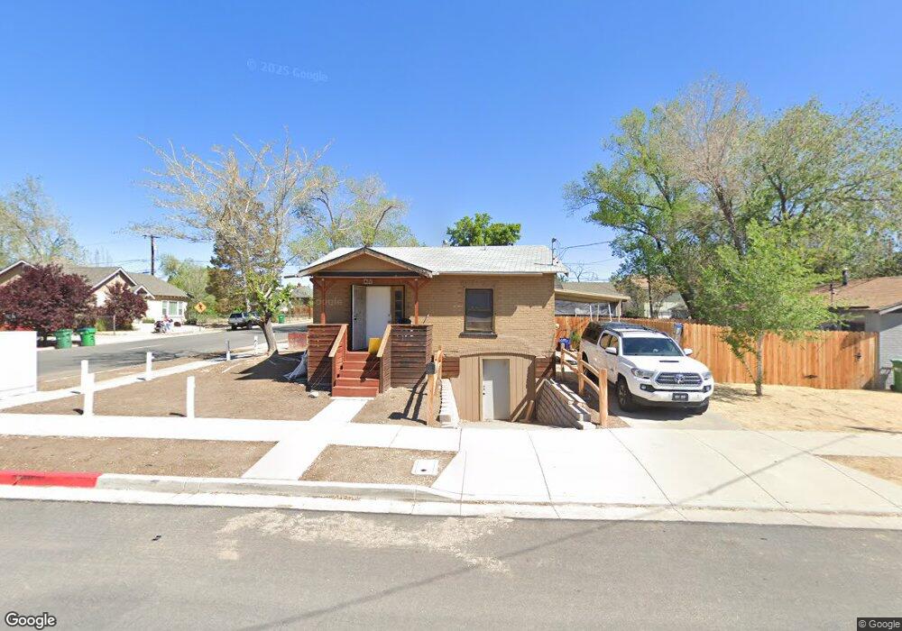
601 Thoma St Reno, NV 89502
Wells Avenue District NeighborhoodEstimated Value: $367,000 - $575,000
4
Beds
2
Baths
1,496
Sq Ft
$330/Sq Ft
Est. Value
About This Home
This home is located at 601 Thoma St, Reno, NV 89502 and is currently estimated at $494,009, approximately $330 per square foot. 601 Thoma St is a home located in Washoe County with nearby schools including Libby C Booth Elementary School, Vaughn Middle School, and Earl Wooster High School.
Ownership History
Date
Name
Owned For
Owner Type
Purchase Details
Closed on
Dec 7, 2020
Sold by
Berg Dale G and Berg Linda L
Bought by
Troendly Richard
Current Estimated Value
Purchase Details
Closed on
Apr 10, 2017
Sold by
Berg Dale
Bought by
Berg Dale G and Berg Linda L
Home Financials for this Owner
Home Financials are based on the most recent Mortgage that was taken out on this home.
Original Mortgage
$187,500
Interest Rate
4.21%
Mortgage Type
Commercial
Create a Home Valuation Report for This Property
The Home Valuation Report is an in-depth analysis detailing your home's value as well as a comparison with similar homes in the area
Home Values in the Area
Average Home Value in this Area
Purchase History
| Date | Buyer | Sale Price | Title Company |
|---|---|---|---|
| Troendly Richard | $270,200 | Stewart Title Company | |
| Berg Dale G | -- | Ticor Title Reno |
Source: Public Records
Mortgage History
| Date | Status | Borrower | Loan Amount |
|---|---|---|---|
| Previous Owner | Berg Dale G | $187,500 |
Source: Public Records
Tax History Compared to Growth
Tax History
| Year | Tax Paid | Tax Assessment Tax Assessment Total Assessment is a certain percentage of the fair market value that is determined by local assessors to be the total taxable value of land and additions on the property. | Land | Improvement |
|---|---|---|---|---|
| 2025 | $1,378 | $79,295 | $52,435 | $26,860 |
| 2024 | $1,378 | $79,062 | $52,435 | $26,627 |
| 2023 | $1,278 | $79,255 | $54,630 | $24,626 |
| 2022 | $1,185 | $64,194 | $43,391 | $20,803 |
| 2021 | $1,111 | $49,353 | $29,892 | $19,461 |
| 2020 | $1,041 | $45,049 | $25,603 | $19,446 |
| 2019 | $990 | $42,877 | $24,406 | $18,471 |
| 2018 | $959 | $33,599 | $15,628 | $17,971 |
| 2017 | $920 | $33,435 | $15,628 | $17,807 |
| 2016 | $895 | $31,162 | $13,699 | $17,463 |
| 2015 | $895 | $27,175 | $9,909 | $17,266 |
| 2014 | $870 | $25,176 | $8,645 | $16,531 |
| 2013 | -- | $22,753 | $6,650 | $16,103 |
Source: Public Records
Map
Nearby Homes