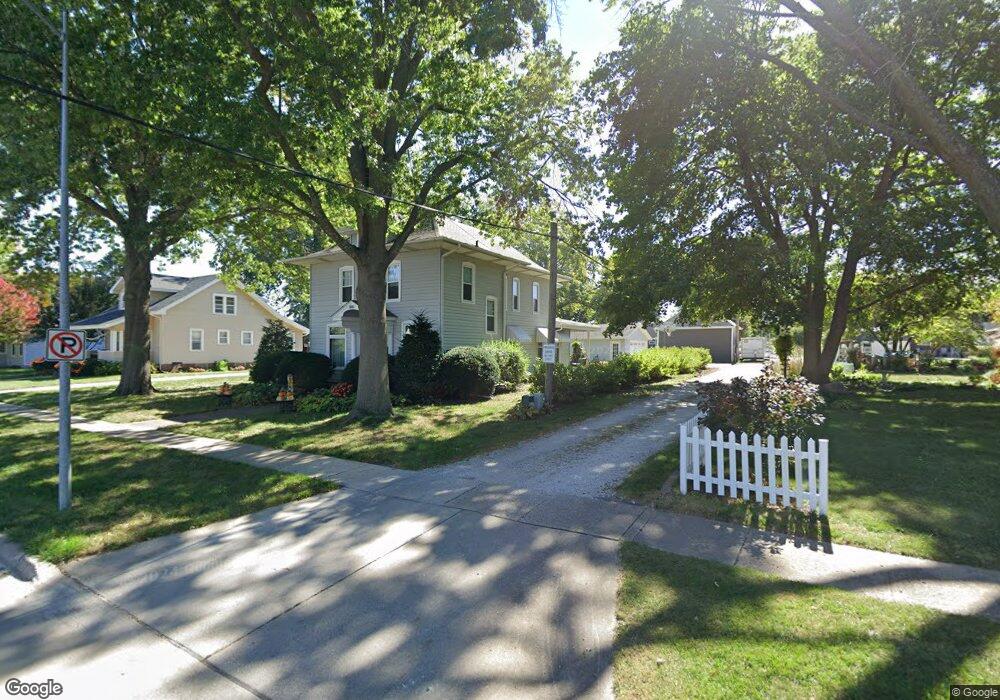
601 W Ashland Ave Indianola, IA 50125
Estimated Value: $207,000 - $304,106
4
Beds
4
Baths
1,936
Sq Ft
$139/Sq Ft
Est. Value
About This Home
This home is located at 601 W Ashland Ave, Indianola, IA 50125 and is currently estimated at $269,527, approximately $139 per square foot. 601 W Ashland Ave is a home located in Warren County with nearby schools including Indianola High School.
Ownership History
Date
Name
Owned For
Owner Type
Purchase Details
Closed on
Jan 4, 2024
Sold by
Hart Jonathan Kenneth and Hart Lindsay
Bought by
Broccolo Joshua and Broccolo Samantha
Current Estimated Value
Home Financials for this Owner
Home Financials are based on the most recent Mortgage that was taken out on this home.
Original Mortgage
$194,000
Outstanding Balance
$190,603
Interest Rate
7.22%
Mortgage Type
New Conventional
Estimated Equity
$78,924
Purchase Details
Closed on
Dec 2, 2022
Sold by
Oberender Caroll L and Oberender Laurey Y
Bought by
Caroll And Laurey Oberender Joint Revocable T
Create a Home Valuation Report for This Property
The Home Valuation Report is an in-depth analysis detailing your home's value as well as a comparison with similar homes in the area
Home Values in the Area
Average Home Value in this Area
Purchase History
| Date | Buyer | Sale Price | Title Company |
|---|---|---|---|
| Broccolo Joshua | $279,000 | None Listed On Document | |
| Caroll And Laurey Oberender Joint Revocable T | -- | -- |
Source: Public Records
Mortgage History
| Date | Status | Borrower | Loan Amount |
|---|---|---|---|
| Open | Broccolo Joshua | $194,000 |
Source: Public Records
Tax History Compared to Growth
Tax History
| Year | Tax Paid | Tax Assessment Tax Assessment Total Assessment is a certain percentage of the fair market value that is determined by local assessors to be the total taxable value of land and additions on the property. | Land | Improvement |
|---|---|---|---|---|
| 2025 | $4,464 | $274,800 | $44,900 | $229,900 |
| 2024 | $4,524 | $269,800 | $43,200 | $226,600 |
| 2023 | $4,716 | $269,800 | $43,200 | $226,600 |
| 2022 | $4,666 | $230,200 | $43,200 | $187,000 |
| 2021 | $4,670 | $230,200 | $43,200 | $187,000 |
| 2020 | $4,670 | $217,800 | $43,200 | $174,600 |
| 2019 | $4,382 | $217,800 | $43,200 | $174,600 |
| 2018 | $4,188 | $202,200 | $0 | $0 |
| 2017 | $4,188 | $202,200 | $0 | $0 |
| 2016 | $3,862 | $186,900 | $0 | $0 |
| 2015 | $3,862 | $186,900 | $0 | $0 |
| 2014 | $3,860 | $187,100 | $0 | $0 |
Source: Public Records
Map
Nearby Homes
- 700 W Boston Ave
- 507 W Clinton Ave
- 400 W Ashland Ave
- 510 W 2nd Ave
- 307 N F St
- 810 W Salem Ave
- 810 W 1st Ave
- 714 W Salem Ave
- 710 W 3rd Ave
- 701 W 3rd Ave
- 910 W Boston Ave
- 506 S Freeman St
- 305 N I St
- 509 S F St
- 2010 N 7th St
- 104 S J St
- 509 N Howard St
- 509 N I St
- 106 W Franklin Ave Unit F
- 410 N 1st St Unit 104
- 509 W Ashland Ave
- 605 W Ashland Ave
- 510 W Salem Ave
- 609 W Ashland Ave
- 602 W Salem Ave
- 508 W Salem Ave
- 600 W Ashland Ave
- 604 W Salem Ave
- 602 W Ashland Ave
- 510 W Ashland Ave
- 506 W Salem Ave
- 611 W Ashland Ave
- 604 W Ashland Ave
- 606 W Salem Ave
- 508 W Ashland Ave
- 608 W Ashland Ave
- 504 W Salem Ave
- 610 W Salem Ave
- 504 W Ashland Ave
- 105 N D St