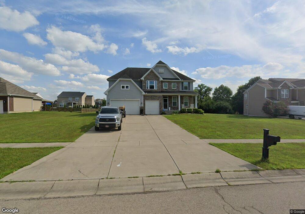
6013 Dawson Dr Middletown, OH 45044
Estimated Value: $597,674 - $693,000
4
Beds
4
Baths
3,391
Sq Ft
$194/Sq Ft
Est. Value
About This Home
This home is located at 6013 Dawson Dr, Middletown, OH 45044 and is currently estimated at $656,669, approximately $193 per square foot. 6013 Dawson Dr is a home with nearby schools including VanGorden Elementary School, Liberty Junior School, and Lakota East High School.
Ownership History
Date
Name
Owned For
Owner Type
Purchase Details
Closed on
Mar 26, 2015
Sold by
Nvr Inc
Bought by
Diangelo Brian and Diangelo Tracey
Current Estimated Value
Home Financials for this Owner
Home Financials are based on the most recent Mortgage that was taken out on this home.
Original Mortgage
$277,852
Outstanding Balance
$211,330
Interest Rate
3.73%
Mortgage Type
New Conventional
Estimated Equity
$445,339
Purchase Details
Closed on
Dec 11, 2014
Sold by
Windsor Estates Inc
Bought by
Nvr Inc
Create a Home Valuation Report for This Property
The Home Valuation Report is an in-depth analysis detailing your home's value as well as a comparison with similar homes in the area
Home Values in the Area
Average Home Value in this Area
Purchase History
| Date | Buyer | Sale Price | Title Company |
|---|---|---|---|
| Diangelo Brian | $347,315 | None Available | |
| Nvr Inc | $54,900 | None Available |
Source: Public Records
Mortgage History
| Date | Status | Borrower | Loan Amount |
|---|---|---|---|
| Open | Diangelo Brian | $277,852 |
Source: Public Records
Tax History
| Year | Tax Paid | Tax Assessment Tax Assessment Total Assessment is a certain percentage of the fair market value that is determined by local assessors to be the total taxable value of land and additions on the property. | Land | Improvement |
|---|---|---|---|---|
| 2025 | $6,985 | $179,320 | $26,260 | $153,060 |
| 2024 | $6,985 | $179,320 | $26,260 | $153,060 |
| 2023 | $6,899 | $179,320 | $26,260 | $153,060 |
| 2022 | $6,312 | $128,540 | $26,260 | $102,280 |
| 2021 | $6,279 | $128,540 | $26,260 | $102,280 |
| 2020 | $6,462 | $128,540 | $26,260 | $102,280 |
| 2019 | $10,887 | $113,020 | $25,640 | $87,380 |
| 2018 | $6,346 | $113,020 | $25,640 | $87,380 |
| 2017 | $6,467 | $113,020 | $25,640 | $87,380 |
| 2016 | $6,503 | $113,020 | $25,640 | $87,380 |
| 2015 | $864 | $14,100 | $14,100 | $0 |
| 2014 | -- | $14,100 | $14,100 | $0 |
Source: Public Records
Map
Nearby Homes
- 5893 Ashlyn Ct
- 6131 Royal Garden Ct
- 203 Shyla Ct
- 6151 Hankins Rd
- STRATTON Plan at Estates of Monroe Crossings
- VALE Plan at Estates of Monroe Crossings
- VANDERBURGH Plan at Estates of Monroe Crossings
- PARKETTE Plan at Estates of Monroe Crossings
- LYNDHURST Plan at Estates of Monroe Crossings
- BUCHANAN Plan at Estates of Monroe Crossings
- SHELBURN Plan at Estates of Monroe Crossings
- ALDEN Plan at Estates of Monroe Crossings
- BENNETT Plan at Estates of Monroe Crossings
- QUENTIN Plan at Estates of Monroe Crossings
- 513 Shawn Dr
- 511 Shawn Dr
- 404 David Lee Ct
- 390 David Lee Ct
- 395 David Lee Ct
- 393 David Lee Ct
- 6003 Dawson Dr
- 6023 Dawson Dr
- 6014 Dawson Dr
- 6024 Dawson Dr
- 6004 Dawson Dr
- 6033 Dawson Dr
- 5993 Dawson Dr
- 6012 Royal Garden Ct
- 6022 Royal Garden Ct
- 5994 Dawson Dr
- 6034 Dawson Dr
- 5983 Dawson Dr
- 6043 Dawson Dr
- 5984 Dawson Dr
- 6002 Royal Garden Ct
- 6032 Royal Garden Ct
- 6042 Royal Garden Ct
- 6044 Dawson Dr
- 6021 Royal Garden Ct
- 5973 Dawson Dr
