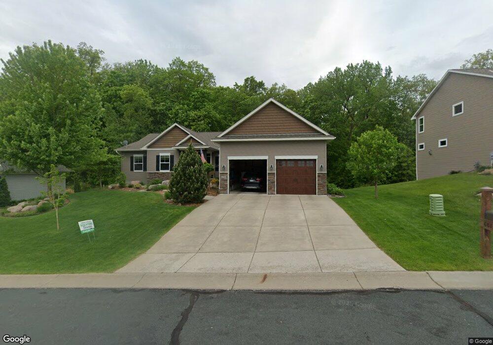
6013 Little Creek Ln Rockford, MN 55373
Estimated Value: $513,000 - $626,000
3
Beds
4
Baths
1,832
Sq Ft
$312/Sq Ft
Est. Value
About This Home
This home is located at 6013 Little Creek Ln, Rockford, MN 55373 and is currently estimated at $571,072, approximately $311 per square foot. 6013 Little Creek Ln is a home located in Wright County with nearby schools including Rockford Elementary Arts Magnet School, Rockford Middle School - Center for Environmental Studies, and Rockford High School.
Ownership History
Date
Name
Owned For
Owner Type
Purchase Details
Closed on
Jun 18, 2014
Bought by
Dawson David David
Current Estimated Value
Home Financials for this Owner
Home Financials are based on the most recent Mortgage that was taken out on this home.
Original Mortgage
$283,568
Interest Rate
4.2%
Purchase Details
Closed on
Jan 15, 2014
Sold by
Carlton Holdings Ii Llc
Bought by
Tollberg Homes Llc
Create a Home Valuation Report for This Property
The Home Valuation Report is an in-depth analysis detailing your home's value as well as a comparison with similar homes in the area
Home Values in the Area
Average Home Value in this Area
Purchase History
| Date | Buyer | Sale Price | Title Company |
|---|---|---|---|
| Dawson David David | $348,600 | -- | |
| Tollberg Homes Llc | $30,000 | -- |
Source: Public Records
Mortgage History
| Date | Status | Borrower | Loan Amount |
|---|---|---|---|
| Previous Owner | Dawson David David | $283,568 |
Source: Public Records
Tax History Compared to Growth
Tax History
| Year | Tax Paid | Tax Assessment Tax Assessment Total Assessment is a certain percentage of the fair market value that is determined by local assessors to be the total taxable value of land and additions on the property. | Land | Improvement |
|---|---|---|---|---|
| 2025 | $5,978 | $530,700 | $90,000 | $440,700 |
| 2024 | $5,492 | $511,100 | $90,000 | $421,100 |
| 2023 | $6,032 | $486,800 | $90,000 | $396,800 |
| 2022 | $6,310 | $477,000 | $85,000 | $392,000 |
| 2021 | $6,390 | $442,600 | $70,000 | $372,600 |
| 2020 | $6,226 | $438,200 | $70,000 | $368,200 |
| 2019 | $5,914 | $401,500 | $0 | $0 |
| 2018 | $5,084 | $366,200 | $0 | $0 |
| 2017 | $4,768 | $337,900 | $0 | $0 |
| 2016 | $4,592 | $0 | $0 | $0 |
| 2015 | $400 | $0 | $0 | $0 |
| 2014 | -- | $0 | $0 | $0 |
Source: Public Records
Map
Nearby Homes
- 4231 Maple Hurst Dr N
- 4040 Maple Hurst Dr S
- 4090 Maple Hurst Dr S
- XXX Jansen Ave SE
- 7021 Meadow Ct
- 6761 Maple Dr
- 8130 Ravenrock Rd
- 6630 Maple Dr
- 8041 Prairie Trail
- 3439 Hall Ave SE
- 7040 Winfield Rd
- 8530 Fir St
- 6101 Boulder Ridge Dr
- 8833 Walnut Place
- 8098 26th St SE
- 8800 86th Ave N
- XX Hamlin Ave SE
- 8907 Foust Ln
- 5311 Greenwood Ln
- 5523 Basswood Cir
- 6011 6011 Little Creek Ln
- 6011 Little Creek Ln
- 6015 Little Creek Ln
- 5021 Cherry Ln
- 6009 Little Creek Ln
- 6017 Little Creek Ln
- 2000 Little Creek Cir
- 5011 Cherry Ln
- 5020 Cherry Ln
- 6010 Little Creek Ln
- 6010 6010 Little Creek Ln
- 6019 Little Creek Ln
- 6007 Little Creek Ln
- 6008 Little Creek Ln
- 6008 6008 Little Creek Ln
- 6018 Little Creek Ln
- 2002 Little Creek Cir
- 6010 Woodhill Ln
- 5010 Cherry Ln
- 5001 Cherry Ln