Estimated Value: $107,000 - $266,000
3
Beds
2
Baths
1,400
Sq Ft
$127/Sq Ft
Est. Value
About This Home
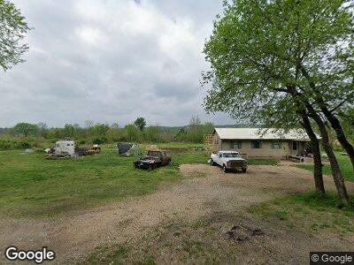
This home is located at 60138 S 4651 Rd, Watts, OK 74964 and is currently estimated at $178,189, approximately $127 per square foot. 60138 S 4651 Rd is a home with nearby schools including Westville Elementary School, Westville Junior High School, and Westville High School.
Ownership History
Date
Name
Owned For
Owner Type
Purchase Details
Closed on
Aug 10, 2016
Sold by
Red Maple Llc
Bought by
Anger Pamela K
Current Estimated Value
Home Financials for this Owner
Home Financials are based on the most recent Mortgage that was taken out on this home.
Original Mortgage
$56,745
Outstanding Balance
$46,006
Interest Rate
3.48%
Mortgage Type
New Conventional
Purchase Details
Closed on
Mar 31, 2010
Sold by
Kittle David G and Kittle Mary L
Bought by
Red Maple Llc
Purchase Details
Closed on
Jun 7, 2004
Sold by
Kittle Prop Inc
Bought by
Kittle David and Kittle Mary
Purchase Details
Closed on
May 20, 2003
Sold by
Kittle David and Kittle Mary
Bought by
Kittle Properties, Inc.
Purchase Details
Closed on
Mar 25, 2003
Sold by
Homecomings
Bought by
Kittle David and Kittle Mary
Purchase Details
Closed on
Jan 27, 2003
Sold by
Adair County Sheriff
Bought by
Homecomings
Create a Home Valuation Report for This Property
The Home Valuation Report is an in-depth analysis detailing your home's value as well as a comparison with similar homes in the area
Home Values in the Area
Average Home Value in this Area
Purchase History
| Date | Buyer | Sale Price | Title Company |
|---|---|---|---|
| Anger Pamela K | $58,500 | None Available | |
| Red Maple Llc | -- | None Available | |
| Kittle David | -- | -- | |
| Kittle Properties, Inc. | -- | -- | |
| Kittle David | $15,000 | -- | |
| Homecomings | -- | -- |
Source: Public Records
Mortgage History
| Date | Status | Borrower | Loan Amount |
|---|---|---|---|
| Open | Anger Pamela K | $56,745 |
Source: Public Records
Tax History Compared to Growth
Tax History
| Year | Tax Paid | Tax Assessment Tax Assessment Total Assessment is a certain percentage of the fair market value that is determined by local assessors to be the total taxable value of land and additions on the property. | Land | Improvement |
|---|---|---|---|---|
| 2024 | $560 | $7,168 | $1,180 | $5,988 |
| 2023 | $560 | $6,827 | $1,178 | $5,649 |
| 2022 | $507 | $6,502 | $1,176 | $5,326 |
| 2021 | $510 | $6,502 | $1,176 | $5,326 |
| 2020 | $523 | $6,642 | $1,176 | $5,466 |
| 2019 | $535 | $6,781 | $1,176 | $5,605 |
| 2018 | $518 | $6,851 | $1,176 | $5,675 |
| 2017 | $536 | $6,991 | $1,176 | $5,815 |
| 2016 | $371 | $4,801 | $567 | $4,234 |
| 2015 | $307 | $4,572 | $588 | $3,984 |
| 2014 | $307 | $4,356 | $502 | $3,854 |
Source: Public Records
Map
Nearby Homes
- 59972 S 4651 Rd
- 59972 S 4651 Rd
- 1229 Pheasant Run Rd
- 1470 Birch Bark Dr
- 1471 Birch Bark Dr
- 1372 Palomino Ln
- 1324 Pinto Cir
- 23167 Flint Ridge Dr
- 24229 Flint Ridge Dr
- 142 Dogwood Cir
- 144 Dogwood Cir
- 23174 Flint Ridge Dr
- 23200 Flint Ridge Dr
- 2480 N Saint Andrews Dr
- 24291 Augusta Dr
- 2413 Cypress Point
- 792 Mallard Rd
- 8128 W Clear Creek Rd
- 25102 Oak Tree Ct
- 2597 Oaktree Dr