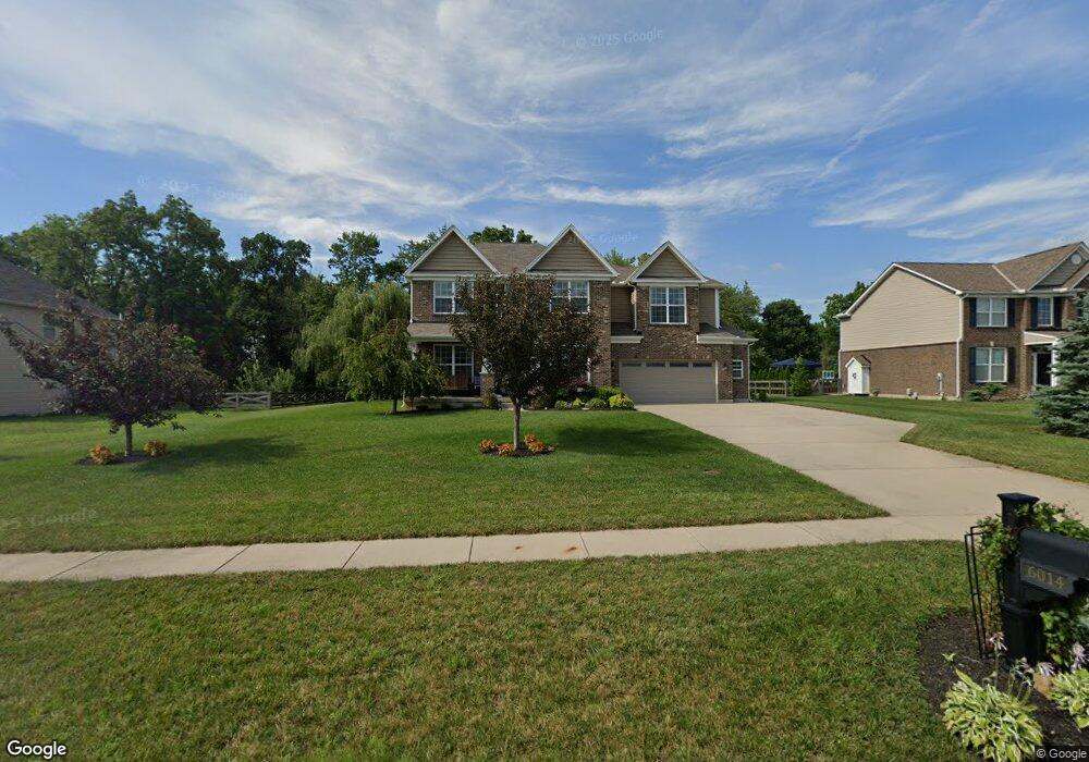
6014 Dawson Dr Middletown, OH 45044
Estimated Value: $576,047 - $635,000
4
Beds
3
Baths
3,248
Sq Ft
$185/Sq Ft
Est. Value
About This Home
This home is located at 6014 Dawson Dr, Middletown, OH 45044 and is currently estimated at $599,762, approximately $184 per square foot. 6014 Dawson Dr is a home with nearby schools including VanGorden Elementary School, Liberty Junior School, and Lakota East High School.
Ownership History
Date
Name
Owned For
Owner Type
Purchase Details
Closed on
Jul 21, 2014
Sold by
M I Homes Of Cincinnati Llc
Bought by
Hamant William Bradley and Hamant Vicki Lindsay
Current Estimated Value
Home Financials for this Owner
Home Financials are based on the most recent Mortgage that was taken out on this home.
Original Mortgage
$337,447
Interest Rate
4.15%
Mortgage Type
VA
Purchase Details
Closed on
Feb 11, 2014
Sold by
Windsor Estates Inc
Bought by
Mi Homes Of Cincinnati
Create a Home Valuation Report for This Property
The Home Valuation Report is an in-depth analysis detailing your home's value as well as a comparison with similar homes in the area
Home Values in the Area
Average Home Value in this Area
Purchase History
| Date | Buyer | Sale Price | Title Company |
|---|---|---|---|
| Hamant William Bradley | $337,447 | None Available | |
| Mi Homes Of Cincinnati | $54,900 | None Available |
Source: Public Records
Mortgage History
| Date | Status | Borrower | Loan Amount |
|---|---|---|---|
| Previous Owner | Hamant William Bradley | $337,447 |
Source: Public Records
Tax History
| Year | Tax Paid | Tax Assessment Tax Assessment Total Assessment is a certain percentage of the fair market value that is determined by local assessors to be the total taxable value of land and additions on the property. | Land | Improvement |
|---|---|---|---|---|
| 2025 | $6,176 | $158,510 | $26,320 | $132,190 |
| 2024 | $6,176 | $158,510 | $26,320 | $132,190 |
| 2023 | $6,099 | $158,510 | $26,320 | $132,190 |
| 2022 | $5,642 | $114,860 | $26,320 | $88,540 |
| 2021 | $5,612 | $114,860 | $26,320 | $88,540 |
| 2020 | $5,777 | $114,860 | $26,320 | $88,540 |
| 2019 | $10,430 | $108,270 | $25,770 | $82,500 |
| 2018 | $6,080 | $108,270 | $25,770 | $82,500 |
| 2017 | $6,197 | $108,270 | $25,770 | $82,500 |
| 2016 | $5,537 | $96,140 | $25,770 | $70,370 |
| 2015 | $5,525 | $96,140 | $25,770 | $70,370 |
| 2014 | -- | $14,170 | $14,170 | $0 |
Source: Public Records
Map
Nearby Homes
- 5904 Ashlyn Ct
- 5952 Anmer Ct
- 6131 Royal Garden Ct
- 513 Shawn Dr
- 511 Shawn Dr
- 404 David Lee Ct
- 390 David Lee Ct
- 395 David Lee Ct
- 393 David Lee Ct
- 5745 Bryson Ln
- 3280 Blue Springs Dr
- 5346 Roden Park Dr
- 3262 Blue Springs Dr
- 51 Kameron Dr
- 6035 Kyles Station Rd
- 5448 Panther Run
- 150 Stone Ridge Ln
- 6098 Hamilton Middletown Rd
- 44 Churchill Manor Ct
- 5566 Selu Dr
- 6004 Dawson Dr
- 6024 Dawson Dr
- 6013 Dawson Dr
- 6003 Dawson Dr
- 6034 Dawson Dr
- 6023 Dawson Dr
- 5994 Dawson Dr
- 6033 Dawson Dr
- 5993 Dawson Dr
- 6044 Dawson Dr
- 5984 Dawson Dr
- 6025 Hankins Rd
- 6043 Dawson Dr
- 6031 Hankins Rd
- 6022 Royal Garden Ct
- 6012 Royal Garden Ct
- 6015 Hankins Rd
- 5983 Dawson Dr
- 5991 Hankins Rd
- 5953 Ashlyn Ct
Your Personal Tour Guide
Ask me questions while you tour the home.