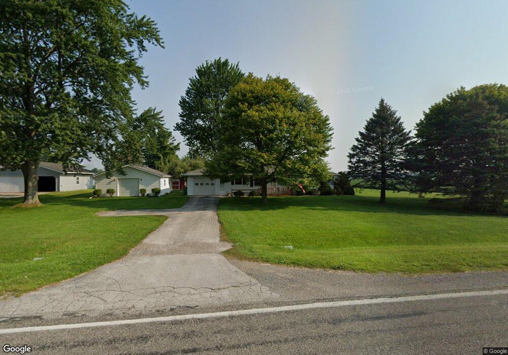
6015 Curtis Rd Bridgeport, MI 48722
Estimated Value: $146,896 - $199,000
3
Beds
1
Bath
1,075
Sq Ft
$163/Sq Ft
Est. Value
About This Home
This home is located at 6015 Curtis Rd, Bridgeport, MI 48722 and is currently estimated at $174,724, approximately $162 per square foot. 6015 Curtis Rd is a home located in Saginaw County with nearby schools including Thomas White School, Martin G. Atkins Elementary School, and Bridgeport-Spaulding Middle School - Martin G. Atkins.
Ownership History
Date
Name
Owned For
Owner Type
Purchase Details
Closed on
Oct 18, 2002
Sold by
Trea Thomas R and Wilson Dorie A
Bought by
Trea Thomas R and Thomas R Trea Revocable Living
Current Estimated Value
Purchase Details
Closed on
Jun 7, 1999
Sold by
Knickerbocker Norby V and Knickerbocker Amy L
Bought by
Trea Thomas R and Wilson Dorie A
Home Financials for this Owner
Home Financials are based on the most recent Mortgage that was taken out on this home.
Original Mortgage
$81,950
Outstanding Balance
$22,023
Interest Rate
7.28%
Mortgage Type
FHA
Estimated Equity
$152,701
Create a Home Valuation Report for This Property
The Home Valuation Report is an in-depth analysis detailing your home's value as well as a comparison with similar homes in the area
Purchase History
| Date | Buyer | Sale Price | Title Company |
|---|---|---|---|
| Trea Thomas R | -- | -- | |
| Trea Thomas R | $82,000 | -- | |
| -- | $82,000 | -- |
Source: Public Records
Mortgage History
| Date | Status | Borrower | Loan Amount |
|---|---|---|---|
| Open | -- | $81,950 |
Source: Public Records
Tax History
| Year | Tax Paid | Tax Assessment Tax Assessment Total Assessment is a certain percentage of the fair market value that is determined by local assessors to be the total taxable value of land and additions on the property. | Land | Improvement |
|---|---|---|---|---|
| 2025 | $433 | $62,900 | $0 | $0 |
| 2024 | $420 | $60,900 | $0 | $0 |
| 2023 | $400 | $53,700 | $0 | $0 |
| 2022 | $1,421 | $48,100 | $0 | $0 |
| 2021 | $1,306 | $42,600 | $0 | $0 |
| 2020 | $1,270 | $39,300 | $0 | $0 |
| 2019 | $1,208 | $37,000 | $4,500 | $32,500 |
| 2018 | $349 | $36,800 | $0 | $0 |
| 2017 | $1,094 | $34,700 | $0 | $0 |
| 2016 | $1,180 | $34,600 | $0 | $0 |
| 2014 | -- | $30,300 | $0 | $25,800 |
| 2013 | -- | $30,200 | $0 | $0 |
Source: Public Records
Map
Nearby Homes
- 6450 Curtis Rd
- 7720 Rookway Rd
- Parcel E W Rolling Hills Dr
- Parcel B W Rolling Hills Dr
- Parcel D W Rolling Hills Dr
- Parcel F W Rolling Hills Dr
- Parcel C W Rolling Hills Dr
- 6260 Lange Rd
- 3937 Curtis Rd
- 6605 Bridgeport Hwy
- 4333 Riverview Dr
- 0 Judd Rd
- 6412 Tin Lizzy Ln
- VL Fort Rd
- 3241 Curtis Rd
- 9750 Marshall Rd
- 6665 Bell Rd
- 5205 Baker Rd
- 6977 Rathbun Rd
- 6580 Bell Rd
- 5967 Curtis Rd
- 6040 Curtis Rd
- 6020 Curtis Rd
- 6082 Curtis Rd
- 6262 Curtis Rd
- 6262 Curtis Rd
- 3100 E Curtis Rd
- 0 E Curtis Rd
- 7085 Moorish Rd
- 7105 Moorish Rd
- 6180 Curtis Rd
- 1385 E Curtis Rd
- 7145 Moorish Rd
- 5917 Curtis Rd
- 6252 Curtis Rd
- 7165 Moorish Rd
- 6258 Curtis Rd
- 6258 Curtis Rd
- 5799 Curtis Rd
- 5799 Curtis Rd