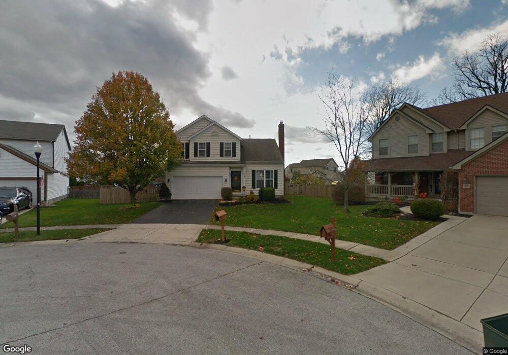
6017 MacNabb Ct Hilliard, OH 43026
Westbrooke NeighborhoodEstimated Value: $418,000 - $451,000
3
Beds
3
Baths
1,849
Sq Ft
$238/Sq Ft
Est. Value
About This Home
This home is located at 6017 MacNabb Ct, Hilliard, OH 43026 and is currently estimated at $440,287, approximately $238 per square foot. 6017 MacNabb Ct is a home located in Franklin County with nearby schools including Hilliard Station Sixth Grade Elementary School, Hilliard Memorial Middle School, and Hilliard Bradley High School.
Ownership History
Date
Name
Owned For
Owner Type
Purchase Details
Closed on
Jul 13, 2006
Sold by
James William P and James Shelly L
Bought by
Petersen Randall M and Petersen Vicki
Current Estimated Value
Home Financials for this Owner
Home Financials are based on the most recent Mortgage that was taken out on this home.
Original Mortgage
$176,200
Interest Rate
6.73%
Mortgage Type
Purchase Money Mortgage
Purchase Details
Closed on
Mar 31, 1999
Sold by
M/I Schottenstein Homes Inc
Bought by
James William P and James Shelly L
Home Financials for this Owner
Home Financials are based on the most recent Mortgage that was taken out on this home.
Original Mortgage
$159,800
Interest Rate
6.94%
Create a Home Valuation Report for This Property
The Home Valuation Report is an in-depth analysis detailing your home's value as well as a comparison with similar homes in the area
Home Values in the Area
Average Home Value in this Area
Purchase History
We collect this data history from publicly available records. To have your information removed, we recommend requesting removal directly through your county’s website.
| Date | Buyer | Sale Price | Title Company |
|---|---|---|---|
| Petersen Randall M | $198,000 | Chicago | |
| James William P | $170,400 | Transohio Residential Title |
Source: Public Records
Mortgage History
We collect this data history from publicly available records. To have your information removed, we recommend requesting removal directly through your county’s website.
| Date | Status | Borrower | Loan Amount |
|---|---|---|---|
| Previous Owner | Petersen Randall M | $176,200 | |
| Previous Owner | James William P | $159,800 |
Source: Public Records
Tax History
| Year | Tax Paid | Tax Assessment Tax Assessment Total Assessment is a certain percentage of the fair market value that is determined by local assessors to be the total taxable value of land and additions on the property. | Land | Improvement |
|---|---|---|---|---|
| 2025 | $7,369 | $130,480 | $46,970 | $83,510 |
| 2024 | $7,369 | $130,480 | $46,970 | $83,510 |
| 2023 | $6,384 | $130,480 | $46,970 | $83,510 |
| 2022 | $5,569 | $91,140 | $17,500 | $73,640 |
| 2021 | $5,563 | $91,140 | $17,500 | $73,640 |
| 2020 | $5,548 | $91,140 | $17,500 | $73,640 |
| 2019 | $5,215 | $73,150 | $14,000 | $59,150 |
| 2018 | $5,187 | $73,150 | $14,000 | $59,150 |
| 2017 | $5,193 | $73,150 | $14,000 | $59,150 |
| 2016 | $5,527 | $72,110 | $18,660 | $53,450 |
| 2015 | $5,180 | $72,110 | $18,660 | $53,450 |
| 2014 | $5,190 | $72,110 | $18,660 | $53,450 |
| 2013 | $2,503 | $68,670 | $17,780 | $50,890 |
Source: Public Records
Map
Nearby Homes
- 5994 Hampton Corners S
- 6146 Ravenhill Rd
- 5832 Heirship Ct
- 5787 Privilege Dr
- 5769 Privilege Dr
- 6408 Pinefield Dr
- 3232 Andrew James Dr
- 6116 Heritage Farms Dr
- 3260 Alton Darby Creek Rd
- 2131 Melone Dr Unit Lot 369
- 6181 Heritage Point Ct
- 5646 Westbriar Dr
- 2846 Frazell Rd
- 6581 Sherry Ln
- 2635 Westrock Dr
- 2619 Westrock Dr
- 5778 Brook Hollow Dr
- 5609 Sandbrook Ln
- 5584 Sandbrook Ln
- 2478 Alton Darby Creek Rd
- 6009 MacNabb Ct
- 6025 MacNabb Ct
- 3054 Landen Farm Rd E
- 3049 Shady Knoll Ln
- 3062 Landen Farm Rd E
- 6001 MacNabb Ct
- 3046 Landen Farm Rd E
- 3070 Landen Farm Rd E
- 3057 Shady Knoll Ln
- 5993 MacNabb Ct
- 6016 MacNabb Ct
- 3041 Shady Knoll Ln
- 3038 Landen Farm Rd E
- 3065 Shady Knoll Ln
- 6000 MacNabb Ct
- 3033 Shady Knoll Ln
- 3073 Shady Knoll Ln
- 3080 Landen Farm Rd E
- 3030 Landen Farm Rd E
- 3075 Fawn Crossing Dr
Your Personal Tour Guide
Ask me questions while you tour the home.