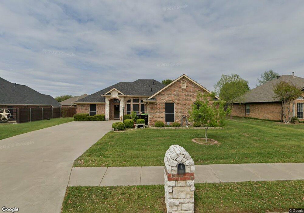
602 Acorn St Pilot Point, TX 76258
Estimated Value: $338,000 - $363,000
3
Beds
2
Baths
1,684
Sq Ft
$208/Sq Ft
Est. Value
About This Home
This home is located at 602 Acorn St, Pilot Point, TX 76258 and is currently estimated at $349,817, approximately $207 per square foot. 602 Acorn St is a home located in Denton County with nearby schools including Pilot Point Early Childhood Center, Pilot Point Elementary School, and Pilot Point Middle School.
Ownership History
Date
Name
Owned For
Owner Type
Purchase Details
Closed on
Sep 25, 2017
Sold by
Sheeder Alicia and Garcia Alicia
Bought by
Mackey Wesley E and Mackey Anna J
Current Estimated Value
Home Financials for this Owner
Home Financials are based on the most recent Mortgage that was taken out on this home.
Original Mortgage
$219,111
Outstanding Balance
$183,411
Interest Rate
3.9%
Mortgage Type
VA
Estimated Equity
$166,406
Purchase Details
Closed on
May 15, 2008
Sold by
Mathis Bonnie G
Bought by
Sheeder Alicia
Home Financials for this Owner
Home Financials are based on the most recent Mortgage that was taken out on this home.
Original Mortgage
$164,419
Interest Rate
5.89%
Mortgage Type
Purchase Money Mortgage
Purchase Details
Closed on
Jul 31, 2000
Sold by
Mcvay James C
Bought by
Mathis Bonnie G
Create a Home Valuation Report for This Property
The Home Valuation Report is an in-depth analysis detailing your home's value as well as a comparison with similar homes in the area
Home Values in the Area
Average Home Value in this Area
Purchase History
| Date | Buyer | Sale Price | Title Company |
|---|---|---|---|
| Mackey Wesley E | -- | Title Resources | |
| Sheeder Alicia | -- | None Available | |
| Mathis Bonnie G | -- | -- |
Source: Public Records
Mortgage History
| Date | Status | Borrower | Loan Amount |
|---|---|---|---|
| Open | Mackey Wesley E | $219,111 | |
| Previous Owner | Sheeder Alicia | $164,419 |
Source: Public Records
Tax History
| Year | Tax Paid | Tax Assessment Tax Assessment Total Assessment is a certain percentage of the fair market value that is determined by local assessors to be the total taxable value of land and additions on the property. | Land | Improvement |
|---|---|---|---|---|
| 2025 | $1,628 | $369,582 | $91,800 | $277,782 |
| 2024 | $6,056 | $336,420 | $0 | $0 |
| 2023 | $1,628 | $305,836 | $91,800 | $297,444 |
| 2022 | $5,716 | $278,033 | $81,000 | $228,026 |
| 2021 | $5,215 | $252,757 | $58,860 | $193,897 |
| 2020 | $5,039 | $242,506 | $58,860 | $183,646 |
| 2019 | $5,415 | $252,787 | $58,860 | $196,262 |
| 2018 | $4,986 | $229,806 | $58,860 | $170,946 |
| 2017 | $4,227 | $194,302 | $46,980 | $159,530 |
| 2016 | $3,843 | $176,638 | $37,800 | $138,838 |
| 2015 | $3,498 | $166,784 | $37,800 | $128,984 |
| 2013 | -- | $165,981 | $37,800 | $128,181 |
Source: Public Records
Map
Nearby Homes
- 1301 N Saint Charles Ave
- 561 Randys Way
- 710 Primrose Ln
- 800 E Northside Dr
- 596 Randys Way
- 0000 N Washington St
- 597 Mb's Way
- 583 Mb Way S
- 729 Amelia Ct
- 620 Ruthye Ln
- 626 Ruthye Ln
- 551 Ruthye Ln
- 709 Primrose Ln
- 723 Primrose Ln
- 497 Mb's Way
- 219 E Evans St
- 467 Mb's Way
- 829 Primrose Ln
- 736 Carson Ln
- 461 Mb's Way
Your Personal Tour Guide
Ask me questions while you tour the home.