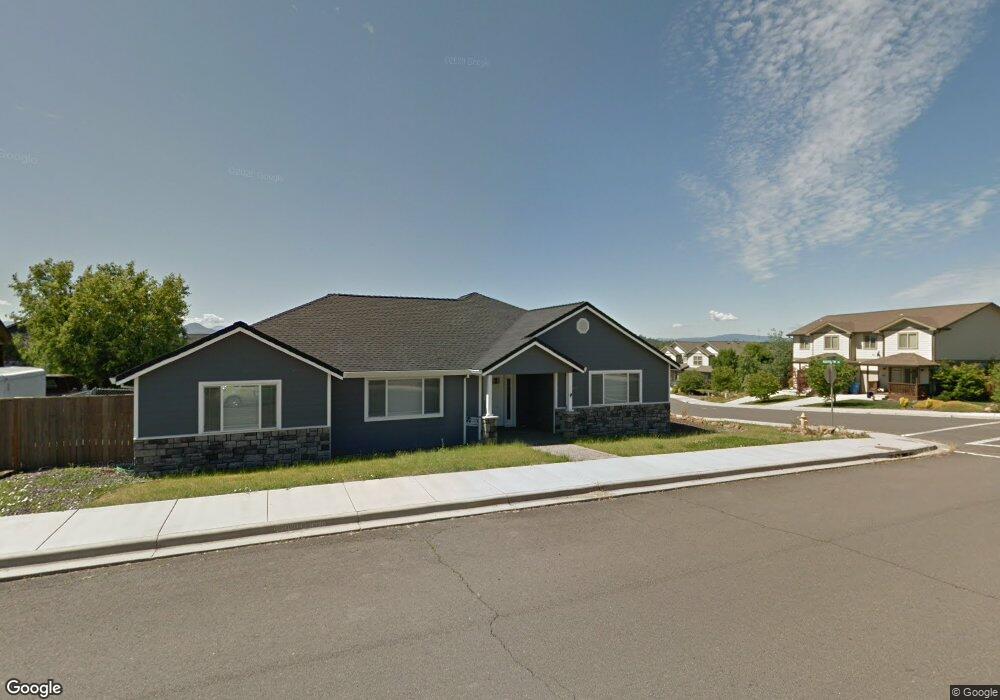
602 Barton Rd Eagle Point, OR 97524
Estimated Value: $401,000 - $457,000
3
Beds
2
Baths
1,933
Sq Ft
$224/Sq Ft
Est. Value
About This Home
This home is located at 602 Barton Rd, Eagle Point, OR 97524 and is currently estimated at $433,093, approximately $224 per square foot. 602 Barton Rd is a home located in Jackson County with nearby schools including Eagle Rock Elementary School, Eagle Point Middle School, and White Mountain Middle School.
Ownership History
Date
Name
Owned For
Owner Type
Purchase Details
Closed on
Nov 27, 2024
Sold by
Masterson Kevin J
Bought by
Masterson Kevin J and Masterson Rachelle R
Current Estimated Value
Purchase Details
Closed on
Feb 12, 2007
Sold by
Snyder Travis M and Snyder Christie
Bought by
Masterson Kevin J
Home Financials for this Owner
Home Financials are based on the most recent Mortgage that was taken out on this home.
Original Mortgage
$248,000
Interest Rate
6.25%
Mortgage Type
New Conventional
Purchase Details
Closed on
Jan 3, 2006
Sold by
Snyder Travis M
Bought by
Snyder Travis M and Snyder Christie
Purchase Details
Closed on
Jul 27, 2005
Sold by
Southern Oregon Development Llc
Bought by
Snyder Travis M
Create a Home Valuation Report for This Property
The Home Valuation Report is an in-depth analysis detailing your home's value as well as a comparison with similar homes in the area
Home Values in the Area
Average Home Value in this Area
Purchase History
| Date | Buyer | Sale Price | Title Company |
|---|---|---|---|
| Masterson Kevin J | -- | Accommodation/Courtesy Recordi | |
| Masterson Kevin J | $310,000 | Ticor Title | |
| Snyder Travis M | -- | -- | |
| Snyder Travis M | $114,900 | Amerititle |
Source: Public Records
Mortgage History
| Date | Status | Borrower | Loan Amount |
|---|---|---|---|
| Previous Owner | Masterson Kevin J | $248,000 |
Source: Public Records
Tax History
| Year | Tax Paid | Tax Assessment Tax Assessment Total Assessment is a certain percentage of the fair market value that is determined by local assessors to be the total taxable value of land and additions on the property. | Land | Improvement |
|---|---|---|---|---|
| 2026 | $3,153 | $231,720 | -- | -- |
| 2025 | $3,078 | $224,980 | $114,070 | $110,910 |
| 2024 | $3,078 | $218,430 | $110,740 | $107,690 |
| 2023 | $2,974 | $212,070 | $107,520 | $104,550 |
| 2022 | $2,893 | $212,070 | $107,520 | $104,550 |
| 2021 | $2,808 | $205,900 | $104,390 | $101,510 |
| 2020 | $2,982 | $199,910 | $101,350 | $98,560 |
| 2019 | $2,937 | $188,440 | $95,530 | $92,910 |
| 2018 | $2,881 | $182,960 | $92,750 | $90,210 |
| 2017 | $2,810 | $182,960 | $92,750 | $90,210 |
| 2016 | $2,756 | $172,470 | $87,420 | $85,050 |
| 2015 | $2,665 | $172,470 | $87,420 | $85,050 |
| 2014 | $2,589 | $162,580 | $82,410 | $80,170 |
Source: Public Records
Map
Nearby Homes
- 584 Barton Rd
- 945 Win Way
- 208 Northview Dr Unit 1B
- 1017 Havenwood Dr
- 700 Nottingham Terrace
- 712 Nottingham Terrace
- 190 Barton Rd
- 1023 Highlands Dr
- 417 E Rolling Hills Dr
- 426 Westminster Dr
- 438 Westminster Dr
- 110 Linton Way
- 925 Sellwood Dr
- 912 Stonewater Dr
- 911 Stonewater Dr
- 917 Stonewater Dr
- 403 N Deanjou Ave
- 407 N Deanjou Ave
- 460 Montclair Way
- 250 Tierra Cir
Your Personal Tour Guide
Ask me questions while you tour the home.