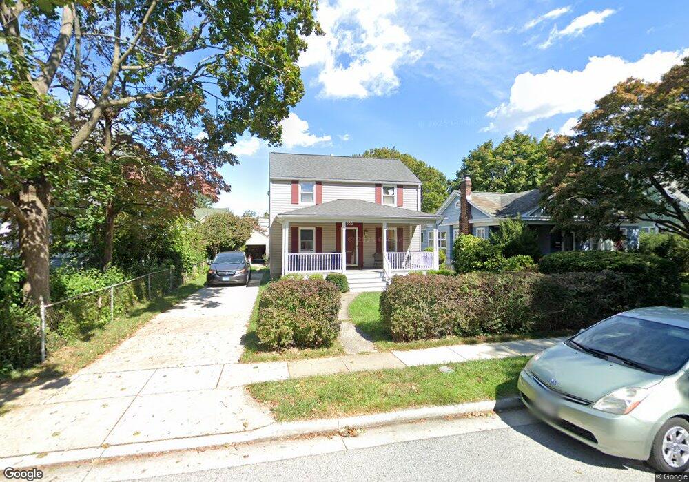
602 Dunkirk Rd Baltimore, MD 21212
Estimated Value: $412,404 - $545,000
Studio
1
Bath
1,300
Sq Ft
$368/Sq Ft
Est. Value
About This Home
This home is located at 602 Dunkirk Rd, Baltimore, MD 21212 and is currently estimated at $478,101, approximately $367 per square foot. 602 Dunkirk Rd is a home located in Baltimore County with nearby schools including Stoneleigh Elementary School, Dumbarton Middle School, and Towson High Law & Public Policy.
Ownership History
Date
Name
Owned For
Owner Type
Purchase Details
Closed on
Dec 7, 1993
Sold by
Desser R B
Bought by
Reinsel Michael D
Current Estimated Value
Home Financials for this Owner
Home Financials are based on the most recent Mortgage that was taken out on this home.
Original Mortgage
$60,000
Interest Rate
6.69%
Purchase Details
Closed on
May 11, 1987
Sold by
Roeder Charles A
Bought by
Desser Richard B
Create a Home Valuation Report for This Property
The Home Valuation Report is an in-depth analysis detailing your home's value as well as a comparison with similar homes in the area
Home Values in the Area
Average Home Value in this Area
Purchase History
| Date | Buyer | Sale Price | Title Company |
|---|---|---|---|
| Reinsel Michael D | $147,000 | -- | |
| Desser Richard B | $110,000 | -- |
Source: Public Records
Mortgage History
| Date | Status | Borrower | Loan Amount |
|---|---|---|---|
| Closed | Reinsel Michael D | $60,000 |
Source: Public Records
Tax History
| Year | Tax Paid | Tax Assessment Tax Assessment Total Assessment is a certain percentage of the fair market value that is determined by local assessors to be the total taxable value of land and additions on the property. | Land | Improvement |
|---|---|---|---|---|
| 2025 | $4,730 | $388,000 | $99,700 | $288,300 |
| 2024 | $4,730 | $366,400 | $0 | $0 |
| 2023 | $2,279 | $344,800 | $0 | $0 |
| 2022 | $4,306 | $323,200 | $94,700 | $228,500 |
| 2021 | $3,895 | $309,233 | $0 | $0 |
| 2020 | $3,895 | $295,267 | $0 | $0 |
| 2019 | $3,774 | $281,300 | $94,700 | $186,600 |
| 2018 | $3,671 | $273,900 | $0 | $0 |
| 2017 | $1,689 | $266,500 | $0 | $0 |
| 2016 | $2,724 | $259,100 | $0 | $0 |
| 2015 | $2,724 | $259,100 | $0 | $0 |
| 2014 | $2,724 | $259,100 | $0 | $0 |
Source: Public Records
Map
Nearby Homes
- 613 Anneslie Rd
- 529 Overbrook Rd
- 615 Overbrook Rd
- 633 Anneslie Rd
- 625 Dunkirk Rd
- 664 Regester Ave
- 501 Stoneleigh Rd
- 722 Anneslie Rd
- 318 Hopkins Rd
- 820 Cedarcroft Rd
- 214 Murdock Rd
- 726 Highwood Dr
- 411 Gittings Ave
- 415 Schwartz Ave
- 111 Dunkirk Rd
- 150 Hopkins Rd
- 709 Cedarcroft Rd
- 6225 Chinquapin Pkwy
- 335 Old Trail Rd
- 12 Stone Ridge Ct
- 600 Dunkirk Rd
- 604 Dunkirk Rd
- 606 Dunkirk Rd
- 603 Murdock Rd
- 601 Murdock Rd
- 605 Murdock Rd
- 608 Dunkirk Rd
- 530 Dunkirk Rd
- 607 Murdock Rd
- 539 Dunkirk Rd
- 537 Dunkirk Rd
- 541 Dunkirk Rd
- 609 Murdock Rd
- 610 Dunkirk Rd
- 535 Dunkirk Rd
- 531 Murdock Rd
- 528 Dunkirk Rd
- 611 Murdock Rd
- 529 Dunkirk Rd
- 529 Dunkirk Rd Unit WING
Your Personal Tour Guide
Ask me questions while you tour the home.