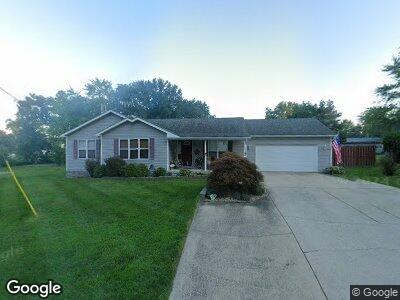
602 Il Route 143 Pocahontas, IL 62275
Estimated Value: $162,000 - $228,000
--
Bed
1
Bath
1,418
Sq Ft
$126/Sq Ft
Est. Value
About This Home
This home is located at 602 Il Route 143, Pocahontas, IL 62275 and is currently estimated at $179,319, approximately $126 per square foot. 602 Il Route 143 is a home located in Bond County with nearby schools including Bond County Community Unit 2 High School.
Ownership History
Date
Name
Owned For
Owner Type
Purchase Details
Closed on
Aug 29, 2011
Sold by
Snyder William R and Snyder Janyce L
Bought by
Detmer James J
Current Estimated Value
Home Financials for this Owner
Home Financials are based on the most recent Mortgage that was taken out on this home.
Original Mortgage
$114,000
Interest Rate
4.14%
Mortgage Type
Purchase Money Mortgage
Create a Home Valuation Report for This Property
The Home Valuation Report is an in-depth analysis detailing your home's value as well as a comparison with similar homes in the area
Home Values in the Area
Average Home Value in this Area
Purchase History
| Date | Buyer | Sale Price | Title Company |
|---|---|---|---|
| Detmer James J | -- | -- |
Source: Public Records
Mortgage History
| Date | Status | Borrower | Loan Amount |
|---|---|---|---|
| Open | Benne Brian K | $110,500 | |
| Closed | Detmer James J | $114,000 | |
| Previous Owner | Snyder William R | $20,000 | |
| Previous Owner | Snyder William R | $71,175 | |
| Previous Owner | Ress-Com Custom Construction Inc | $0 |
Source: Public Records
Tax History Compared to Growth
Tax History
| Year | Tax Paid | Tax Assessment Tax Assessment Total Assessment is a certain percentage of the fair market value that is determined by local assessors to be the total taxable value of land and additions on the property. | Land | Improvement |
|---|---|---|---|---|
| 2023 | $2,810 | $44,308 | $2,024 | $42,284 |
| 2022 | $2,694 | $41,883 | $1,913 | $39,970 |
| 2021 | $3,092 | $40,358 | $1,913 | $38,445 |
| 2020 | $3,131 | $40,358 | $1,913 | $38,445 |
| 2019 | $3,132 | $40,358 | $1,913 | $38,445 |
| 2018 | $3,115 | $40,358 | $1,913 | $38,445 |
| 2016 | $2,985 | $40,358 | $1,913 | $38,445 |
| 2015 | $2,526 | $40,358 | $1,913 | $38,445 |
| 2013 | $252 | $36,523 | $2,748 | $33,775 |
| 2011 | $2,461 | $36,523 | $2,748 | $33,775 |
Source: Public Records
Map
Nearby Homes
- 602 Haller Dr
- 425 Trestle Ave
- 4 Hill Valley Dr
- 112 Blaine St
- 0 W State St
- 0 W State Street Lot 3 Unit MAR24014942
- 0 W State Street Lot 2 Unit MAR24014905
- 0 W State Street Lot 1 Unit MAR24014842
- 39 W State St
- 38 W State St
- 35 W State St
- 34 W State St
- 33 W State St
- 32 W State St
- 29 W State St
- 37 W State St
- 36 W State St
- 26 W State St
- 25 W State St
- 24 W State St