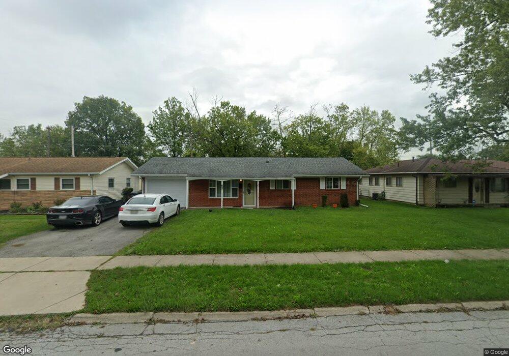
602 Mackenzie Dr Lima, OH 45805
Westgate NeighborhoodEstimated Value: $127,000 - $138,607
3
Beds
1
Bath
1,040
Sq Ft
$126/Sq Ft
Est. Value
About This Home
This home is located at 602 Mackenzie Dr, Lima, OH 45805 and is currently estimated at $130,652, approximately $125 per square foot. 602 Mackenzie Dr is a home located in Allen County with nearby schools including Heritage Elementary School, Lima West Middle School, and Lima North Middle School.
Ownership History
Date
Name
Owned For
Owner Type
Purchase Details
Closed on
May 5, 2015
Sold by
Hsbc Bank Na
Bought by
Rumbaugh Properties Llc
Current Estimated Value
Purchase Details
Closed on
Apr 28, 2015
Sold by
Harris Katrina L
Bought by
Hsbc Bank Usa Na
Purchase Details
Closed on
May 11, 1995
Sold by
Hanes Todd
Bought by
Mack Rosie
Home Financials for this Owner
Home Financials are based on the most recent Mortgage that was taken out on this home.
Original Mortgage
$49,500
Interest Rate
8.39%
Mortgage Type
New Conventional
Purchase Details
Closed on
Aug 31, 1987
Bought by
Hanes Todd L
Create a Home Valuation Report for This Property
The Home Valuation Report is an in-depth analysis detailing your home's value as well as a comparison with similar homes in the area
Home Values in the Area
Average Home Value in this Area
Purchase History
| Date | Buyer | Sale Price | Title Company |
|---|---|---|---|
| Rumbaugh Properties Llc | $34,500 | Linear Title & Closing | |
| Hsbc Bank Usa Na | $39,000 | None Available | |
| Mack Rosie | $55,000 | -- | |
| Hanes Todd L | $35,000 | -- |
Source: Public Records
Mortgage History
| Date | Status | Borrower | Loan Amount |
|---|---|---|---|
| Previous Owner | Mack Rosie | $49,500 |
Source: Public Records
Tax History
| Year | Tax Paid | Tax Assessment Tax Assessment Total Assessment is a certain percentage of the fair market value that is determined by local assessors to be the total taxable value of land and additions on the property. | Land | Improvement |
|---|---|---|---|---|
| 2024 | $1,229 | $32,940 | $6,270 | $26,670 |
| 2023 | $1,037 | $23,870 | $4,550 | $19,320 |
| 2022 | $1,042 | $23,870 | $4,550 | $19,320 |
| 2021 | $1,101 | $23,870 | $4,550 | $19,320 |
| 2020 | $935 | $17,750 | $4,340 | $13,410 |
| 2019 | $935 | $17,750 | $4,340 | $13,410 |
| 2018 | $912 | $17,750 | $4,340 | $13,410 |
| 2017 | $907 | $17,120 | $4,340 | $12,780 |
| 2016 | $914 | $17,120 | $4,340 | $12,780 |
| 2015 | $931 | $17,120 | $4,340 | $12,780 |
| 2014 | $931 | $17,750 | $4,590 | $13,160 |
| 2013 | $906 | $17,750 | $4,590 | $13,160 |
Source: Public Records
Map
Nearby Homes
- 1600 Leland Ave
- 1753 Leland Ave
- 705 Cornell Dr
- 3 Poulston Place
- 1607 W Wayne St
- 1716 Oakland Pkwy
- 1517 Allentown Rd
- 1918 Oakland Pkwy
- 1407 Latham Ave
- 1541 Oakland Pkwy
- 1508 Oakland Pkwy
- 858 Mackenzie Dr
- 1245 Latham Ave
- 275 N Dale Dr
- 1209 Rice Ave
- 102 Charwood Dr
- 2057 W High St
- 1015 N Cole St
- 0 Latham
- 1160 Richie Ave
Your Personal Tour Guide
Ask me questions while you tour the home.