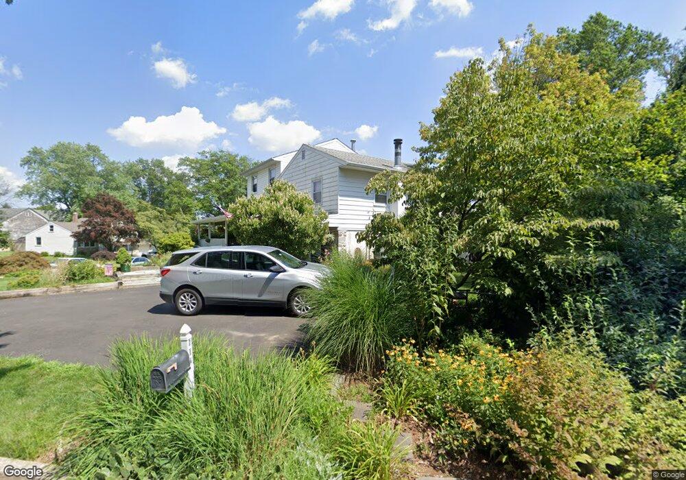
602 Paddock Rd Southampton, PA 18966
Estimated Value: $505,342 - $541,000
3
Beds
2
Baths
1,454
Sq Ft
$360/Sq Ft
Est. Value
About This Home
This home is located at 602 Paddock Rd, Southampton, PA 18966 and is currently estimated at $522,836, approximately $359 per square foot. 602 Paddock Rd is a home located in Bucks County with nearby schools including Davis Elementary School, Klinger Middle School, and William Tennent High School.
Ownership History
Date
Name
Owned For
Owner Type
Purchase Details
Closed on
Aug 31, 1998
Sold by
Smith Gordon Andy and Elliott Smith Jamie D
Bought by
Oziminski Joseph R and Oziminski Mary Jane
Current Estimated Value
Home Financials for this Owner
Home Financials are based on the most recent Mortgage that was taken out on this home.
Original Mortgage
$140,696
Outstanding Balance
$30,107
Interest Rate
6.92%
Mortgage Type
FHA
Estimated Equity
$492,729
Purchase Details
Closed on
Apr 10, 1990
Bought by
Smith Gordon Andy
Create a Home Valuation Report for This Property
The Home Valuation Report is an in-depth analysis detailing your home's value as well as a comparison with similar homes in the area
Home Values in the Area
Average Home Value in this Area
Purchase History
| Date | Buyer | Sale Price | Title Company |
|---|---|---|---|
| Oziminski Joseph R | $141,000 | -- | |
| Smith Gordon Andy | $141,000 | -- |
Source: Public Records
Mortgage History
| Date | Status | Borrower | Loan Amount |
|---|---|---|---|
| Open | Oziminski Joseph R | $140,696 |
Source: Public Records
Tax History Compared to Growth
Tax History
| Year | Tax Paid | Tax Assessment Tax Assessment Total Assessment is a certain percentage of the fair market value that is determined by local assessors to be the total taxable value of land and additions on the property. | Land | Improvement |
|---|---|---|---|---|
| 2025 | $5,732 | $26,800 | $5,320 | $21,480 |
| 2024 | $5,732 | $26,800 | $5,320 | $21,480 |
| 2023 | $5,558 | $26,800 | $5,320 | $21,480 |
| 2022 | $5,441 | $26,800 | $5,320 | $21,480 |
| 2021 | $5,343 | $26,800 | $5,320 | $21,480 |
| 2020 | $5,269 | $26,800 | $5,320 | $21,480 |
| 2019 | $5,075 | $26,800 | $5,320 | $21,480 |
| 2018 | $4,958 | $26,800 | $5,320 | $21,480 |
| 2017 | $4,818 | $26,800 | $5,320 | $21,480 |
| 2016 | $4,818 | $26,800 | $5,320 | $21,480 |
| 2015 | -- | $26,800 | $5,320 | $21,480 |
| 2014 | -- | $26,800 | $5,320 | $21,480 |
Source: Public Records
Map
Nearby Homes
- 1310 Dennis Rd
- 559 Maple Ave
- 448 W Bristol Rd
- 1081 Cherry Ln
- 225 Green Dr
- 215 Surrey Rd
- 955 Bristol Rd
- 29 Devon Rd
- 1020 Pennsylvania Ave
- 1495 Estate Ln
- 902 Manor Ln
- 909 Carlin Dr
- 1435 Churchville Rd
- 950 Manor Ln
- 249 New Rd
- 86 Valley Dr
- 161 New Rd
- 756 Churchville Rd
- 1336 Stephen Way
- 1370 Mill Creek Rd