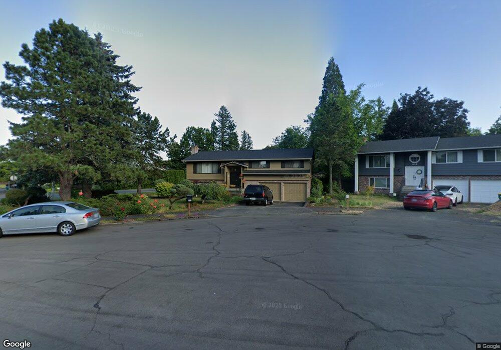
602 SW 19th Cir Troutdale, OR 97060
Sunrise NeighborhoodEstimated Value: $486,000 - $529,000
4
Beds
3
Baths
2,146
Sq Ft
$239/Sq Ft
Est. Value
About This Home
This home is located at 602 SW 19th Cir, Troutdale, OR 97060 and is currently estimated at $513,089, approximately $239 per square foot. 602 SW 19th Cir is a home located in Multnomah County with nearby schools including Troutdale Elementary School, Walt Morey Middle School, and Reynolds High School.
Ownership History
Date
Name
Owned For
Owner Type
Purchase Details
Closed on
Jun 10, 2014
Sold by
Graalum Jason
Bought by
Fransham Mark B and Fransham Marilyn L
Current Estimated Value
Home Financials for this Owner
Home Financials are based on the most recent Mortgage that was taken out on this home.
Original Mortgage
$119,000
Outstanding Balance
$90,112
Interest Rate
4.16%
Mortgage Type
New Conventional
Estimated Equity
$422,977
Purchase Details
Closed on
Mar 11, 2011
Sold by
Hosmer Richard G
Bought by
Graalum Jason and Graalum Diana
Purchase Details
Closed on
Jan 16, 1998
Sold by
Price Roger Lee
Bought by
Hosmer Richard Gary and Hosmer Carolyn Elizabeth
Home Financials for this Owner
Home Financials are based on the most recent Mortgage that was taken out on this home.
Original Mortgage
$146,300
Interest Rate
7.13%
Mortgage Type
Purchase Money Mortgage
Create a Home Valuation Report for This Property
The Home Valuation Report is an in-depth analysis detailing your home's value as well as a comparison with similar homes in the area
Home Values in the Area
Average Home Value in this Area
Purchase History
| Date | Buyer | Sale Price | Title Company |
|---|---|---|---|
| Fransham Mark B | $230,000 | First American | |
| Graalum Jason | $147,500 | Lawyers Title | |
| Hosmer Richard Gary | $154,000 | Pacific Nw Title |
Source: Public Records
Mortgage History
| Date | Status | Borrower | Loan Amount |
|---|---|---|---|
| Open | Fransham Mark B | $119,000 | |
| Previous Owner | Hosmer Richard Gary | $146,300 |
Source: Public Records
Tax History Compared to Growth
Tax History
| Year | Tax Paid | Tax Assessment Tax Assessment Total Assessment is a certain percentage of the fair market value that is determined by local assessors to be the total taxable value of land and additions on the property. | Land | Improvement |
|---|---|---|---|---|
| 2025 | $5,192 | $281,490 | -- | -- |
| 2024 | $4,906 | $273,300 | -- | -- |
| 2023 | $4,778 | $265,340 | $0 | $0 |
| 2022 | $4,663 | $257,620 | $0 | $0 |
| 2021 | $4,555 | $250,120 | $0 | $0 |
| 2020 | $4,260 | $242,840 | $0 | $0 |
| 2019 | $4,089 | $235,770 | $0 | $0 |
| 2018 | $4,061 | $228,910 | $0 | $0 |
| 2017 | $4,053 | $222,250 | $0 | $0 |
| 2016 | $3,917 | $215,780 | $0 | $0 |
| 2015 | $3,819 | $209,500 | $0 | $0 |
| 2014 | $3,713 | $203,400 | $0 | $0 |
Source: Public Records
Map
Nearby Homes
- 2020 SW Laura Ct
- 665 SW 24th St
- 839 SW Grant Way
- 1021 SW 24th St
- 821 SW 14th St
- 1226 SW Hensley Rd
- 1427 SW 24th St
- 2326 SW Mcginnis Ave
- 2154 SE Sandy Ct
- 2511 S Troutdale Rd
- 724 SW 28th St
- 1212 SW Edgefield Ave
- 2846 SW Faith Ct
- 809 SW Crestview Way
- 735 SW Sunset Way
- 1330 SW 28th St Unit 1332
- 1106 SW Dottie Ct
- 1953 SW Northstar Way
- 2701 SW Latourell Place
- 1392 SW Berryessa Place
- 614 SW 19th Cir
- 526 SW 19th Place
- 685 SW 20th Cir
- 628 SW 19th Cir
- 525 SW 19th Place
- 605 SW 19th Cir
- 645 SW 19th Cir
- 701 SW 20th Cir
- 619 SW 19th Cir
- 518 SW 19th Place
- 673 SW 20th Cir
- 633 SW 19th Cir Unit 1
- 633 SW 19th Cir
- 2010 SW Hensley Rd
- 1838 SW Hensley Rd
- 503 SW 19th Place
- 2018 SW Hensley Rd
- 537 SW 19th Place
- 504 SW 19th Place
- 718 SW 20th Cir