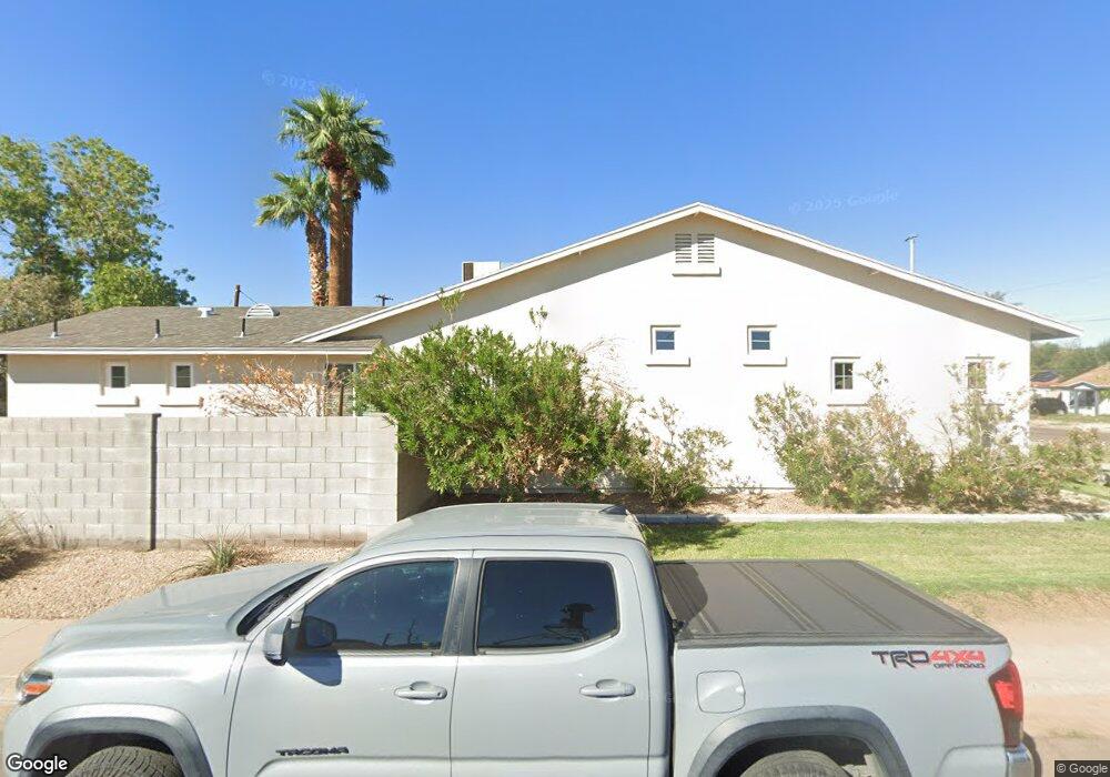
602 W Howe St Tempe, AZ 85281
Mitchell Park West NeighborhoodEstimated Value: $587,000 - $892,000
--
Bed
1
Bath
2,506
Sq Ft
$293/Sq Ft
Est. Value
About This Home
This home is located at 602 W Howe St, Tempe, AZ 85281 and is currently estimated at $734,186, approximately $292 per square foot. 602 W Howe St is a home located in Maricopa County with nearby schools including Geneva Epps Mosley Middle School, Tempe High School, and New School for the Arts & Academics.
Ownership History
Date
Name
Owned For
Owner Type
Purchase Details
Closed on
Aug 23, 2011
Sold by
Espinasse Pierre
Bought by
Howe Rentals Llc
Current Estimated Value
Purchase Details
Closed on
Aug 17, 2011
Sold by
Wright Timothyr and Washington Federal Savings
Bought by
Espnosasse Pierre A P
Purchase Details
Closed on
May 7, 1999
Sold by
Lloyd Jones Richard
Bought by
Lloyd Jones Jeffrey L
Home Financials for this Owner
Home Financials are based on the most recent Mortgage that was taken out on this home.
Original Mortgage
$95,000
Interest Rate
6.86%
Mortgage Type
Seller Take Back
Purchase Details
Closed on
Apr 28, 1999
Sold by
Lloyd Jones Jeffrey L
Bought by
Wright Timothy R
Home Financials for this Owner
Home Financials are based on the most recent Mortgage that was taken out on this home.
Original Mortgage
$95,000
Interest Rate
6.86%
Mortgage Type
Seller Take Back
Create a Home Valuation Report for This Property
The Home Valuation Report is an in-depth analysis detailing your home's value as well as a comparison with similar homes in the area
Home Values in the Area
Average Home Value in this Area
Purchase History
| Date | Buyer | Sale Price | Title Company |
|---|---|---|---|
| Howe Rentals Llc | -- | None Available | |
| Espnosasse Pierre A P | $103,697 | Magnus Title Agency | |
| Lloyd Jones Jeffrey L | -- | Chicago Title Insurance Co | |
| Wright Timothy R | $125,000 | Chicago Title Insurance Co |
Source: Public Records
Mortgage History
| Date | Status | Borrower | Loan Amount |
|---|---|---|---|
| Previous Owner | Wright Timothy R | $95,000 |
Source: Public Records
Tax History Compared to Growth
Tax History
| Year | Tax Paid | Tax Assessment Tax Assessment Total Assessment is a certain percentage of the fair market value that is determined by local assessors to be the total taxable value of land and additions on the property. | Land | Improvement |
|---|---|---|---|---|
| 2025 | $4,883 | $40,739 | -- | -- |
| 2024 | $4,508 | $38,799 | -- | -- |
| 2023 | $4,508 | $67,130 | $13,420 | $53,710 |
| 2022 | $4,325 | $53,860 | $10,770 | $43,090 |
| 2021 | $4,355 | $49,860 | $9,970 | $39,890 |
| 2020 | $4,222 | $45,600 | $9,120 | $36,480 |
| 2019 | $1,393 | $16,430 | $3,280 | $13,150 |
| 2018 | $1,358 | $15,470 | $3,090 | $12,380 |
| 2017 | $1,318 | $12,870 | $2,570 | $10,300 |
| 2016 | $1,308 | $12,530 | $2,500 | $10,030 |
| 2015 | $1,257 | $11,030 | $2,200 | $8,830 |
Source: Public Records
Map
Nearby Homes
- 620 W Howe St
- 522 W Howe St
- 538 W 13th St
- 538 W 13th St Unit A
- 531 W 14th St
- 1218 S Farmer Ave
- 1101 S Farmer Ave
- 1234 S Farmer Ave
- 542 W 15th St
- 601 W 15th St
- 535 W 15th St
- 942 S Ash Ave Unit 103
- 700 W University Dr Unit 122
- 700 W University Dr Unit 253
- 63 W 13th St Unit 63 & 69
- 117 W 10th St
- 1190 S Maple Ave Unit 1
- 919 W Parkway Blvd
- 1224 S Maple Ave
- 901 W 16th St
- 1118 S Roosevelt St
- 1116 S Roosevelt St
- 612 W Howe St
- 530 W Howe St
- 528 W Howe St
- 1122 S Roosevelt St
- 605 W Howe St
- 609 W Howe St
- 616 W Howe St
- 616 W Howe St
- 611 W Howe St
- 1115 S Roosevelt St
- 524 W Howe St
- 601 W 11th St
- 605 W 11th St
- 525 W Howe St
- 615 W Howe St
- 611 W 11th St
- 1111 S Roosevelt St
- 1132 S Roosevelt St