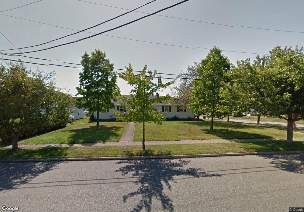
6020 Sheridan Rd Youngstown, OH 44514
Estimated Value: $241,000 - $343,000
4
Beds
2
Baths
1,976
Sq Ft
$151/Sq Ft
Est. Value
About This Home
This home is located at 6020 Sheridan Rd, Youngstown, OH 44514 and is currently estimated at $298,669, approximately $151 per square foot. 6020 Sheridan Rd is a home located in Mahoning County with nearby schools including Poland Union Elementary School, Poland Middle School, and Poland Seminary High School.
Ownership History
Date
Name
Owned For
Owner Type
Purchase Details
Closed on
Jun 10, 2014
Sold by
Moyer Rex C
Bought by
Moyer Rex C and John G Moyer Family Trust
Current Estimated Value
Purchase Details
Closed on
May 23, 2007
Sold by
Moyer John G
Bought by
Moyer John G
Purchase Details
Closed on
May 15, 2007
Sold by
Estate Of Margaret Eula Moyer
Bought by
Moyer John G and Moyer John Garfield
Purchase Details
Closed on
Sep 12, 1989
Bought by
Moyer John G and Moyer Margaret E
Create a Home Valuation Report for This Property
The Home Valuation Report is an in-depth analysis detailing your home's value as well as a comparison with similar homes in the area
Home Values in the Area
Average Home Value in this Area
Purchase History
| Date | Buyer | Sale Price | Title Company |
|---|---|---|---|
| Moyer Rex C | -- | Attorney | |
| Moyer John G | -- | Attorney | |
| Moyer John G | -- | None Available | |
| Moyer John G | $55,000 | -- |
Source: Public Records
Tax History Compared to Growth
Tax History
| Year | Tax Paid | Tax Assessment Tax Assessment Total Assessment is a certain percentage of the fair market value that is determined by local assessors to be the total taxable value of land and additions on the property. | Land | Improvement |
|---|---|---|---|---|
| 2024 | $4,230 | $82,300 | $6,630 | $75,670 |
| 2023 | $4,179 | $82,300 | $6,630 | $75,670 |
| 2022 | $3,081 | $60,500 | $5,660 | $54,840 |
| 2021 | $3,700 | $60,500 | $5,660 | $54,840 |
| 2020 | $3,714 | $60,500 | $5,660 | $54,840 |
| 2019 | $3,214 | $47,640 | $4,460 | $43,180 |
| 2018 | $3,186 | $47,640 | $4,460 | $43,180 |
| 2017 | $1,628 | $47,640 | $4,460 | $43,180 |
| 2016 | $2,435 | $36,830 | $730 | $36,100 |
| 2015 | $1,428 | $21,880 | $730 | $21,150 |
| 2014 | $869 | $21,880 | $730 | $21,150 |
| 2013 | $859 | $21,880 | $730 | $21,150 |
Source: Public Records
Map
Nearby Homes
- 1894 Lealand Ave
- 1859 Mathews Rd
- 1890 Mathews Rd
- 2035 Woodward Ave
- 0 Oles Ave
- 1804 Alverne Dr
- 0 Woodlawn Ave
- 5710 Youngstown Poland Rd
- 0 Mathews Rd Unit 5149232
- 0 Mathews Rd Unit 5143059
- 1827 Alverne Dr
- 1919 Wingate Rd
- 1841 Wingate Rd
- 34 Venloe Dr
- 43 Venloe Dr
- 2128 Lyon Blvd
- 1738 Island Dr
- 2153 Lyon Blvd
- 2089 Shetland Ln
- 2035 Holbrook Rd
- 6028 Sheridan Rd
- 1875 Lemont Dr
- 1869 Lemont Dr
- 6036 Sheridan Rd
- 1898 Lealand Ave
- 1863 Lemont Dr
- 1890 Lealand Ave
- 6044 Sheridan Rd
- 1914 Peachtree Ct
- 1857 Lemont Dr
- 1888 Lealand Ave
- 1911 Peachtree Ct
- 1882 Lealand Ave
- 1877 Lealand Ave
- 1918 Peachtree Ct
- 1899 Lynn Mar Ave
- 6052 Sheridan Rd
- 1915 Peachtree Ct
- 1895 Lynn Mar Ave
- 1853 Lemont Dr