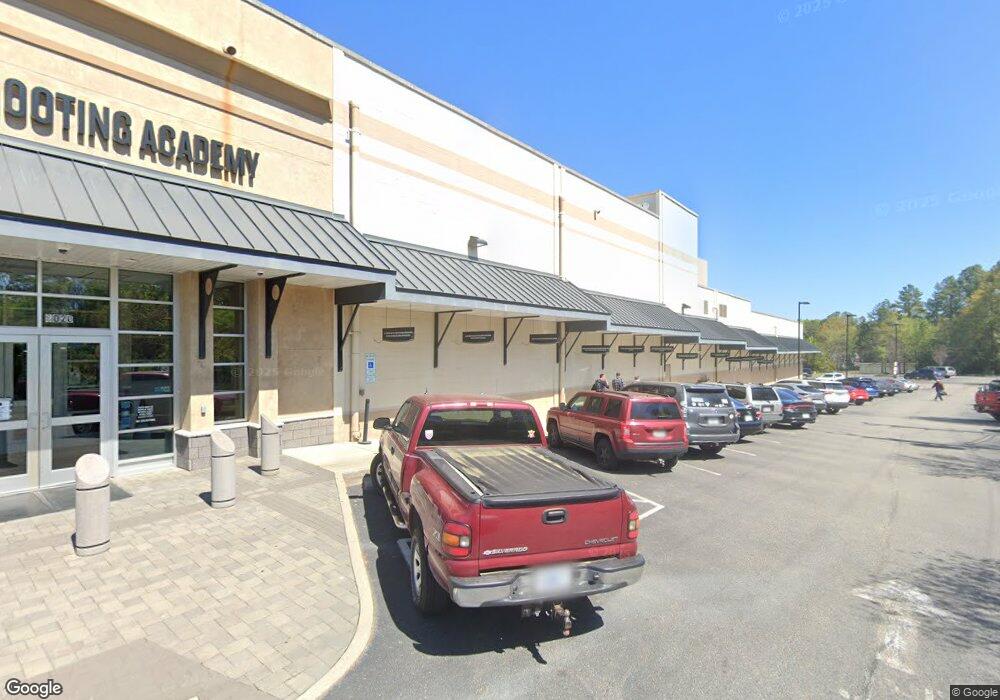
6020 W Broad St Richmond, VA 23230
Crestview NeighborhoodEstimated Value: $6,750,554
--
Bed
--
Bath
42,365
Sq Ft
$159/Sq Ft
Est. Value
About This Home
This home is located at 6020 W Broad St, Richmond, VA 23230 and is currently estimated at $6,750,554, approximately $159 per square foot. 6020 W Broad St is a home located in Henrico County with nearby schools including Johnson Elementary School, Tuckahoe Middle School, and Tucker High School.
Ownership History
Date
Name
Owned For
Owner Type
Purchase Details
Closed on
Feb 27, 2025
Sold by
Broad Street Colony Llc
Bought by
Freedom Land Rva Real Estate Llc
Current Estimated Value
Home Financials for this Owner
Home Financials are based on the most recent Mortgage that was taken out on this home.
Original Mortgage
$5,600,000
Outstanding Balance
$5,571,835
Interest Rate
6.96%
Mortgage Type
Credit Line Revolving
Estimated Equity
$1,084,978
Create a Home Valuation Report for This Property
The Home Valuation Report is an in-depth analysis detailing your home's value as well as a comparison with similar homes in the area
Home Values in the Area
Average Home Value in this Area
Purchase History
| Date | Buyer | Sale Price | Title Company |
|---|---|---|---|
| Freedom Land Rva Real Estate Llc | $6,517,147 | Old Republic National Title In |
Source: Public Records
Mortgage History
| Date | Status | Borrower | Loan Amount |
|---|---|---|---|
| Open | Freedom Land Rva Real Estate Llc | $5,600,000 |
Source: Public Records
Tax History Compared to Growth
Tax History
| Year | Tax Paid | Tax Assessment Tax Assessment Total Assessment is a certain percentage of the fair market value that is determined by local assessors to be the total taxable value of land and additions on the property. | Land | Improvement |
|---|---|---|---|---|
| 2025 | $49,549 | $5,887,200 | $1,114,400 | $4,772,800 |
| 2024 | $49,549 | $5,505,100 | $1,114,400 | $4,390,700 |
| 2023 | $46,793 | $5,505,100 | $1,114,400 | $4,390,700 |
| 2022 | $43,642 | $5,134,300 | $1,114,400 | $4,019,900 |
| 2021 | $40,517 | $4,673,300 | $1,114,400 | $3,558,900 |
| 2020 | $40,658 | $4,673,300 | $1,114,400 | $3,558,900 |
| 2019 | $40,104 | $4,609,600 | $1,114,400 | $3,495,200 |
| 2018 | $39,716 | $4,565,000 | $1,114,400 | $3,450,600 |
| 2017 | $39,738 | $4,567,600 | $1,075,200 | $3,492,400 |
| 2016 | $39,102 | $4,494,500 | $1,036,000 | $3,458,500 |
| 2015 | $37,588 | $4,389,400 | $996,800 | $3,392,600 |
| 2014 | $37,588 | $4,320,500 | $996,800 | $3,323,700 |
Source: Public Records
Map
Nearby Homes
- 6401 Millhiser Ave
- 6304 Engel Rd
- 5423 Falmouth St
- 6423 Millhiser Ave
- Lot 11 Bethlehem Rd
- TBD Bethlehem Rd
- Lot 9 Bethlehem Rd
- 2248 Libbie Lake St W Unit B
- 5408 Masons Ln
- 5309 Masons Ln
- 6424 W Grace St
- 6500 W Grace St
- 4927 Dollard Dr
- 2006 Libbie Lake St W Unit B
- 6213 Monument Ave
- 5605 Hard Rock Place
- 4910 Regent Rd
- 3004 Dunwick Rd
- 4914 Dollard Dr
- 6608 W Grace St
- 6018 W Broad St
- 6100 W Broad St
- 6016 W Broad St
- 6103 W Broad St
- 6101 W Broad St
- 6021 W Broad St
- 6019 W Broad St
- 6202 W Broad St
- 6109 W Broad St
- 5310 Falmouth St
- 6017 W Broad St
- 6010 W Broad St
- 6017 Indigo Rd
- 2309 Indigo Rd
- 2003 W Club Ln
- 2000 W Club Ln
- 6015 Indigo Rd
- 6015 W Broad St
- 6006 W Broad St
- 5300 Falmouth St
