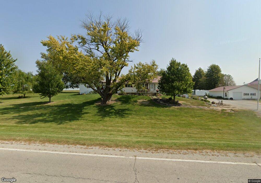
6020 Wapsi Ave SE Lone Tree, IA 52755
Estimated Value: $256,000 - $313,000
--
Bed
2
Baths
1,820
Sq Ft
$159/Sq Ft
Est. Value
About This Home
This home is located at 6020 Wapsi Ave SE, Lone Tree, IA 52755 and is currently estimated at $288,968, approximately $158 per square foot. 6020 Wapsi Ave SE is a home located in Johnson County with nearby schools including Lone Tree Elementary School and Lone Tree Junior/Senior High School.
Ownership History
Date
Name
Owned For
Owner Type
Purchase Details
Closed on
Oct 14, 2020
Sold by
Schnoebelen Kurt
Bought by
Slaughter Eldon E and Slaughter Cynthia K
Current Estimated Value
Create a Home Valuation Report for This Property
The Home Valuation Report is an in-depth analysis detailing your home's value as well as a comparison with similar homes in the area
Home Values in the Area
Average Home Value in this Area
Purchase History
| Date | Buyer | Sale Price | Title Company |
|---|---|---|---|
| Slaughter Eldon E | $6,500 | None Available |
Source: Public Records
Tax History Compared to Growth
Tax History
| Year | Tax Paid | Tax Assessment Tax Assessment Total Assessment is a certain percentage of the fair market value that is determined by local assessors to be the total taxable value of land and additions on the property. | Land | Improvement |
|---|---|---|---|---|
| 2025 | $3,650 | $263,900 | $36,400 | $227,500 |
| 2024 | $3,630 | $296,500 | $71,400 | $225,100 |
| 2023 | $3,050 | $296,500 | $71,400 | $225,100 |
| 2022 | $3,014 | $205,800 | $36,500 | $169,300 |
| 2021 | $3,162 | $205,800 | $36,500 | $169,300 |
| 2020 | $3,162 | $205,800 | $36,500 | $169,300 |
| 2019 | $2,846 | $205,800 | $36,500 | $169,300 |
| 2018 | $2,792 | $183,200 | $36,500 | $146,700 |
| 2017 | $2,792 | $183,200 | $36,500 | $146,700 |
| 2016 | $2,900 | $186,200 | $36,500 | $149,700 |
| 2015 | $2,900 | $186,200 | $36,500 | $149,700 |
| 2014 | $3,032 | $188,200 | $36,500 | $151,700 |
Source: Public Records
Map
Nearby Homes
- 745 N Perkins St
- 201 N Devoe St
- 221 W Commercial St
- 407 E Elm St
- 500 S Center St
- 106 Dorothy Ln
- 5888 Sand Rd SE
- 25840 Golden Oak Ln Lot 1
- 25838 Golden Oak Ln Lot 7
- 25836 Golden Oak Ln Lot 8
- 25832 Golden Oak Ln Lot 12
- 25736 Golden Pond Ln Se Lot 17
- 25738 Golden Pond Ln Se Lot 16
- 25824 Golden Oak Ln Lot 9
- 1092 Walnut Ave Unit 209
- 1092 Walnut Ave Unit 114 Bld D
- Lot 2 116th Cir
- 2 Commercial Dr
- Lot 39 Walter Mapp Dr
- 1118 120th St
- 6040 Wapsi Ave SE
- 6004 Wapsi Ave SE
- 0 Iowa 22
- 501 N Devoe St
- 104 W Sanders St
- 5997 Wapsi Ave SE
- 108 W Sanders St
- 112 W Sanders St
- 116 W Sanders St
- 5177 Highway 22 SE
- 509 N Huskins St
- 507 N Huskins St
- 300 N Devoe St
- 331 N Devoe St
- 321 N Devoe St
- 616 N Perkins St
- 612 N Perkins St
- 700 N Perkins St
- 316 N Marner St
- 720 N Perkins St