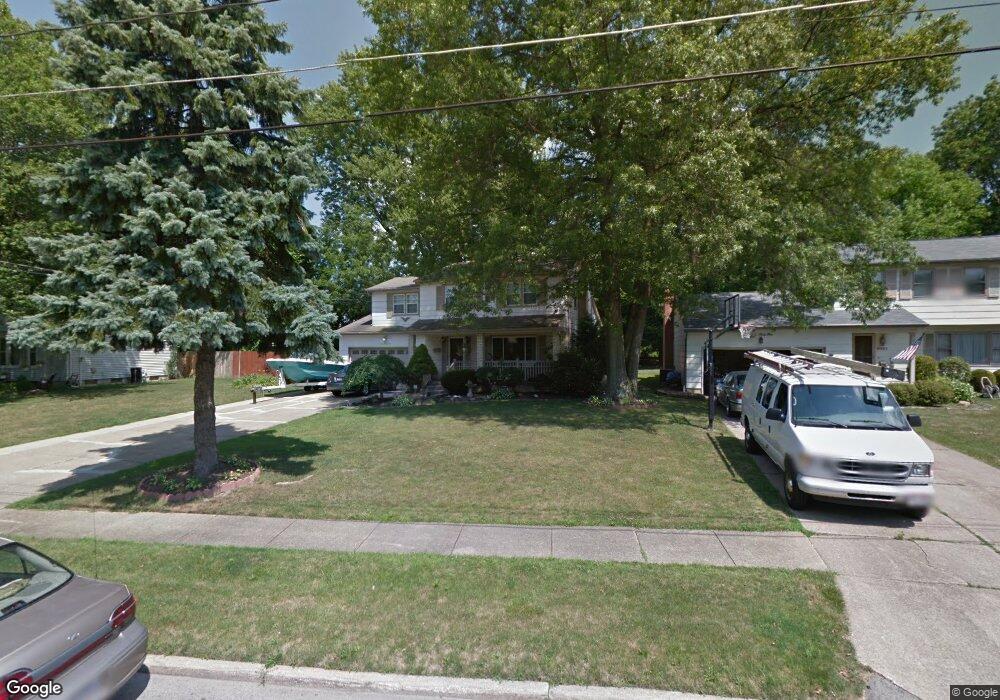
6021 Applecrest Dr Youngstown, OH 44512
Estimated Value: $274,316 - $320,000
4
Beds
3
Baths
2,041
Sq Ft
$144/Sq Ft
Est. Value
About This Home
This home is located at 6021 Applecrest Dr, Youngstown, OH 44512 and is currently estimated at $293,829, approximately $143 per square foot. 6021 Applecrest Dr is a home located in Mahoning County with nearby schools including Robinwood Lane Elementary School, Boardman Glenwood Junior High School, and Boardman High School.
Ownership History
Date
Name
Owned For
Owner Type
Purchase Details
Closed on
Jun 28, 1996
Sold by
Natt Kenneth W
Bought by
Huff Robert E and Sutton Michelle G
Current Estimated Value
Home Financials for this Owner
Home Financials are based on the most recent Mortgage that was taken out on this home.
Original Mortgage
$95,600
Outstanding Balance
$6,844
Interest Rate
8.13%
Mortgage Type
New Conventional
Estimated Equity
$286,985
Purchase Details
Closed on
Nov 30, 1994
Sold by
Scott George D
Bought by
Nemcik Christine M
Home Financials for this Owner
Home Financials are based on the most recent Mortgage that was taken out on this home.
Original Mortgage
$48,000
Interest Rate
8.91%
Mortgage Type
New Conventional
Purchase Details
Closed on
Mar 22, 1991
Bought by
Natt Kenneth W and Natt Jolene
Create a Home Valuation Report for This Property
The Home Valuation Report is an in-depth analysis detailing your home's value as well as a comparison with similar homes in the area
Home Values in the Area
Average Home Value in this Area
Purchase History
| Date | Buyer | Sale Price | Title Company |
|---|---|---|---|
| Huff Robert E | $119,500 | -- | |
| Nemcik Christine M | $60,000 | -- | |
| Natt Kenneth W | $107,500 | -- |
Source: Public Records
Mortgage History
| Date | Status | Borrower | Loan Amount |
|---|---|---|---|
| Open | Huff Robert E | $95,600 | |
| Previous Owner | Nemcik Christine M | $48,000 |
Source: Public Records
Tax History Compared to Growth
Tax History
| Year | Tax Paid | Tax Assessment Tax Assessment Total Assessment is a certain percentage of the fair market value that is determined by local assessors to be the total taxable value of land and additions on the property. | Land | Improvement |
|---|---|---|---|---|
| 2024 | $4,127 | $81,370 | $9,230 | $72,140 |
| 2023 | $4,072 | $81,370 | $9,230 | $72,140 |
| 2022 | $3,088 | $47,000 | $7,490 | $39,510 |
| 2021 | $3,090 | $47,000 | $7,490 | $39,510 |
| 2020 | $3,106 | $47,000 | $7,490 | $39,510 |
| 2019 | $3,017 | $40,520 | $6,460 | $34,060 |
| 2018 | $2,609 | $40,520 | $6,460 | $34,060 |
| 2017 | $2,645 | $40,520 | $6,460 | $34,060 |
| 2016 | $2,705 | $42,000 | $6,460 | $35,540 |
| 2015 | $2,652 | $42,000 | $6,460 | $35,540 |
| 2014 | $2,659 | $42,000 | $6,460 | $35,540 |
| 2013 | $2,626 | $42,000 | $6,460 | $35,540 |
Source: Public Records
Map
Nearby Homes
- 6001 Applecrest Dr
- 197 Mathews Rd Unit B
- 0 Mathews Rd Unit 5038026
- 642 Oakridge Dr
- 178 Mathews Rd
- 6785 Tanglewood Dr
- 707 Oakridge Dr
- 424 Mathews Rd
- 796 Edenridge Dr
- 167 Afton Ave
- 88 Arlene Ave
- 792 Forest Ridge Dr
- 772 Teakwood Dr
- 6229 Appleridge Dr
- 268 Erskine Ave
- 6278 Appleridge Dr
- 323 Melrose Ave
- 5522 Southern Blvd
- 44 Gertrude Ave
- 857 Maple Ridge Dr
- 6011 Applecrest Dr
- 6031 Applecrest Dr
- 6019 Applecrest Dr
- 6019 Applecrest Ct
- 6017 Applecrest Ct
- 6041 Applecrest Dr
- 6015 Applecrest Ct
- 6015 Applecrest Ct Unit 3
- 6020 Applecrest Dr
- 6013 Applecrest Ct Unit 7B
- 6040 Applecrest Dr
- 6010 Applecrest Dr
- 5991 Applecrest Dr
- 6011 Applecrest Ct
- 6011 Applecrest Ct Unit A
- 6029 Applecrest Ct
- 6027 Applecrest Ct Unit D41
- 6051 Applecrest Dr
- 6025 Applecrest Ct
- 6000 Applecrest Dr