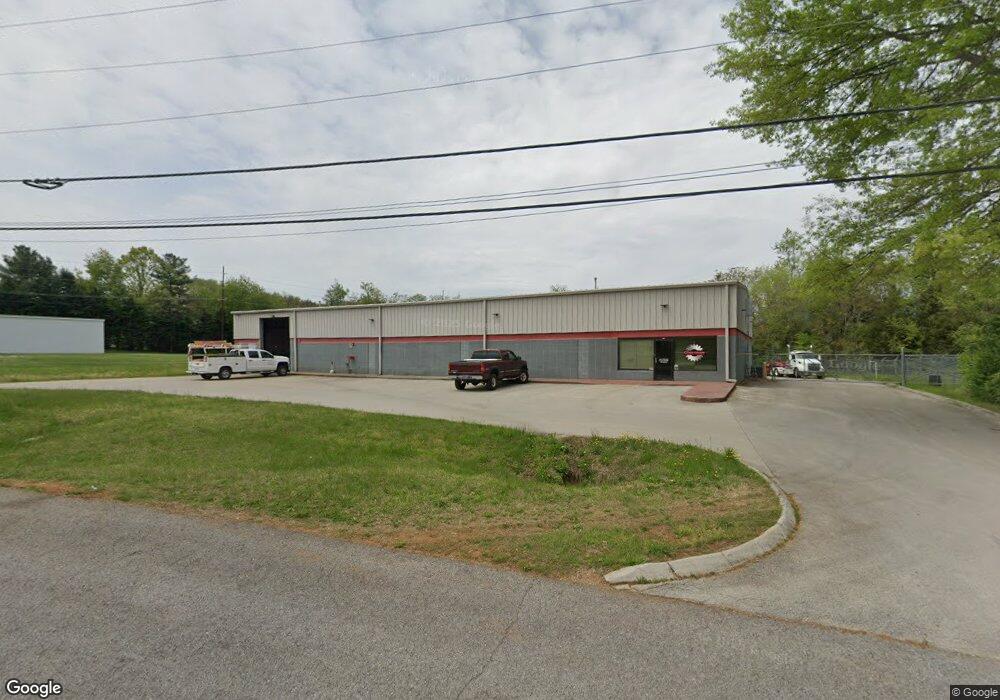
6023 Ontario Cir Morristown, TN 37814
Estimated Value: $716,727
--
Bed
1
Bath
10,000
Sq Ft
$72/Sq Ft
Est. Value
About This Home
This home is located at 6023 Ontario Cir, Morristown, TN 37814 and is currently estimated at $716,727, approximately $71 per square foot. 6023 Ontario Cir is a home located in Hamblen County with nearby schools including Alpha Elementary School, West View Middle School, and Morristown West High School.
Ownership History
Date
Name
Owned For
Owner Type
Purchase Details
Closed on
Oct 31, 2013
Sold by
Mcguffin Partners
Bought by
Massey Properties Llc
Current Estimated Value
Purchase Details
Closed on
Mar 27, 2003
Sold by
Mcguffin John F
Bought by
Mcguffin Partners
Purchase Details
Closed on
Jun 12, 1992
Bought by
Mcguffin John Franklin and George Pat
Purchase Details
Closed on
Jan 29, 1990
Bought by
Ind Dev Bd Of Morristown
Create a Home Valuation Report for This Property
The Home Valuation Report is an in-depth analysis detailing your home's value as well as a comparison with similar homes in the area
Home Values in the Area
Average Home Value in this Area
Purchase History
| Date | Buyer | Sale Price | Title Company |
|---|---|---|---|
| Massey Properties Llc | $280,000 | -- | |
| Mcguffin Partners | -- | -- | |
| Mcguffin John Franklin | $17,900 | -- | |
| Ind Dev Bd Of Morristown | -- | -- |
Source: Public Records
Tax History Compared to Growth
Tax History
| Year | Tax Paid | Tax Assessment Tax Assessment Total Assessment is a certain percentage of the fair market value that is determined by local assessors to be the total taxable value of land and additions on the property. | Land | Improvement |
|---|---|---|---|---|
| 2024 | $2,937 | $166,880 | $19,520 | $147,360 |
| 2023 | $2,937 | $166,880 | $0 | $0 |
| 2022 | $5,273 | $166,880 | $19,520 | $147,360 |
| 2021 | $5,273 | $166,880 | $19,520 | $147,360 |
| 2020 | $5,266 | $166,880 | $19,520 | $147,360 |
| 2019 | $5,007 | $147,240 | $13,520 | $133,720 |
| 2018 | $4,639 | $147,240 | $13,520 | $133,720 |
| 2017 | $4,565 | $147,240 | $13,520 | $133,720 |
| 2016 | $4,358 | $147,240 | $13,520 | $133,720 |
| 2015 | $4,055 | $147,240 | $13,520 | $133,720 |
| 2014 | -- | $147,240 | $13,520 | $133,720 |
| 2013 | -- | $200,920 | $0 | $0 |
Source: Public Records
Map
Nearby Homes
- 6925 Westgate Cir
- 5908 Bernie Cir
- 6518 Archer Cir
- 234 Meek St
- Tract 2 Hunter Rd
- 6864 Westgate Cir
- 6820 Romines Rd
- 0 Old Poplar Ridge Rd
- 5629 Buell St
- Lot 1 & 2 Old Poplar Ridge Rd
- 514 Phyllis Cir
- 7037 Maxwell Terrace
- 633 Shaver Dr
- 502 Barbara Dr
- 7350 W Andrew Johnson Hwy
- 818 Shaver Dr
- 6262 Wintergreen Rd
- 8 Talbott-Kansas Rd
- 7 Talbott-Kansas Rd
- 6 Talbott-Kansas Rd
- 6262 Lavern Cir
- 6272 Lavern Cir
- 6252 Lavern Cir
- 6270 Lavern Cir
- 6354 Lavern Cir
- 6242 Lavern Cir
- 6360 Lavern Cir
- 6231 Lavern Cir
- 6404 Clover Ln
- 6374 Lavern Cir
- 6232 Lavern Cir
- 6405 Clover Ln
- 6211 Lavern Cir
- 6426 Clover Ln
- 6370 Lavern Cir
- 6212 Lavern Cir
- 6005 Superior Ct
- 6377 Lavern Cir
- 6435 Clover Ln
- 6181 Lavern Cir