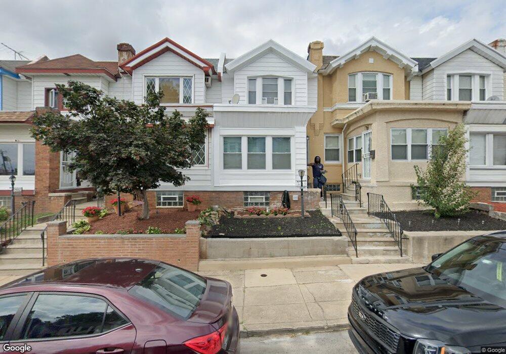
6025 Nassau Rd Philadelphia, PA 19151
Overbrook NeighborhoodEstimated Value: $161,000 - $205,000
3
Beds
1
Bath
1,302
Sq Ft
$145/Sq Ft
Est. Value
About This Home
This home is located at 6025 Nassau Rd, Philadelphia, PA 19151 and is currently estimated at $188,565, approximately $144 per square foot. 6025 Nassau Rd is a home located in Philadelphia County with nearby schools including Overbrook Elementary School, Overbrook High School, and Ad Prima Charter School.
Ownership History
Date
Name
Owned For
Owner Type
Purchase Details
Closed on
Nov 30, 2000
Sold by
Washington Etta and Estate Of Harry D Showell
Bought by
Jason Emma
Current Estimated Value
Home Financials for this Owner
Home Financials are based on the most recent Mortgage that was taken out on this home.
Original Mortgage
$47,000
Outstanding Balance
$17,245
Interest Rate
7.64%
Estimated Equity
$171,320
Create a Home Valuation Report for This Property
The Home Valuation Report is an in-depth analysis detailing your home's value as well as a comparison with similar homes in the area
Home Values in the Area
Average Home Value in this Area
Purchase History
| Date | Buyer | Sale Price | Title Company |
|---|---|---|---|
| Jason Emma | $47,000 | -- |
Source: Public Records
Mortgage History
| Date | Status | Borrower | Loan Amount |
|---|---|---|---|
| Open | Jason Emma | $47,000 |
Source: Public Records
Tax History Compared to Growth
Tax History
| Year | Tax Paid | Tax Assessment Tax Assessment Total Assessment is a certain percentage of the fair market value that is determined by local assessors to be the total taxable value of land and additions on the property. | Land | Improvement |
|---|---|---|---|---|
| 2025 | $1,445 | $168,900 | $33,780 | $135,120 |
| 2024 | $1,445 | $168,900 | $33,780 | $135,120 |
| 2023 | $1,445 | $148,200 | $29,640 | $118,560 |
| 2022 | $1,445 | $103,200 | $29,640 | $73,560 |
| 2021 | $1,445 | $0 | $0 | $0 |
| 2020 | $1,445 | $0 | $0 | $0 |
| 2019 | $1,445 | $0 | $0 | $0 |
| 2018 | $1,445 | $0 | $0 | $0 |
| 2017 | $1,445 | $0 | $0 | $0 |
| 2016 | $1,445 | $0 | $0 | $0 |
| 2015 | $1,339 | $0 | $0 | $0 |
| 2014 | -- | $106,500 | $7,912 | $98,588 |
| 2012 | -- | $11,008 | $2,352 | $8,656 |
Source: Public Records
Map
Nearby Homes
- 6029 W Jefferson St
- 6137 W Jefferson St
- 5951 W Jefferson St
- 6136 W Oxford St
- 6146 W Columbia Ave
- 1746 N 62nd St
- 1709 N Robinson St
- 1724 N Redfield St
- 1722 N Redfield St
- 6021 Clifford Terrace
- 1734 N 59th St
- 6158 Lebanon Ave
- 1636 N Edgewood St
- 1639 N 60th St
- 6127 Lebanon Ave
- 1621 N 61st St
- 1646 N 62nd St
- 1656 N 59th St
- 1613 N 61st St
- 2025 N 62nd St
- 6023 Nassau Rd
- 6027 Nassau Rd
- 6021 Nassau Rd
- 6029 Nassau Rd
- 6019 Nassau Rd
- 6031 Nassau Rd
- 6017 Nassau Rd
- 6033 Nassau Rd
- 6015 Nassau Rd
- 6035 Nassau Rd
- 6013 Nassau Rd
- 6037 Nassau Rd
- 6024 W Oxford St
- 6022 W Oxford St
- 6026 W Oxford St
- 6028 W Oxford St
- 6018 W Oxford St
- 6011 Nassau Rd
- 6020 W Oxford St
- 6030 W Oxford St