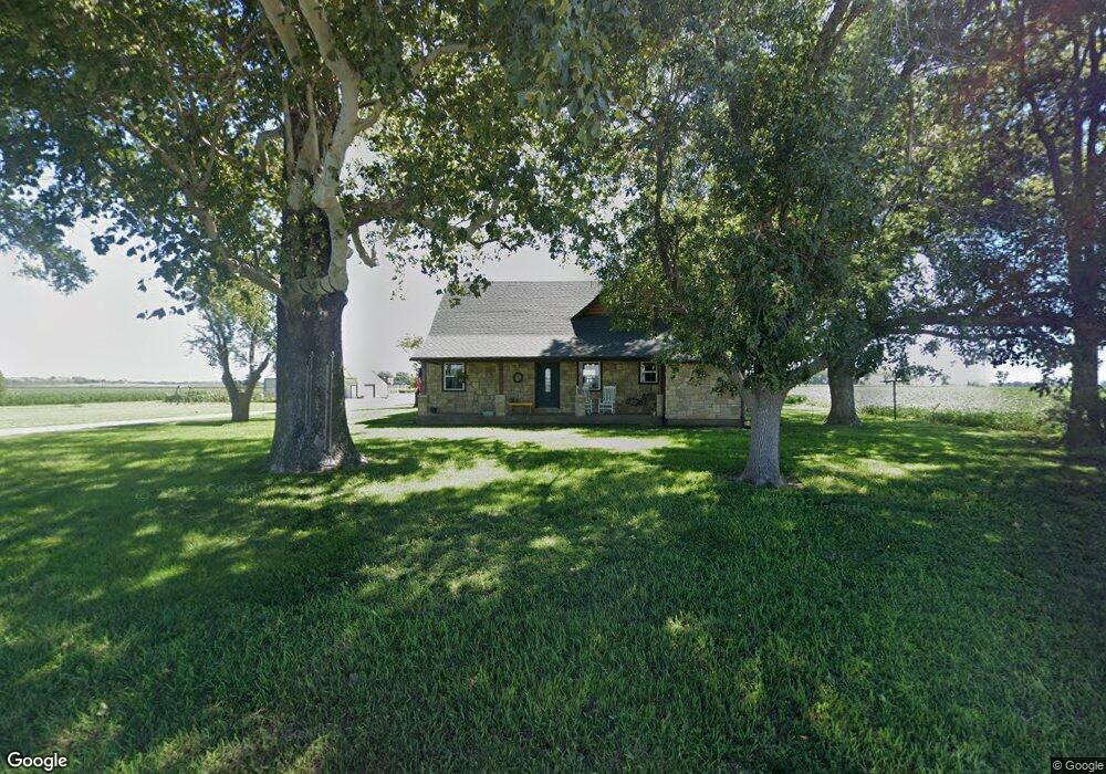
6026 NW Boyd Rd Rossville, KS 66533
Estimated Value: $342,000 - $481,000
3
Beds
2
Baths
2,441
Sq Ft
$163/Sq Ft
Est. Value
About This Home
This home is located at 6026 NW Boyd Rd, Rossville, KS 66533 and is currently estimated at $398,369, approximately $163 per square foot. 6026 NW Boyd Rd is a home located in Shawnee County with nearby schools including Rossville Elementary School and Rossville Junior/Senior High School.
Ownership History
Date
Name
Owned For
Owner Type
Purchase Details
Closed on
Jun 15, 2023
Sold by
Shibler Martin D and Shibler Kathleen A
Bought by
Ralston Family Trust
Current Estimated Value
Home Financials for this Owner
Home Financials are based on the most recent Mortgage that was taken out on this home.
Original Mortgage
$345,000
Outstanding Balance
$335,775
Interest Rate
6.39%
Mortgage Type
VA
Estimated Equity
$62,594
Purchase Details
Closed on
Jun 3, 2010
Sold by
First National Bank Of Wamego
Bought by
Shibler Martin D and Shibler Kathleen A
Home Financials for this Owner
Home Financials are based on the most recent Mortgage that was taken out on this home.
Original Mortgage
$40,000
Interest Rate
4.93%
Mortgage Type
Balloon
Create a Home Valuation Report for This Property
The Home Valuation Report is an in-depth analysis detailing your home's value as well as a comparison with similar homes in the area
Home Values in the Area
Average Home Value in this Area
Purchase History
| Date | Buyer | Sale Price | Title Company |
|---|---|---|---|
| Ralston Family Trust | -- | Lawyers Title | |
| Shibler Martin D | -- | Lawyers Title | |
| Shibler Martin D | -- | First American Title |
Source: Public Records
Mortgage History
| Date | Status | Borrower | Loan Amount |
|---|---|---|---|
| Open | Ralston Family Trust | $345,000 | |
| Previous Owner | Shibler Martin D | $40,000 |
Source: Public Records
Tax History Compared to Growth
Tax History
| Year | Tax Paid | Tax Assessment Tax Assessment Total Assessment is a certain percentage of the fair market value that is determined by local assessors to be the total taxable value of land and additions on the property. | Land | Improvement |
|---|---|---|---|---|
| 2025 | $4,824 | $38,974 | -- | -- |
| 2023 | $4,824 | $32,844 | $0 | $0 |
| 2022 | $1,317 | $11,161 | $0 | $0 |
| 2021 | $1,220 | $9,964 | $0 | $0 |
| 2020 | $1,184 | $9,964 | $0 | $0 |
| 2019 | $1,124 | $9,582 | $0 | $0 |
| 2018 | $1,143 | $9,582 | $0 | $0 |
| 2017 | $1,121 | $9,394 | $0 | $0 |
| 2014 | $956 | $8,073 | $0 | $0 |
Source: Public Records
Map
Nearby Homes
- 16037 U S 24
- 0000 NW Bailey Rd
- 117 N Main St
- 321 W Perry St
- 208 W Pottawatomie St
- 611 Pearl St
- 000 Wabaunsee Rd E
- 0000 Wabaunsee Rd E
- 25160 Highway 24
- tract 2 Highway 24
- 300 W Durink St
- 00000 NW 86th St
- 1224 N Pawnee Dr
- Lot 8 Valley View Rd
- Lot 1 Valley View Rd
- Lot 5 Valley View Rd
- Lot 20 Valley View Rd
- Lot 13 Valley View Rd
- Lot 2 Valley View Rd
- Lot 17 Valley View Rd