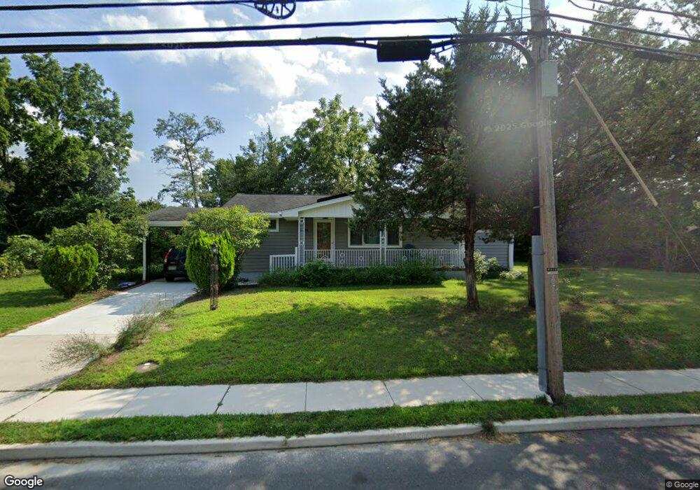
6028 3rd St Mays Landing, NJ 08330
Estimated Value: $281,341 - $335,000
--
Bed
--
Bath
1,224
Sq Ft
$256/Sq Ft
Est. Value
About This Home
This home is located at 6028 3rd St, Mays Landing, NJ 08330 and is currently estimated at $313,585, approximately $256 per square foot. 6028 3rd St is a home located in Atlantic County with nearby schools including Joseph Shaner School, George L. Hess Educational Complex, and William Davies Middle School.
Ownership History
Date
Name
Owned For
Owner Type
Purchase Details
Closed on
Jun 23, 1998
Sold by
Kirar Barica
Bought by
Guzman Carlos E and Guzman Brenda J
Current Estimated Value
Home Financials for this Owner
Home Financials are based on the most recent Mortgage that was taken out on this home.
Original Mortgage
$100,971
Outstanding Balance
$20,270
Interest Rate
7.09%
Mortgage Type
FHA
Estimated Equity
$293,315
Create a Home Valuation Report for This Property
The Home Valuation Report is an in-depth analysis detailing your home's value as well as a comparison with similar homes in the area
Home Values in the Area
Average Home Value in this Area
Purchase History
| Date | Buyer | Sale Price | Title Company |
|---|---|---|---|
| Guzman Carlos E | $102,000 | -- |
Source: Public Records
Mortgage History
| Date | Status | Borrower | Loan Amount |
|---|---|---|---|
| Open | Guzman Carlos E | $100,971 |
Source: Public Records
Tax History Compared to Growth
Tax History
| Year | Tax Paid | Tax Assessment Tax Assessment Total Assessment is a certain percentage of the fair market value that is determined by local assessors to be the total taxable value of land and additions on the property. | Land | Improvement |
|---|---|---|---|---|
| 2025 | $5,575 | $162,500 | $45,300 | $117,200 |
| 2024 | $5,575 | $162,500 | $45,300 | $117,200 |
| 2023 | $5,107 | $158,300 | $45,300 | $113,000 |
| 2022 | $5,107 | $158,300 | $45,300 | $113,000 |
| 2021 | $5,096 | $158,300 | $45,300 | $113,000 |
| 2020 | $5,096 | $158,300 | $45,300 | $113,000 |
| 2019 | $5,108 | $158,300 | $45,300 | $113,000 |
| 2018 | $4,929 | $158,300 | $45,300 | $113,000 |
| 2017 | $4,852 | $158,300 | $45,300 | $113,000 |
| 2016 | $4,716 | $158,300 | $45,300 | $113,000 |
| 2015 | $4,556 | $158,300 | $45,300 | $113,000 |
| 2014 | $4,581 | $174,400 | $53,900 | $120,500 |
Source: Public Records
Map
Nearby Homes
- 535 Park Rd
- 526 Bainbridge Ave
- 565 Park Rd
- Rt 50 and Old Mays Landing Rd
- 0 3rd St
- 717 Route 50
- 80 Mill St
- 5745 2nd St
- 6126 Longwood Ave
- 225 Old River Rd
- 1st First Ave
- 0 Cape May Ave
- Lot:11.02-12.02 Estelle Ave
- B:534 L:11.01 Estelle Ave
- B:534 L:12.02 Estelle Ave
- B:534 L:11.02 Estelle Ave
- 22 Ernst Ct
- Bl 531 Lot 8&9 Adams Ave
- 42 Ernst Ct
- 504 Meadowbrook Dr
- 202 Lenape Ave
- 6024 3rd St
- 6029 Ken Scull Ave
- 6035 Ken Scull Ave
- 6027 3rd St
- 221 Acorn Terrace
- 6023 3rd St
- 6032 Ken Scull Ave
- 6027 Ken Scull Ave
- 6040 Ken Scull Ave
- 6021 3rd St
- 6036 Ken Scull Ave
- 205 Acorn Terrace
- 237 Lenape Ave
- 512 Park Rd
- 222 Acorn Terrace
- 302 Lenape Ave
- 515 Park Rd
- 301 Hanthorn St
- 204 Acorn Terrace