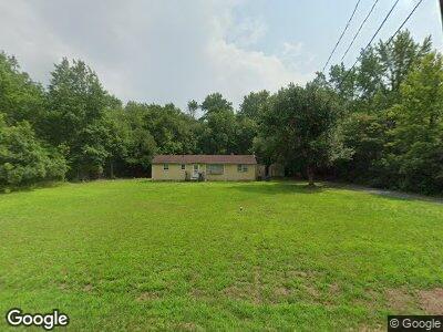
6029 James Moore Rd Port Norris, NJ 08349
Commercial Township NeighborhoodEstimated Value: $164,000 - $244,000
--
Bed
--
Bath
1,356
Sq Ft
$149/Sq Ft
Est. Value
About This Home
This home is located at 6029 James Moore Rd, Port Norris, NJ 08349 and is currently estimated at $202,661, approximately $149 per square foot. 6029 James Moore Rd is a home located in Cumberland County with nearby schools including Commercial Township School and Port Norris Elementary School.
Ownership History
Date
Name
Owned For
Owner Type
Purchase Details
Closed on
Oct 21, 2015
Sold by
Township Of Commercial
Bought by
Myers Joseph A and Langston Myers Temika
Current Estimated Value
Purchase Details
Closed on
Oct 6, 2011
Sold by
Langston John E and Langston Marilyn
Bought by
Langston John E
Purchase Details
Closed on
Apr 9, 2007
Sold by
Langston Marilyn S
Bought by
Langston Temika
Create a Home Valuation Report for This Property
The Home Valuation Report is an in-depth analysis detailing your home's value as well as a comparison with similar homes in the area
Home Values in the Area
Average Home Value in this Area
Purchase History
| Date | Buyer | Sale Price | Title Company |
|---|---|---|---|
| Myers Joseph A | $20,000 | None Available | |
| Langston John E | -- | -- | |
| Langston Temika | -- | -- |
Source: Public Records
Tax History Compared to Growth
Tax History
| Year | Tax Paid | Tax Assessment Tax Assessment Total Assessment is a certain percentage of the fair market value that is determined by local assessors to be the total taxable value of land and additions on the property. | Land | Improvement |
|---|---|---|---|---|
| 2024 | $3,485 | $119,800 | $51,000 | $68,800 |
| 2023 | $3,806 | $132,700 | $51,000 | $81,700 |
| 2022 | $3,774 | $132,700 | $51,000 | $81,700 |
| 2021 | $3,623 | $132,700 | $51,000 | $81,700 |
| 2020 | $3,623 | $132,700 | $51,000 | $81,700 |
| 2019 | $3,373 | $132,700 | $51,000 | $81,700 |
| 2018 | $3,390 | $132,700 | $51,000 | $81,700 |
| 2017 | $3,267 | $132,700 | $51,000 | $81,700 |
| 2016 | $3,150 | $132,700 | $51,000 | $81,700 |
| 2015 | $3,186 | $132,700 | $51,000 | $81,700 |
| 2014 | $3,051 | $132,700 | $51,000 | $81,700 |
Source: Public Records
Map
Nearby Homes
- 7000 Sockwell Rd
- 7079 James Moore Rd
- 0 James Moore Rd Unit 241606
- 0 North Ave Unit 590347
- 1528 North Ave
- 9059 Highland St
- 8896 Highland St
- 1600 North Ave
- 1654 North Ave
- 7020 Parsons Ln
- 8114 Ferry Rd
- 6502 Yock Wock Rd
- 6518 Yock Wock Rd
- 2310 Bacon St
- 2408 Lincoln St
- 6820 Brown St
- 2409 Market St
- 6834 Brown St
- 1603 Main St
- 1639 Main St