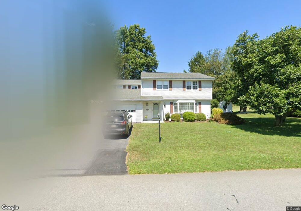
6029 Shepherd Hills Ave Allentown, PA 18106
Lower Macungie Township East NeighborhoodEstimated Value: $406,000 - $478,000
4
Beds
2
Baths
1,975
Sq Ft
$220/Sq Ft
Est. Value
About This Home
This home is located at 6029 Shepherd Hills Ave, Allentown, PA 18106 and is currently estimated at $434,878, approximately $220 per square foot. 6029 Shepherd Hills Ave is a home located in Lehigh County with nearby schools including Willow Lane Elementary School, Lower Macungie Middle School, and Emmaus High School.
Ownership History
Date
Name
Owned For
Owner Type
Purchase Details
Closed on
Feb 2, 2007
Sold by
Delre Michael and Delre Wendy
Bought by
Davis Rod S and Davis Michelle L
Current Estimated Value
Home Financials for this Owner
Home Financials are based on the most recent Mortgage that was taken out on this home.
Original Mortgage
$189,200
Outstanding Balance
$113,700
Interest Rate
6.22%
Mortgage Type
Purchase Money Mortgage
Estimated Equity
$321,178
Purchase Details
Closed on
Jun 11, 2004
Sold by
Thompson Richard K
Bought by
Delre Michael and Delre Wendy
Home Financials for this Owner
Home Financials are based on the most recent Mortgage that was taken out on this home.
Original Mortgage
$179,100
Interest Rate
5.99%
Mortgage Type
Purchase Money Mortgage
Purchase Details
Closed on
Jul 19, 1982
Sold by
Buel Edward H
Bought by
Thompson Richard K
Create a Home Valuation Report for This Property
The Home Valuation Report is an in-depth analysis detailing your home's value as well as a comparison with similar homes in the area
Home Values in the Area
Average Home Value in this Area
Purchase History
| Date | Buyer | Sale Price | Title Company |
|---|---|---|---|
| Davis Rod S | $236,500 | None Available | |
| Delre Michael | $199,000 | -- | |
| Thompson Richard K | $80,000 | -- |
Source: Public Records
Mortgage History
| Date | Status | Borrower | Loan Amount |
|---|---|---|---|
| Open | Davis Rod S | $189,200 | |
| Previous Owner | Delre Michael | $179,100 |
Source: Public Records
Tax History Compared to Growth
Tax History
| Year | Tax Paid | Tax Assessment Tax Assessment Total Assessment is a certain percentage of the fair market value that is determined by local assessors to be the total taxable value of land and additions on the property. | Land | Improvement |
|---|---|---|---|---|
| 2025 | $5,272 | $206,500 | $34,900 | $171,600 |
| 2024 | $5,101 | $206,500 | $34,900 | $171,600 |
| 2023 | $4,999 | $206,500 | $34,900 | $171,600 |
| 2022 | $4,880 | $206,500 | $171,600 | $34,900 |
| 2021 | $4,777 | $206,500 | $34,900 | $171,600 |
| 2020 | $4,731 | $206,500 | $34,900 | $171,600 |
| 2019 | $4,651 | $206,500 | $34,900 | $171,600 |
| 2018 | $4,589 | $206,500 | $34,900 | $171,600 |
| 2017 | $4,509 | $206,500 | $34,900 | $171,600 |
| 2016 | -- | $206,500 | $34,900 | $171,600 |
| 2015 | -- | $206,500 | $34,900 | $171,600 |
| 2014 | -- | $206,500 | $34,900 | $171,600 |
Source: Public Records
Map
Nearby Homes
- 6179 Fairway Ln
- 5736 Greens Dr
- 5673 Wedge Ln
- 5619 Stonecroft Ln
- 5524 Stonecroft Ln
- 5475 Hamilton Blvd Unit 7
- 1037 Village Round Unit L
- 6007 Timberknoll Dr
- 6645 Stein Way Unit 6639-6661
- 997 Village Round Unit K
- 997K Village Round Unit 104K
- 6126 Palomino Dr
- 5300 Hanover Dr
- 6779 Hickory Rd
- 1385 Brookside Rd
- 5821 Daniel St
- 5280 Townsquare Dr
- 1675 Hamlet Dr
- 1991 Autumn Ridge Rd
- 2056 Autumn Ridge Rd
- 6017 Shepherd Hills Ave
- 6041 Shepherd Hills Ave
- 6032 Shepherd Hills Ave
- 6051 Shepherd Hills Ave
- 6010 Shepherd Hills Ave
- 6007 Shepherd Hills Ave
- 6044 Shepherd Hills Ave
- 5998 Shepherd Hills Ave
- 6061 Shepherd Hills Ave
- 6054 Shepherd Hills Ave
- 5995 Shepherd Hills Ave
- 5978 Shepherd Hills Ave
- 6064 Shepherd Hills Ave
- 5950 Shepherd Hills Ave
- 5971 Shepherd Hills Ave
- 6048 Hamilton Blvd
- 6034 Hamilton Blvd
- 6034 Hamilton Blvd Unit A
- 6078 Shepherd Hills Ave
- 6087 Shepherd Hills Ave