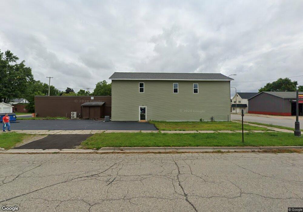
603 & 605 N State St Big Rapids, MI 49307
Estimated Value: $101,869
--
Bed
2
Baths
5,000
Sq Ft
$20/Sq Ft
Est. Value
About This Home
This home is located at 603 & 605 N State St, Big Rapids, MI 49307 and is currently estimated at $101,869, approximately $20 per square foot. 603 & 605 N State St is a home located in Mecosta County with nearby schools including Big Rapids High School, Crossroads Charter Academy Elementary School, and Crossroads Charter Academy Middle/High School.
Ownership History
Date
Name
Owned For
Owner Type
Purchase Details
Closed on
Apr 24, 2024
Sold by
Tucker Kevin Lee and Tucker Eileen Theresa
Bought by
Kajoe Llc
Current Estimated Value
Home Financials for this Owner
Home Financials are based on the most recent Mortgage that was taken out on this home.
Original Mortgage
$132,000
Outstanding Balance
$130,024
Interest Rate
6.87%
Mortgage Type
New Conventional
Estimated Equity
-$22,127
Purchase Details
Closed on
Dec 27, 2016
Sold by
Truman Audrey Elaine
Bought by
Tucker Kevin Lee and Tucker Eileen Therese
Create a Home Valuation Report for This Property
The Home Valuation Report is an in-depth analysis detailing your home's value as well as a comparison with similar homes in the area
Home Values in the Area
Average Home Value in this Area
Purchase History
| Date | Buyer | Sale Price | Title Company |
|---|---|---|---|
| Kajoe Llc | -- | Sun Title | |
| Tucker Kevin Lee | $75,000 | None Available |
Source: Public Records
Mortgage History
| Date | Status | Borrower | Loan Amount |
|---|---|---|---|
| Open | Kajoe Llc | $132,000 |
Source: Public Records
Tax History Compared to Growth
Tax History
| Year | Tax Paid | Tax Assessment Tax Assessment Total Assessment is a certain percentage of the fair market value that is determined by local assessors to be the total taxable value of land and additions on the property. | Land | Improvement |
|---|---|---|---|---|
| 2025 | $2,887 | $79,800 | $0 | $0 |
| 2024 | -- | $61,900 | $0 | $0 |
| 2023 | -- | $59,500 | $0 | $0 |
| 2022 | $2,768 | $51,600 | $0 | $0 |
| 2021 | $2,768 | $48,600 | $0 | $0 |
| 2020 | -- | -- | $0 | $0 |
| 2019 | -- | -- | $0 | $0 |
| 2018 | -- | -- | $0 | $0 |
| 2017 | -- | -- | $0 | $0 |
| 2016 | -- | -- | $0 | $0 |
| 2014 | -- | -- | $0 | $0 |
| 2013 | -- | -- | $0 | $0 |
Source: Public Records
Map
Nearby Homes
- 118 E Grand Traverse St
- 521 N Michigan Ave
- 818 N State St
- 629 Rose Ave
- 513 Rose Ave
- 409 Marion Ave
- 709 Tioga Park Dr
- 717 Tioga Park Dr Unit 717
- 713 Tioga Park Dr
- 734 Unit 734 Tioga Park
- 722 Tioga Park Dr Unit 722
- 114 N Warren Ave
- 226 Baldwin St
- 515 W Bridge St
- 817 N 4th Ave
- V/L Northland Dr
- 308 Finley Ave
- 316 2nd Ave
- 226 2nd Ave
- 417 Maple St
- 621 N State St
- 625 N State St
- 115 W Grand Traverse St
- 621 Marion Ave
- 623 Marion Ave
- 603 Marion Ave
- 611 Marion Ave
- 124 E Grand Traverse St
- 120 E Grand Traverse St
- 112 E Grand Traverse St
- 631 Marion Ave
- 618 Marion Ave
- 620 Marion Ave
- 604 Marion Ave
- 630 Marion Ave
- 531 N State St
- 612 N State St
- 113 E Bridge St
- 115 W Bridge St
- 525 N State St