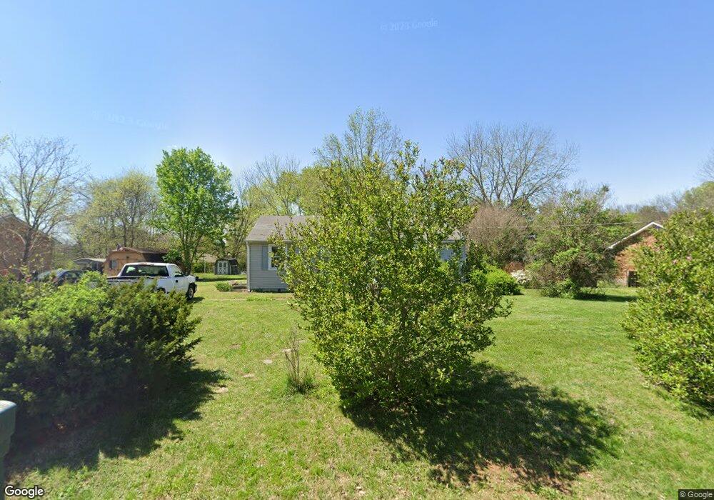
603 Flintlock Dr Smyrna, TN 37167
Estimated Value: $232,995 - $343,000
--
Bed
1
Bath
1,040
Sq Ft
$283/Sq Ft
Est. Value
About This Home
This home is located at 603 Flintlock Dr, Smyrna, TN 37167 and is currently estimated at $294,499, approximately $283 per square foot. 603 Flintlock Dr is a home located in Rutherford County with nearby schools including Stewartsboro Elementary School, Rocky Fork Middle School, and Smyrna High School.
Ownership History
Date
Name
Owned For
Owner Type
Purchase Details
Closed on
Dec 19, 2012
Sold by
Andrews Stephen F
Bought by
Andrews Stephen F Leslie
Current Estimated Value
Purchase Details
Closed on
Jul 8, 2003
Sold by
Smith Steven D and Smith Virginia
Bought by
Andrews Stephen F
Home Financials for this Owner
Home Financials are based on the most recent Mortgage that was taken out on this home.
Original Mortgage
$60,900
Interest Rate
5.29%
Create a Home Valuation Report for This Property
The Home Valuation Report is an in-depth analysis detailing your home's value as well as a comparison with similar homes in the area
Home Values in the Area
Average Home Value in this Area
Purchase History
| Date | Buyer | Sale Price | Title Company |
|---|---|---|---|
| Andrews Stephen F Leslie | -- | -- | |
| Andrews Stephen F | $80,000 | -- |
Source: Public Records
Mortgage History
| Date | Status | Borrower | Loan Amount |
|---|---|---|---|
| Previous Owner | Andrews Stephen F | $60,900 |
Source: Public Records
Tax History Compared to Growth
Tax History
| Year | Tax Paid | Tax Assessment Tax Assessment Total Assessment is a certain percentage of the fair market value that is determined by local assessors to be the total taxable value of land and additions on the property. | Land | Improvement |
|---|---|---|---|---|
| 2025 | $1,083 | $45,100 | $13,750 | $31,350 |
| 2024 | $1,083 | $45,100 | $13,750 | $31,350 |
| 2023 | $1,083 | $45,100 | $13,750 | $31,350 |
| 2022 | $966 | $45,100 | $13,750 | $31,350 |
| 2021 | $862 | $29,525 | $7,750 | $21,775 |
| 2020 | $862 | $29,525 | $7,750 | $21,775 |
| 2019 | $862 | $29,525 | $7,750 | $21,775 |
| 2018 | $827 | $29,525 | $0 | $0 |
| 2017 | $722 | $20,275 | $0 | $0 |
| 2016 | $722 | $20,275 | $0 | $0 |
| 2015 | $722 | $20,275 | $0 | $0 |
| 2014 | $504 | $20,275 | $0 | $0 |
| 2013 | -- | $19,750 | $0 | $0 |
Source: Public Records
Map
Nearby Homes
- 308 Custer Ct
- 203 Longfellow Ln
- 109 Longfellow Ln
- 101 Longfellow Ln
- 340 Stewarts Landing Cir
- 211 Stewarts Landing Cir
- 213 Stewarts Landing Cir
- 374 Longhorn Dr
- 304 Belgian Ln
- 335 Longhorn Dr
- 1026 Rosemont Terrace
- 1014 Rosemont Terrace
- 321 Longhorn Dr
- 1170 Rimrock Rd
- 320 Longhorn Dr
- 1172 Rimrock Rd
- 1023 Avery Park Dr
- 212 Eusa Cantrell Ln
- 2110 Alteras Dr
- 1176 Rimrock Rd
- 605 Flintlock Dr
- 402 Pioneer Dr
- 404 Pioneer Dr
- 607 Flintlock Dr
- 400 Pioneer Dr
- 600 Flintlock Dr
- 604 Flintlock Dr
- 602 Flintlock Dr
- 406 Pioneer Dr
- 609 Flintlock Dr
- 606 Flintlock Dr
- 504 Roundup Rd
- 502 Roundup Rd
- 322 Pioneer Dr
- 408 Pioneer Dr
- 509 Roundup Rd
- 506 Roundup Rd
- 608 Flintlock Dr
- 403 Pioneer Dr
- 611 Flintlock Dr