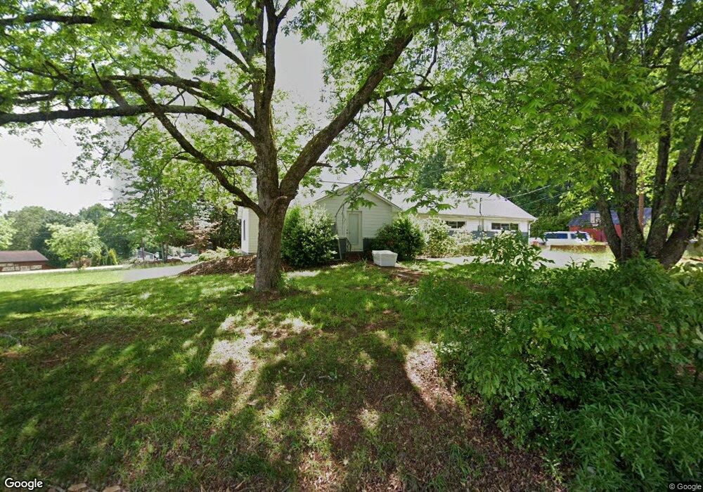
603 Playground Rd Walhalla, SC 29691
Estimated Value: $282,000 - $428,000
4
Beds
3
Baths
2,998
Sq Ft
$114/Sq Ft
Est. Value
About This Home
This home is located at 603 Playground Rd, Walhalla, SC 29691 and is currently estimated at $341,872, approximately $114 per square foot. 603 Playground Rd is a home located in Oconee County with nearby schools including Walhalla Elementary School, Walhalla Middle School, and Walhalla High School.
Ownership History
Date
Name
Owned For
Owner Type
Purchase Details
Closed on
Oct 6, 2020
Sold by
Ward Vanessa K and Miller Vanessa
Bought by
Ward Jacob L
Current Estimated Value
Purchase Details
Closed on
Sep 25, 2007
Sold by
Hartford Glen F and Hartford Carol S
Bought by
Ward Jacob L and Ward Vanessa K
Home Financials for this Owner
Home Financials are based on the most recent Mortgage that was taken out on this home.
Original Mortgage
$146,160
Outstanding Balance
$91,352
Interest Rate
6.41%
Mortgage Type
FHA
Estimated Equity
$250,520
Create a Home Valuation Report for This Property
The Home Valuation Report is an in-depth analysis detailing your home's value as well as a comparison with similar homes in the area
Home Values in the Area
Average Home Value in this Area
Purchase History
| Date | Buyer | Sale Price | Title Company |
|---|---|---|---|
| Ward Jacob L | -- | None Available | |
| Ward Jacob L | $160,000 | Attorney |
Source: Public Records
Mortgage History
| Date | Status | Borrower | Loan Amount |
|---|---|---|---|
| Open | Ward Jacob L | $146,160 |
Source: Public Records
Tax History Compared to Growth
Tax History
| Year | Tax Paid | Tax Assessment Tax Assessment Total Assessment is a certain percentage of the fair market value that is determined by local assessors to be the total taxable value of land and additions on the property. | Land | Improvement |
|---|---|---|---|---|
| 2025 | $1,179 | $6,110 | $691 | $5,419 |
| 2024 | $1,167 | $6,110 | $691 | $5,419 |
| 2023 | $1,145 | $6,110 | $691 | $5,419 |
| 2022 | $1,145 | $6,110 | $691 | $5,419 |
| 2021 | $671 | $6,188 | $1,058 | $5,130 |
| 2020 | $671 | $6,188 | $1,058 | $5,130 |
| 2019 | $671 | $0 | $0 | $0 |
| 2018 | $1,356 | $0 | $0 | $0 |
| 2017 | $1,138 | $0 | $0 | $0 |
| 2016 | $1,138 | $0 | $0 | $0 |
| 2015 | -- | $0 | $0 | $0 |
| 2014 | -- | $6,118 | $1,636 | $4,482 |
| 2013 | -- | $0 | $0 | $0 |
Source: Public Records
Map
Nearby Homes
- Tract B Bobolink Dr
- 606 N Poplar St
- 101 Hazelwood Way
- 223 N Dogwood Dr
- 221 Cub Cove Dr
- 00 Fox Run Rd
- Lot 57 Fox Run Rd
- 00 N Church St
- 203 Tulip Dr
- 804 W North Broad St
- 731 Christmas Tree Ln
- 301 Shadybrook Dr Unit B
- 412 N Spring St
- 606 W South Broad St
- 910 White Cut Rd
- 106 Torrington Rd
- 545 Knollington Dr
- 46 Mason Dr
- 1050 Highlands Hwy
- 209 Moore Ave
- 101 Peach Dr
- 600 Playground Rd
- 00 Playground Rd Unit Rocky Knoll Road
- 00 Playground Rd
- L2 Playground Rd
- 706 N Poplar St
- 105 Peach Dr
- 528 Playground Rd Unit Bobolink
- 528 Playground Rd
- 525 Playground Rd
- 526 Playground Rd
- 105 Meadowlark Dr
- 654 N Poplar St
- 622 Playground Rd
- 104 Bobolink Dr
- 521 Playground Rd
- 112 Bobolink Dr
- 000 Bobolink Dr
- 01-03 Bobolink Dr
- 00 Bobolink Dr