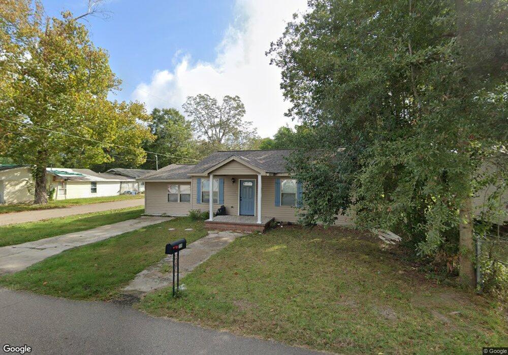
603 S Curran Ave Picayune, MS 39466
Estimated Value: $79,771 - $157,000
2
Beds
1
Bath
1,100
Sq Ft
$110/Sq Ft
Est. Value
About This Home
This home is located at 603 S Curran Ave, Picayune, MS 39466 and is currently estimated at $120,943, approximately $109 per square foot. 603 S Curran Ave is a home located in Pearl River County with nearby schools including Roseland Park Elementary School, Picayune Junior High School, and Picayune Memorial High School.
Ownership History
Date
Name
Owned For
Owner Type
Purchase Details
Closed on
Mar 31, 2025
Sold by
Spurlock Shawn
Bought by
Edwards Billie G
Current Estimated Value
Purchase Details
Closed on
Aug 23, 2022
Sold by
Feddeck Daniel R and Feddeck Amanda L
Bought by
Spurlock Shawn
Home Financials for this Owner
Home Financials are based on the most recent Mortgage that was taken out on this home.
Original Mortgage
$83,460
Interest Rate
5.22%
Mortgage Type
Construction
Create a Home Valuation Report for This Property
The Home Valuation Report is an in-depth analysis detailing your home's value as well as a comparison with similar homes in the area
Home Values in the Area
Average Home Value in this Area
Purchase History
| Date | Buyer | Sale Price | Title Company |
|---|---|---|---|
| Edwards Billie G | -- | Attorney Only | |
| Spurlock Shawn | $84,294 | Pilger Title Co |
Source: Public Records
Mortgage History
| Date | Status | Borrower | Loan Amount |
|---|---|---|---|
| Previous Owner | Spurlock Shawn | $83,460 |
Source: Public Records
Tax History Compared to Growth
Tax History
| Year | Tax Paid | Tax Assessment Tax Assessment Total Assessment is a certain percentage of the fair market value that is determined by local assessors to be the total taxable value of land and additions on the property. | Land | Improvement |
|---|---|---|---|---|
| 2024 | $911 | $5,642 | $0 | $0 |
| 2023 | $911 | $5,189 | $0 | $0 |
| 2022 | $430 | $3,459 | $0 | $0 |
| 2021 | $430 | $3,459 | $0 | $0 |
| 2020 | $391 | $3,459 | $0 | $0 |
| 2019 | $374 | $3,279 | $0 | $0 |
| 2018 | $376 | $3,279 | $0 | $0 |
| 2017 | $371 | $3,279 | $0 | $0 |
| 2016 | $371 | $3,279 | $0 | $0 |
| 2015 | $315 | $2,698 | $0 | $0 |
| 2014 | $321 | $2,698 | $0 | $0 |
Source: Public Records
Map
Nearby Homes
- 304 Culpepper St
- 307 S Steele Ave
- 221 S Curran Ave
- NHN Corner S Main and Elizabeth St
- 204 S Monroe Ave
- 9 W Canal St
- 522 E Canal St
- 10 W Canal St
- NHN S Main St
- 200 N Steele Ave
- Nhn Lawrence St
- 220 N Haugh Ave
- 820 Mitchell St
- 628 Telly Rd
- 200 N Monroe Ave
- 0 Elm St
- 00 Elm St
- 617 Mill St
- NHN Katie Beck Dees Street Lot 3 4 & 5
- 510 W Canal St
- 519 S Curran Ave
- 605 S Curran Ave
- 604 S Curran Ave
- 518 S Curran Ave
- 200 Seal St
- 609 S Curran Ave
- 210 Seal St
- 515 S Curran Ave
- 517 S Curran Ave
- 520 S Haugh Ave
- 516 S Curran Ave
- 501 S Curran Ave
- 507 S Curran Ave
- 702 S Curran Ave
- 206 Whitfield St
- 704 S Curran Ave
- 604 S Harvey Ave
- 502 S Curran Ave
- 204 Whitfield St
- 516 S Haugh Ave