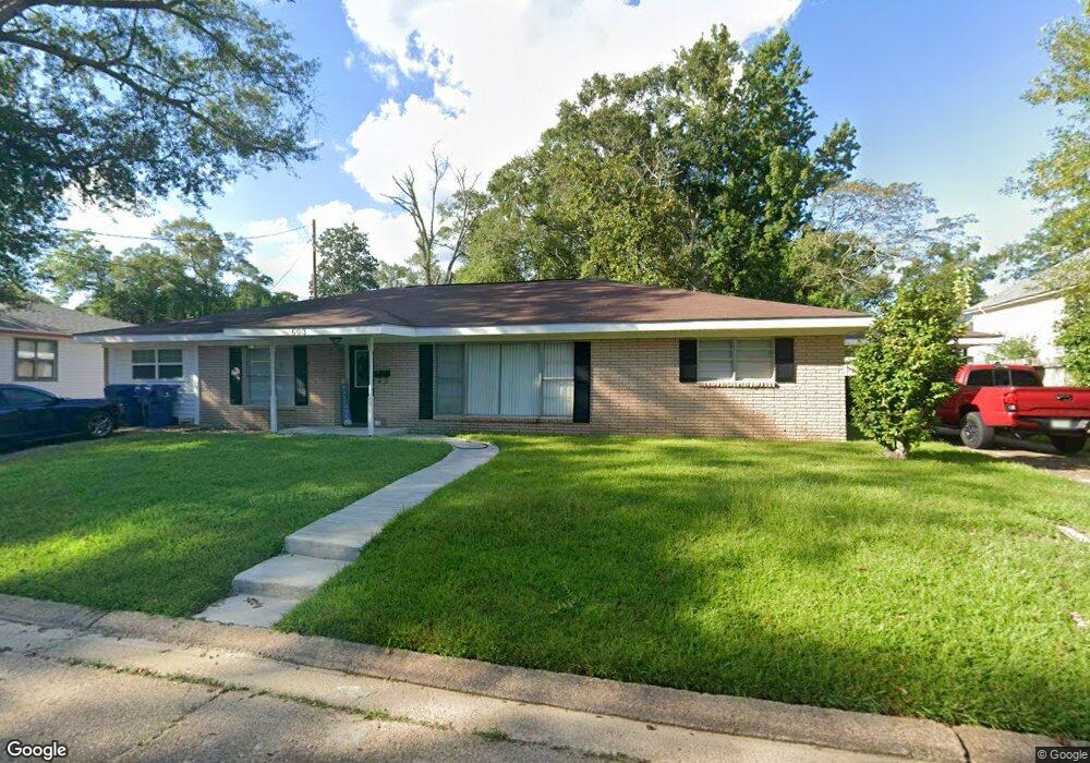
603 W 3rd St Deridder, LA 70634
Estimated Value: $149,554 - $217,000
4
Beds
3
Baths
2,845
Sq Ft
$66/Sq Ft
Est. Value
About This Home
This home is located at 603 W 3rd St, Deridder, LA 70634 and is currently estimated at $188,389, approximately $66 per square foot. 603 W 3rd St is a home located in Beauregard Parish with nearby schools including K.R. Hanchey Elementary School, Pine Wood Elementary School, and DeRidder Junior High School.
Ownership History
Date
Name
Owned For
Owner Type
Purchase Details
Closed on
Sep 20, 2011
Sold by
Stark Mance Mason and Stark Linda Bartrella Quave
Bought by
Steltzlen James Barrett and Steltzlen Dottie Jo Currie
Current Estimated Value
Purchase Details
Closed on
Jun 10, 2011
Sold by
Beauregard Federal Savings Bank
Bought by
Stark Mance Mason and Stark Linda Bartrella Quave
Home Financials for this Owner
Home Financials are based on the most recent Mortgage that was taken out on this home.
Original Mortgage
$67,000
Interest Rate
4.7%
Create a Home Valuation Report for This Property
The Home Valuation Report is an in-depth analysis detailing your home's value as well as a comparison with similar homes in the area
Purchase History
| Date | Buyer | Sale Price | Title Company |
|---|---|---|---|
| Steltzlen James Barrett | $111,000 | -- | |
| Stark Mance Mason | $47,200 | -- |
Source: Public Records
Mortgage History
| Date | Status | Borrower | Loan Amount |
|---|---|---|---|
| Previous Owner | Stark Mance Mason | $67,000 |
Source: Public Records
Tax History
| Year | Tax Paid | Tax Assessment Tax Assessment Total Assessment is a certain percentage of the fair market value that is determined by local assessors to be the total taxable value of land and additions on the property. | Land | Improvement |
|---|---|---|---|---|
| 2025 | $1,138 | $11,008 | $375 | $10,633 |
| 2024 | $1,130 | $11,008 | $375 | $10,633 |
| 2023 | $1,160 | $11,040 | $500 | $10,540 |
| 2022 | $1,159 | $11,040 | $500 | $10,540 |
| 2021 | $1,159 | $11,040 | $500 | $10,540 |
| 2020 | $1,159 | $11,040 | $500 | $10,540 |
| 2019 | $1,161 | $11,040 | $500 | $10,540 |
| 2018 | $1,161 | $11,040 | $500 | $10,540 |
| 2017 | $1,161 | $11,040 | $500 | $10,540 |
| 2016 | $1,161 | $11,040 | $500 | $10,540 |
| 2015 | $437 | $11,040 | $500 | $10,540 |
| 2014 | $437 | $11,040 | $500 | $10,540 |
Source: Public Records
Map
Nearby Homes
- 613 W 1st St
- 401 Bon Ami St
- 104 N Royal St
- 0 S Pine St Unit 51-188
- 0 S Pine St Unit 2-5618
- 0 S Pine St Unit SWL25101883
- 0 Tbd Shirley St
- 205 N Royal St
- 801 Shirley St
- 112 S Texas St Unit S
- 106 N Texas St
- 307 S Texas St
- 0 S Texas St
- 304 Broad St Unit Street
- 502 S Texas St
- 115 N Texas St
- 1022 W 1st St
- 116 W Port St
- 801 W 8th St
- 707 S Texas St
- 125 S Royal St
- 125 S Royal St Unit Street
- 121 S Royal St
- 605 W 3rd St
- 119 S Royal St
- 602 W 3rd St
- 611 W 3rd St Unit A
- 606 W 3rd St
- 117 S Royal St
- 608 W 3rd St
- 114 S Division St
- 126 S Royal St
- 126 S Royal St Unit (511 W 3RD ST
- 305 S Royal St
- 301 S Royal St
- 124 S Royal St
- 124 S Royal St
- 107 S Royal St
- 308-310 S Bobcat Aly Unit 310 S Bobcat Alley
- 308-310 S Bobcat Aly Unit 308 S Bobcat Alley
Your Personal Tour Guide
Ask me questions while you tour the home.