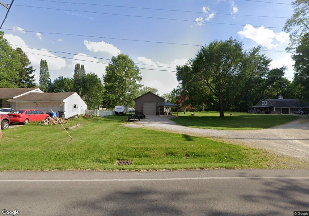
603 W Cole Rd Fremont, OH 43420
Estimated Value: $219,000 - $244,000
3
Beds
2
Baths
1,632
Sq Ft
$143/Sq Ft
Est. Value
About This Home
This home is located at 603 W Cole Rd, Fremont, OH 43420 and is currently estimated at $232,929, approximately $142 per square foot. 603 W Cole Rd is a home located in Sandusky County with nearby schools including Fremont Ross High School, Bishop Hoffman Catholic School - This is St Joe's School now, and St. Joseph School.
Ownership History
Date
Name
Owned For
Owner Type
Purchase Details
Closed on
Feb 19, 1999
Sold by
Miller Scott R
Bought by
Veleba Terry L and Veleba Michelle R
Current Estimated Value
Home Financials for this Owner
Home Financials are based on the most recent Mortgage that was taken out on this home.
Original Mortgage
$68,000
Outstanding Balance
$16,289
Interest Rate
6.88%
Mortgage Type
New Conventional
Estimated Equity
$216,640
Purchase Details
Closed on
Aug 8, 1994
Sold by
Shanahan Terrance O
Bought by
Horn Timothy J
Home Financials for this Owner
Home Financials are based on the most recent Mortgage that was taken out on this home.
Original Mortgage
$88,400
Interest Rate
4.99%
Mortgage Type
New Conventional
Purchase Details
Closed on
Mar 1, 1987
Bought by
Veleba Terry L and Veleba Michelle R
Create a Home Valuation Report for This Property
The Home Valuation Report is an in-depth analysis detailing your home's value as well as a comparison with similar homes in the area
Home Values in the Area
Average Home Value in this Area
Purchase History
| Date | Buyer | Sale Price | Title Company |
|---|---|---|---|
| Veleba Terry L | $116,000 | -- | |
| Horn Timothy J | $104,000 | -- | |
| Veleba Terry L | $53,000 | -- |
Source: Public Records
Mortgage History
| Date | Status | Borrower | Loan Amount |
|---|---|---|---|
| Open | Veleba Terry L | $68,000 | |
| Previous Owner | Horn Timothy J | $88,400 |
Source: Public Records
Tax History Compared to Growth
Tax History
| Year | Tax Paid | Tax Assessment Tax Assessment Total Assessment is a certain percentage of the fair market value that is determined by local assessors to be the total taxable value of land and additions on the property. | Land | Improvement |
|---|---|---|---|---|
| 2024 | $2,596 | $66,780 | $12,110 | $54,670 |
| 2023 | $2,596 | $46,690 | $8,470 | $38,220 |
| 2022 | $1,938 | $46,690 | $8,470 | $38,220 |
| 2021 | $1,997 | $46,690 | $8,470 | $38,220 |
| 2020 | $1,747 | $40,040 | $8,470 | $31,570 |
| 2019 | $1,745 | $40,040 | $8,470 | $31,570 |
| 2018 | $1,615 | $40,040 | $8,470 | $31,570 |
| 2017 | $1,531 | $35,910 | $8,470 | $27,440 |
| 2016 | $1,342 | $35,910 | $8,470 | $27,440 |
| 2015 | $1,320 | $35,910 | $8,470 | $27,440 |
| 2014 | $1,416 | $36,900 | $8,230 | $28,670 |
| 2013 | $1,386 | $36,900 | $8,230 | $28,670 |
Source: Public Records
Map
Nearby Homes
- 1818 Finley Dr
- 350 Conner Dr
- 135 Briarwood Cir
- 1970 Morrison Rd
- 1832 Myrtle St
- 10 Meadowbrook Ln
- 10 Meadowbrook Dr
- 64 River Run Dr Unit J
- 1420 Center St
- 933 E Cole Rd
- 18 Katlyn Dr
- 1013 Whittlesey St
- 905 Twinn St
- 1485 Autumn Woods Dr
- 1719 Buckland Ave
- 625 Bush Place
- 1028 June St
- 815 South St
- 616 S Wood St
- 1015 Hayes Ave
- 603 W Cole Rd
- 513 W Cole Rd
- 512 Guernsey Dr
- 600 Guernsey Dr
- 701 W Cole Rd
- 501 W Cole Rd
- 1810 Edgeworth Dr
- 520 W Cole Rd
- 508 W Cole Rd
- 500 Guernsey Dr
- 1748 Japack Dr
- 606 W Cole Rd
- 21 Brookview Dr Unit 21
- 23 Brookview Dr
- 509 Guernsey Dr
- 1820 Guernsey Dr
- 1837 Guernsey Dr
- 25 Brookview Dr
- 714 W Cole Rd
- 503 Guernsey Dr