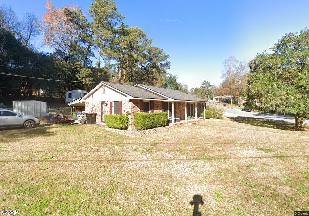
6031 Boeing Dr Columbus, GA 31909
Estimated Value: $170,231 - $209,000
3
Beds
3
Baths
1,314
Sq Ft
$146/Sq Ft
Est. Value
About This Home
This home is located at 6031 Boeing Dr, Columbus, GA 31909 and is currently estimated at $191,808, approximately $145 per square foot. 6031 Boeing Dr is a home located in Muscogee County with nearby schools including Blanchard Elementary School, Veterans Memorial Middle School, and Hardaway High School.
Ownership History
Date
Name
Owned For
Owner Type
Purchase Details
Closed on
Aug 7, 2018
Sold by
Ehouse Allison J
Bought by
Loftin Jessica Leigh
Current Estimated Value
Home Financials for this Owner
Home Financials are based on the most recent Mortgage that was taken out on this home.
Original Mortgage
$107,346
Outstanding Balance
$94,454
Interest Rate
5.12%
Mortgage Type
FHA
Estimated Equity
$97,354
Create a Home Valuation Report for This Property
The Home Valuation Report is an in-depth analysis detailing your home's value as well as a comparison with similar homes in the area
Home Values in the Area
Average Home Value in this Area
Purchase History
| Date | Buyer | Sale Price | Title Company |
|---|---|---|---|
| Loftin Jessica Leigh | $119,000 | -- |
Source: Public Records
Mortgage History
| Date | Status | Borrower | Loan Amount |
|---|---|---|---|
| Open | Loftin Jessica Leigh | $107,346 |
Source: Public Records
Tax History Compared to Growth
Tax History
| Year | Tax Paid | Tax Assessment Tax Assessment Total Assessment is a certain percentage of the fair market value that is determined by local assessors to be the total taxable value of land and additions on the property. | Land | Improvement |
|---|---|---|---|---|
| 2025 | $981 | $47,988 | $8,256 | $39,732 |
| 2024 | $980 | $47,988 | $8,256 | $39,732 |
| 2023 | $292 | $47,988 | $8,256 | $39,732 |
| 2022 | $1,022 | $35,204 | $8,256 | $26,948 |
| 2021 | $1,015 | $38,252 | $8,256 | $29,996 |
| 2020 | $1,015 | $38,252 | $8,256 | $29,996 |
| 2019 | $1,020 | $38,252 | $8,256 | $29,996 |
| 2018 | $1,008 | $38,252 | $8,256 | $29,996 |
| 2017 | $1,013 | $38,252 | $8,256 | $29,996 |
| 2016 | $1,018 | $44,218 | $3,440 | $40,778 |
| 2015 | $1,020 | $44,218 | $3,440 | $40,778 |
| 2014 | $1,022 | $44,218 | $3,440 | $40,778 |
| 2013 | -- | $44,218 | $3,440 | $40,778 |
Source: Public Records
Map
Nearby Homes
- 5829 Ventura Dr
- 6138 Seaton Dr
- 3325 N North Quay Dr
- 5817 Sherborne Dr
- 5836 Sherborne Dr
- 3204 Weems Rd
- 6221 Charing Dr
- 6308 Adams Park Dr
- 5552 Perry Ave
- 3120 Weems Rd
- 6226 Westbrook Dr
- 6232 Westbrook Dr
- 6200 Karen Ct
- 6231 Westbrook Dr
- 6225 Westbrook Dr
- 2528 Lorraine St
- 3308 Mustang Dr
- 2516 Lorraine St
- 3732 Arrel Dr
- 3710 Winkfield Place
- 6037 Boeing Dr
- 5802 Catalina Dr
- 5808 Catalina Dr
- 6043 Boeing Dr
- 6018 Boeing Dr
- 5714 Catalina Dr
- 5814 Catalina Dr
- 6030 Boeing Dr
- 6049 Boeing Dr
- 5708 Catalina Dr
- 5820 Catalina Dr
- 6046 Boeing Dr
- 5711 Fairchild Dr
- 5719 Fairchild Dr
- 5707 Fairchild Dr
- 6055 Boeing Dr
- 5801 Fairchild Dr
- 5703 Fairchild Dr
- 5702 Catalina Dr
- 5824 Catalina Dr