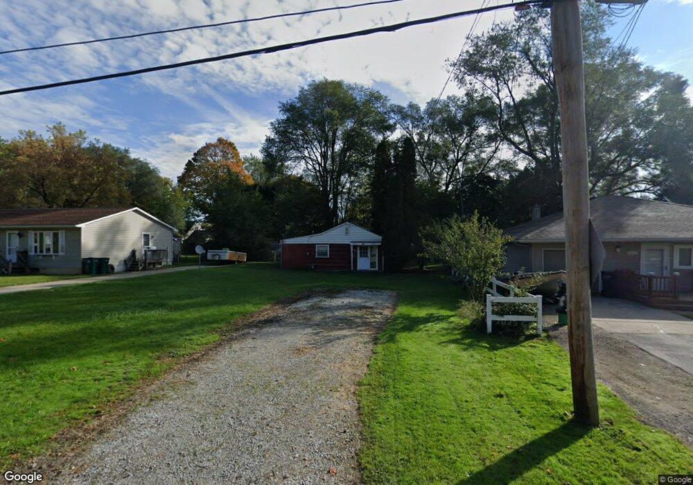
6031 Pheasant Ave Lansing, MI 48911
Southern Lansing NeighborhoodEstimated Value: $99,120 - $128,000
2
Beds
1
Bath
744
Sq Ft
$152/Sq Ft
Est. Value
About This Home
This home is located at 6031 Pheasant Ave, Lansing, MI 48911 and is currently estimated at $113,280, approximately $152 per square foot. 6031 Pheasant Ave is a home located in Ingham County with nearby schools including Reo Elementary School, Attwood School, and Everett High School.
Ownership History
Date
Name
Owned For
Owner Type
Purchase Details
Closed on
Nov 6, 2025
Sold by
Johnson Lynn D
Bought by
Johnson Lynn D and Johnson Linda J
Current Estimated Value
Purchase Details
Closed on
May 27, 2015
Sold by
Johnson Donna M
Bought by
Johnson Bryan L and Johnson Lynn D
Create a Home Valuation Report for This Property
The Home Valuation Report is an in-depth analysis detailing your home's value as well as a comparison with similar homes in the area
Home Values in the Area
Average Home Value in this Area
Purchase History
| Date | Buyer | Sale Price | Title Company |
|---|---|---|---|
| Johnson Lynn D | -- | None Listed On Document | |
| Johnson Bryan L | -- | None Available |
Source: Public Records
Tax History
| Year | Tax Paid | Tax Assessment Tax Assessment Total Assessment is a certain percentage of the fair market value that is determined by local assessors to be the total taxable value of land and additions on the property. | Land | Improvement |
|---|---|---|---|---|
| 2025 | $1,836 | $47,600 | $7,800 | $39,800 |
| 2024 | $15 | $38,600 | $7,800 | $30,800 |
| 2023 | $1,730 | $33,400 | $7,800 | $25,600 |
| 2022 | $1,582 | $28,200 | $5,400 | $22,800 |
| 2021 | $1,546 | $25,100 | $5,400 | $19,700 |
| 2020 | $1,535 | $23,200 | $5,400 | $17,800 |
| 2019 | $1,480 | $20,800 | $5,400 | $15,400 |
| 2018 | $1,406 | $18,500 | $5,400 | $13,100 |
| 2017 | $1,352 | $18,500 | $5,400 | $13,100 |
| 2016 | $1,361 | $17,800 | $5,400 | $12,400 |
| 2015 | $1,361 | $17,000 | $10,845 | $6,155 |
| 2014 | $1,361 | $17,600 | $16,870 | $730 |
Source: Public Records
Map
Nearby Homes
- 2411 Bliesener St
- 5838 S Martin Luther King Junior Blvd
- 5650 Hughes Rd
- 6037 Hughes Rd
- 5902 Haag Rd
- 3220 W Miller Rd
- 1406 Weymouth Ct
- 1309 Penrod Ct
- 5641 Ashley Dr
- 2918 Midwood St
- 2416 Midwood St
- 1020 R G Curtiss Ave
- 0 Midwood St
- 2700 Eaton Rapids Road #193 Rd
- 2706 W Jolly Rd
- 1006 Attwood Dr
- 5815 Caleta Dr
- 5017 Christiansen Rd
- 4927 Starr Ave
- 4928 Hughes Rd
- 6037 Pheasant Ave
- 6025 Pheasant Ave
- 6041 Pheasant Ave
- 6019 Pheasant Ave
- 6024 Piper Ave
- 6013 Pheasant Ave
- 6042 Piper Ave
- 6018 Piper Ave
- 6034 Pheasant Ave
- 6024 Pheasant Ave
- 6014 Piper Ave
- 6020 Pheasant Ave
- 6014 Pheasant Ave
- 6008 Piper Ave
- 2219 Newark Ave
- 6006 Pheasant Ave
- 6052 Pheasant Ave
- 6000 Piper Ave
- 2318 Bliesener St
- 6058 Pheasant Ave
Your Personal Tour Guide
Ask me questions while you tour the home.