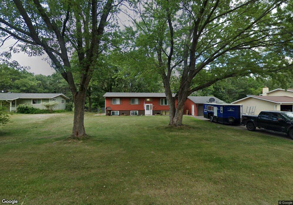
6034 Donald St Baxter, MN 56425
Estimated Value: $316,082 - $360,000
5
Beds
3
Baths
1,344
Sq Ft
$254/Sq Ft
Est. Value
About This Home
This home is located at 6034 Donald St, Baxter, MN 56425 and is currently estimated at $341,521, approximately $254 per square foot. 6034 Donald St is a home located in Crow Wing County with nearby schools including Baxter Elementary School, Forestview Middle School, and Brainerd Senior High School.
Ownership History
Date
Name
Owned For
Owner Type
Purchase Details
Closed on
May 27, 2016
Sold by
Warren Lloyd Lloyd
Bought by
Tonn Jeremy and Tonn Megan
Current Estimated Value
Home Financials for this Owner
Home Financials are based on the most recent Mortgage that was taken out on this home.
Original Mortgage
$164,000
Outstanding Balance
$130,568
Interest Rate
3.58%
Estimated Equity
$210,953
Purchase Details
Closed on
Sep 1, 2009
Bought by
Warren Lloyd
Purchase Details
Closed on
Dec 1, 2005
Sold by
Smith Kirk P and Smith Shirley J
Bought by
Schindler Brian J
Create a Home Valuation Report for This Property
The Home Valuation Report is an in-depth analysis detailing your home's value as well as a comparison with similar homes in the area
Home Values in the Area
Average Home Value in this Area
Purchase History
We collect this data history from publicly available records. To have your information removed, we recommend requesting removal directly through your county’s website.
| Date | Buyer | Sale Price | Title Company |
|---|---|---|---|
| Tonn Jeremy | $165,000 | -- | |
| Warren Lloyd | $127,300 | -- | |
| Schindler Brian J | $189,000 | -- |
Source: Public Records
Mortgage History
We collect this data history from publicly available records. To have your information removed, we recommend requesting removal directly through your county’s website.
| Date | Status | Borrower | Loan Amount |
|---|---|---|---|
| Open | Tonn Jeremy | $164,000 |
Source: Public Records
Tax History
| Year | Tax Paid | Tax Assessment Tax Assessment Total Assessment is a certain percentage of the fair market value that is determined by local assessors to be the total taxable value of land and additions on the property. | Land | Improvement |
|---|---|---|---|---|
| 2025 | $3,824 | $292,900 | $50,700 | $242,200 |
| 2024 | $3,868 | $292,200 | $49,500 | $242,700 |
| 2023 | $2,560 | $280,600 | $56,700 | $223,900 |
| 2022 | $2,300 | $252,900 | $42,300 | $210,600 |
| 2021 | $2,280 | $195,400 | $40,400 | $155,000 |
| 2020 | $2,198 | $189,600 | $43,600 | $146,000 |
| 2019 | $2,102 | $183,300 | $41,500 | $141,800 |
| 2018 | $1,952 | $179,700 | $41,500 | $138,200 |
| 2017 | $1,782 | $156,017 | $35,638 | $120,379 |
| 2016 | $1,664 | $127,800 | $26,400 | $101,400 |
| 2015 | $1,548 | $116,400 | $21,700 | $94,700 |
| 2014 | $719 | $110,900 | $15,700 | $95,200 |
Source: Public Records
Map
Nearby Homes
- 6078 Donald St
- 13895 Knollwood Dr
- 6141 Donald St
- 14093 Cherrywood Dr
- 13910 Cherrywood Dr
- TBD Dahlin Rd N
- 14449 Kimberlee Dr N
- 6195 Cosmos Rd
- XXX Kimberlee Dr
- 6508 Mary St
- 14104 Inglewood Dr
- Outlot A and D Rockrose Dr
- 14502 Lynndale Dr N
- 6285 Clearwater Rd
- 5850 Fairview Rd
- TBD Clearwater Rd N
- 7205 Clearwater Rd N
- L1&2 B3 Clearwater Rd N
- L1&2 B1 Clearwater Rd N
- 6083 Knollwood Ct
- 6042 Donald St
- 6006 Donald St
- 6068 Donald St
- 6023 Donald St
- 13971 Kenwood Dr
- 6051 Donald St
- 6015 Donald St
- 6061 Donald St
- 13945 Kenwood Dr
- 13065 Kenwood Dr
- 13925 Knollwood Dr
- 6112 Donald St
- 13937 Kenwood Dr
- 6119 Donald St
- 13876 Kenwood Dr
- 6130 Donald St
- 13905 Kenwood Dr
- 13867 Knollwood Dr
- 13867 Knollwood Dr
- 6158 Donald St
Your Personal Tour Guide
Ask me questions while you tour the home.