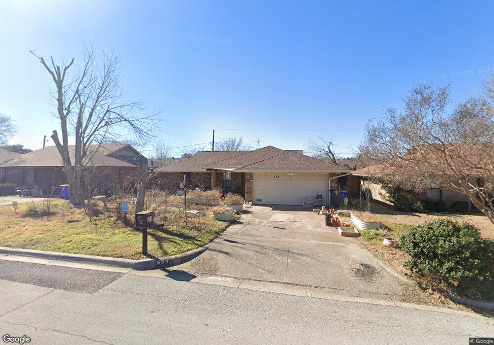
604 Allencrest Dr Fort Worth, TX 76108
Estimated Value: $224,000 - $239,000
3
Beds
2
Baths
1,234
Sq Ft
$189/Sq Ft
Est. Value
About This Home
This home is located at 604 Allencrest Dr, Fort Worth, TX 76108 and is currently estimated at $233,477, approximately $189 per square foot. 604 Allencrest Dr is a home located in Tarrant County with nearby schools including West Elementary School, Brewer Middle School, and Tannahill Intermediate School.
Ownership History
Date
Name
Owned For
Owner Type
Purchase Details
Closed on
May 28, 2002
Sold by
Miller Ronnie Foster and Miller Carylon Ruth
Bought by
Morin William Lee and Morin Linda Reena
Current Estimated Value
Home Financials for this Owner
Home Financials are based on the most recent Mortgage that was taken out on this home.
Original Mortgage
$89,150
Outstanding Balance
$37,988
Interest Rate
6.92%
Mortgage Type
VA
Estimated Equity
$195,489
Create a Home Valuation Report for This Property
The Home Valuation Report is an in-depth analysis detailing your home's value as well as a comparison with similar homes in the area
Home Values in the Area
Average Home Value in this Area
Purchase History
| Date | Buyer | Sale Price | Title Company |
|---|---|---|---|
| Morin William Lee | -- | Alamo Title Company |
Source: Public Records
Mortgage History
| Date | Status | Borrower | Loan Amount |
|---|---|---|---|
| Open | Morin William Lee | $89,150 |
Source: Public Records
Tax History Compared to Growth
Tax History
| Year | Tax Paid | Tax Assessment Tax Assessment Total Assessment is a certain percentage of the fair market value that is determined by local assessors to be the total taxable value of land and additions on the property. | Land | Improvement |
|---|---|---|---|---|
| 2025 | $1,044 | $230,077 | $32,125 | $197,952 |
| 2024 | $1,044 | $230,077 | $32,125 | $197,952 |
| 2023 | $3,292 | $192,800 | $32,125 | $160,675 |
| 2022 | $2,460 | $187,002 | $25,000 | $162,002 |
| 2021 | $3,148 | $169,431 | $25,000 | $144,431 |
| 2020 | $2,883 | $130,000 | $25,000 | $105,000 |
| 2019 | $2,721 | $130,000 | $25,000 | $105,000 |
| 2018 | $1,747 | $85,983 | $12,000 | $73,983 |
| 2017 | $2,284 | $91,854 | $12,000 | $79,854 |
| 2016 | $2,077 | $90,000 | $12,000 | $78,000 |
| 2015 | $1,320 | $64,600 | $12,400 | $52,200 |
| 2014 | $1,320 | $64,600 | $12,400 | $52,200 |
Source: Public Records
Map
Nearby Homes
- 8528 Pemberton Ct
- 501 Allencrest Dr
- 428 S Las Vegas Trail
- 411 S Las Vegas Trail
- 800 Pemberton St
- 409 S Las Vegas Trail
- 407 S Las Vegas Trail
- 405 S Las Vegas Trail
- 508 Grant Cir
- 501 Pemberton St
- 8437 Redonda St
- 8508 Michael St
- 8354 Sussex St
- 8500 Wyatt Dr
- 8552 Gibbs Dr
- 8400 Wyatt Dr
- 9100 Rowland Dr
- 809 Mirike Dr
- 1725 S Las Vegas Trail
- 8402 Melrose St W
- 608 Allencrest Dr
- 600 Allencrest Dr
- 605 S Las Vegas Trail
- 611 S Las Vegas Trail
- 609 S Las Vegas Trail
- 612 Allencrest Dr
- 601 S Las Vegas Trail
- 530 Allencrest Dr
- 605 Allencrest Dr
- 601 Allencrest Dr
- 613 S Las Vegas Trail
- 525 S Las Vegas Trail
- 609 Allencrest Dr
- 610 Allencrest Dr
- 524 Allencrest Dr
- 523 S Las Vegas Trail
- 8548 Whitney Dr
- 617 S Las Vegas Trail
- 619 S Las Vegas Trail
- 8545 Whitney Dr