Estimated Value: $230,124 - $255,000
3
Beds
1
Bath
1,253
Sq Ft
$195/Sq Ft
Est. Value
About This Home
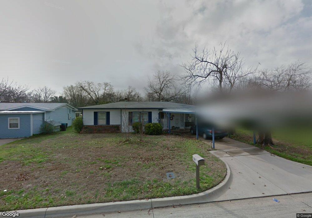
This home is located at 604 Brookfield Dr, Hurst, TX 76053 and is currently estimated at $244,531, approximately $195 per square foot. 604 Brookfield Dr is a home located in Tarrant County with nearby schools including Bellaire Elementary School, Hurst J High School, and L.D. Bell High School.
Ownership History
Date
Name
Owned For
Owner Type
Purchase Details
Closed on
Sep 13, 2001
Sold by
Ragland James D
Bought by
Chitwood Brenda D
Current Estimated Value
Home Financials for this Owner
Home Financials are based on the most recent Mortgage that was taken out on this home.
Original Mortgage
$79,273
Outstanding Balance
$30,664
Interest Rate
6.88%
Mortgage Type
FHA
Estimated Equity
$213,867
Purchase Details
Closed on
Sep 2, 1999
Sold by
Ramsey Marsha F
Bought by
Ungar Charlotte and Ramsey James
Create a Home Valuation Report for This Property
The Home Valuation Report is an in-depth analysis detailing your home's value as well as a comparison with similar homes in the area
Home Values in the Area
Average Home Value in this Area
Purchase History
| Date | Buyer | Sale Price | Title Company |
|---|---|---|---|
| Chitwood Brenda D | -- | Metroplex Title Inc | |
| Ungar Charlotte | -- | -- |
Source: Public Records
Mortgage History
| Date | Status | Borrower | Loan Amount |
|---|---|---|---|
| Open | Chitwood Brenda D | $79,273 |
Source: Public Records
Tax History Compared to Growth
Tax History
| Year | Tax Paid | Tax Assessment Tax Assessment Total Assessment is a certain percentage of the fair market value that is determined by local assessors to be the total taxable value of land and additions on the property. | Land | Improvement |
|---|---|---|---|---|
| 2025 | $426 | $214,218 | $50,000 | $164,218 |
| 2024 | $426 | $214,218 | $50,000 | $164,218 |
| 2023 | $3,234 | $192,456 | $35,000 | $157,456 |
| 2022 | $3,379 | $189,974 | $35,000 | $154,974 |
| 2021 | $3,217 | $182,400 | $35,000 | $147,400 |
| 2020 | $2,918 | $144,103 | $35,000 | $109,103 |
| 2019 | $2,698 | $145,132 | $35,000 | $110,132 |
| 2018 | $795 | $100,224 | $15,000 | $85,224 |
| 2017 | $2,306 | $100,202 | $15,000 | $85,202 |
| 2016 | $2,096 | $93,022 | $15,000 | $78,022 |
| 2015 | $869 | $75,300 | $15,000 | $60,300 |
| 2014 | $869 | $75,300 | $15,000 | $60,300 |
Source: Public Records
Map
Nearby Homes
- 712 Brookfield Dr
- 704 Tanglewood Dr
- 720 Tanglewood Dr
- 212 E Ellen Ave
- 716 E Pecan St Unit 716 - 722
- 1501 Woodridge Cir
- 508 Oak Park Dr
- 1407 Woodridge Cir
- 1302 Woodridge Cir
- 260 Corinna Ct
- 120 Donald Dr
- 205 Corinna Ct
- 812 Forest Hollow Dr
- 1309 Driftwood Dr
- 644 Caduceus Ln
- 552 Norwood Dr
- 1200 Tanglewood Trail
- 120 Charlene Dr
- 624 Harrison Ln
- 3216 Jetranger Rd
- 608 Brookfield Dr
- 600 Brookfield Dr
- 612 Brookfield Dr
- 512 Brookfield Dr
- 603 Bluebonnet Dr
- 607 Bluebonnet Dr
- 601 Bluebonnet Dr
- 616 Brookfield Dr
- 508 Brookfield Dr
- 611 Bluebonnet Dr
- 511 Bluebonnet Dr
- 603 Brookfield Dr
- 601 Brookfield Dr
- 607 Brookfield Dr
- 615 Bluebonnet Dr
- 507 Bluebonnet Dr
- 511 Brookfield Dr
- 504 Brookfield Dr
- 620 Brookfield Dr
- 611 Brookfield Dr