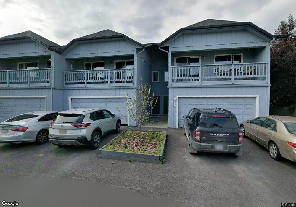
604 King Arthur Cir Unit I06 Anchorage, AK 99518
Taku-Campbell NeighborhoodEstimated Value: $313,461 - $323,000
3
Beds
2
Baths
1,438
Sq Ft
$221/Sq Ft
Est. Value
About This Home
This home is located at 604 King Arthur Cir Unit I06, Anchorage, AK 99518 and is currently estimated at $318,231, approximately $221 per square foot. 604 King Arthur Cir Unit I06 is a home located in Anchorage Municipality with nearby schools including Taku Elementary School, Romig Middle School, and West High School.
Ownership History
Date
Name
Owned For
Owner Type
Purchase Details
Closed on
Jun 18, 2010
Sold by
Buchanan James E and Buchanan Jo Ann
Bought by
Nguyen Gary C
Current Estimated Value
Home Financials for this Owner
Home Financials are based on the most recent Mortgage that was taken out on this home.
Original Mortgage
$195,369
Outstanding Balance
$131,065
Interest Rate
4.99%
Mortgage Type
FHA
Estimated Equity
$187,166
Create a Home Valuation Report for This Property
The Home Valuation Report is an in-depth analysis detailing your home's value as well as a comparison with similar homes in the area
Home Values in the Area
Average Home Value in this Area
Purchase History
| Date | Buyer | Sale Price | Title Company |
|---|---|---|---|
| Nguyen Gary C | -- | Atga |
Source: Public Records
Mortgage History
| Date | Status | Borrower | Loan Amount |
|---|---|---|---|
| Open | Nguyen Gary C | $195,369 |
Source: Public Records
Tax History Compared to Growth
Tax History
| Year | Tax Paid | Tax Assessment Tax Assessment Total Assessment is a certain percentage of the fair market value that is determined by local assessors to be the total taxable value of land and additions on the property. | Land | Improvement |
|---|---|---|---|---|
| 2025 | $315 | $286,800 | -- | $286,800 |
| 2024 | $315 | $244,500 | $0 | $244,500 |
| 2023 | $3,951 | $232,000 | $0 | $232,000 |
| 2022 | $369 | $214,900 | $0 | $214,900 |
| 2021 | $3,898 | $216,300 | $0 | $216,300 |
| 2020 | $2,894 | $213,100 | $0 | $213,100 |
| 2019 | $2,714 | $207,400 | $0 | $207,400 |
| 2018 | $2,779 | $211,800 | $0 | $211,800 |
| 2017 | $2,982 | $210,400 | $0 | $210,400 |
| 2016 | $2,490 | $191,200 | $0 | $191,200 |
| 2015 | $2,490 | $212,200 | $0 | $212,200 |
| 2014 | $2,490 | $197,500 | $0 | $197,500 |
Source: Public Records
Map
Nearby Homes
- 6942 Briar Loop Unit 34
- 601 King Arthur Cir Unit H08
- 720 Bridgestone Ct Unit 16
- 607 Copperbush Ct Unit 607
- 302 Sweetgale Ct Unit 302
- 501 Nathan Dr Unit 5
- 7827 Old Seward Hwy
- 6348 Fairweather Dr Unit 3
- 6536 Fairweather Dr Unit 613
- 6290 Fairweather Dr Unit 36
- 7441 Glade Place
- 7446 Nathan Dr
- 1250 E 70th Ave
- 6405 Old Seward Hwy
- 7602 Lumbis Ave Unit A2
- 7232 Foxridge Cir Unit 9A
- 7242 Foxridge Cir Unit 10D
- 311 Lynnwood Dr Unit 4
- 7331 Huntsmen Cir Unit 20F
- 7311 Huntsmen Cir Unit 22F
- 612 King Arthur Cir Unit I04
- 600 King Arthur Cir
- 624 King Arthur Cir
- 612 King Arthur Cir Unit 4I
- 600 King Arthur Cir Unit I07
- 624 King Arthur Cir Unit 1
- 620 King Arthur Cir Unit 2
- 608 King Arthur Cir Unit I 05
- 612 King Arthur Cir Unit 14
- 600 King Arthur Cir Unit 7
- 616 King Arthur Cir Unit I-03
- 608 King Arthur Cir
- 600 King Arthur Cir Unit 107
- 612 King Arthur Cir Unit I4
- 604 King Arthur Cir Unit 6
- 608 King Arthur Cir Unit 5
- 6930 Briar Loop Unit 62
- 6936 Briar Loop Unit 60
- 6938 Briar Loop Unit 59
- 6924 Briar Loop Unit 64