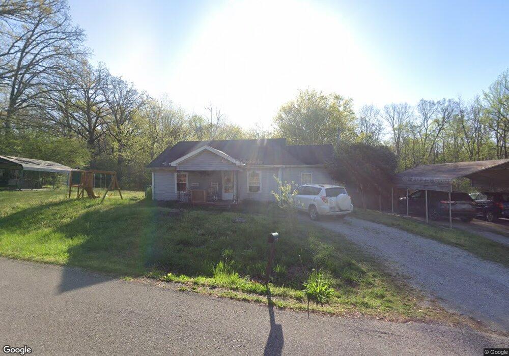
604 N Forrest Ave Camden, TN 38320
Estimated Value: $104,081 - $199,000
--
Bed
1
Bath
1,024
Sq Ft
$135/Sq Ft
Est. Value
About This Home
This home is located at 604 N Forrest Ave, Camden, TN 38320 and is currently estimated at $137,770, approximately $134 per square foot. 604 N Forrest Ave is a home located in Benton County with nearby schools including Camden Elementary School, Briarwood School, and Camden Junior High School.
Ownership History
Date
Name
Owned For
Owner Type
Purchase Details
Closed on
Jul 16, 2008
Sold by
Allen Anthony
Bought by
Allen Anthony
Current Estimated Value
Purchase Details
Closed on
Feb 3, 1998
Sold by
Wheatley Raymond N Heirs
Bought by
Surrett Ruth
Purchase Details
Closed on
Nov 19, 1997
Bought by
Surrett Ruth
Purchase Details
Closed on
Oct 27, 1947
Bought by
Wheatley Raymond N Heirs
Create a Home Valuation Report for This Property
The Home Valuation Report is an in-depth analysis detailing your home's value as well as a comparison with similar homes in the area
Home Values in the Area
Average Home Value in this Area
Purchase History
| Date | Buyer | Sale Price | Title Company |
|---|---|---|---|
| Allen Anthony | -- | -- | |
| Surrett Ruth | -- | -- | |
| Surrett Ruth | -- | -- | |
| Wheatley Raymond N Heirs | -- | -- | |
| Allen Anthony | -- | -- |
Source: Public Records
Tax History Compared to Growth
Tax History
| Year | Tax Paid | Tax Assessment Tax Assessment Total Assessment is a certain percentage of the fair market value that is determined by local assessors to be the total taxable value of land and additions on the property. | Land | Improvement |
|---|---|---|---|---|
| 2025 | $630 | $24,050 | $0 | $0 |
| 2024 | $630 | $17,200 | $3,500 | $13,700 |
| 2023 | $630 | $17,200 | $3,500 | $13,700 |
| 2022 | $630 | $17,200 | $3,500 | $13,700 |
| 2021 | $630 | $17,200 | $3,500 | $13,700 |
| 2020 | $631 | $17,200 | $3,500 | $13,700 |
| 2019 | $575 | $14,550 | $3,500 | $11,050 |
| 2018 | $575 | $14,550 | $3,500 | $11,050 |
| 2017 | $577 | $14,600 | $3,500 | $11,100 |
| 2016 | $577 | $14,600 | $3,500 | $11,100 |
| 2015 | $583 | $14,600 | $3,500 | $11,100 |
| 2014 | $537 | $14,600 | $3,500 | $11,100 |
| 2013 | $537 | $13,629 | $0 | $0 |
Source: Public Records
Map
Nearby Homes
- 215 Woodside St
- 0 Forrest Ave N
- 121 Davidson St
- 0 George St
- 876 Flatwoods Rd
- 186 N Forrest Ave
- 90 Wren Ave
- 1762 Washington Ave
- 0 Higdon Ck Rd Unit RTC2993447
- 197 Stigall St
- 510 Longview St
- 00 Flatwoods Rd
- 222 Stigall St
- 130 Mimosa St
- 0 Longview St
- 116 Magnolia St
- 136 N Forrest Ave
- 116 N Church Ave
- 121 Washington Ave
- 148 E Lake St
- 602 N Forrest Ave
- 110 Rowsey St
- 151 Rowsey St
- 593 N Forrest Ave
- 614 N Forrest Ave
- 105 Rowsey St
- 103 Rowsey St
- 114 Rowsey St
- 101 Rowsey St
- 116 Rowsey St
- 118 Rowsey St
- 222 Mockingbird Ln
- 620 N Forrest Ave
- 220 Mockingbird Ln
- 218 Mockingbird Ln
- 216 Mockingbird Ln
- 128 Rowsey St
- 212 Mockingbird Ln
- 631 Wren Ave
- 615 Wren Ave