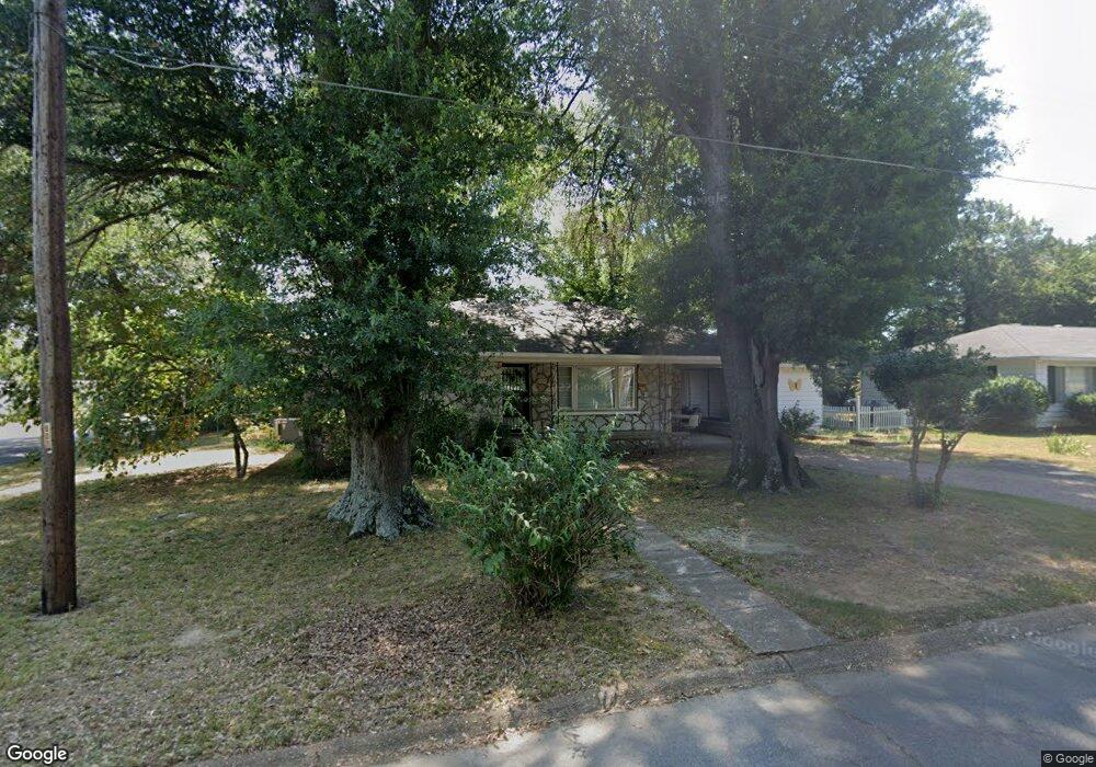
604 N Hussey St Searcy, AR 72143
Estimated Value: $106,000 - $121,000
--
Bed
1
Bath
1,158
Sq Ft
$97/Sq Ft
Est. Value
About This Home
This home is located at 604 N Hussey St, Searcy, AR 72143 and is currently estimated at $112,833, approximately $97 per square foot. 604 N Hussey St is a home located in White County with nearby schools including Sidney Deener Elementary School, Southwest Middle School, and Ahlf Junior High School.
Ownership History
Date
Name
Owned For
Owner Type
Purchase Details
Closed on
Oct 20, 2020
Sold by
Resurrection Rentals Llc
Bought by
Singleton Jonathan and Singleton Julia
Current Estimated Value
Home Financials for this Owner
Home Financials are based on the most recent Mortgage that was taken out on this home.
Original Mortgage
$63,650
Outstanding Balance
$45,649
Interest Rate
2.8%
Mortgage Type
New Conventional
Estimated Equity
$67,184
Purchase Details
Closed on
May 27, 2008
Sold by
Rogers Alyce
Bought by
Pugh Paula and Pugh Jamesd
Home Financials for this Owner
Home Financials are based on the most recent Mortgage that was taken out on this home.
Original Mortgage
$20,000
Interest Rate
5.89%
Mortgage Type
Future Advance Clause Open End Mortgage
Purchase Details
Closed on
Nov 1, 1990
Bought by
Rogers Vernon E
Create a Home Valuation Report for This Property
The Home Valuation Report is an in-depth analysis detailing your home's value as well as a comparison with similar homes in the area
Home Values in the Area
Average Home Value in this Area
Purchase History
| Date | Buyer | Sale Price | Title Company |
|---|---|---|---|
| Singleton Jonathan | $67,000 | Dalco Closing & Title | |
| Pugh Paula | $60,000 | -- | |
| Rogers Vernon E | $41,000 | -- |
Source: Public Records
Mortgage History
| Date | Status | Borrower | Loan Amount |
|---|---|---|---|
| Open | Singleton Jonathan | $63,650 | |
| Previous Owner | Pugh Paula | $20,000 |
Source: Public Records
Tax History Compared to Growth
Tax History
| Year | Tax Paid | Tax Assessment Tax Assessment Total Assessment is a certain percentage of the fair market value that is determined by local assessors to be the total taxable value of land and additions on the property. | Land | Improvement |
|---|---|---|---|---|
| 2025 | $573 | $14,110 | $1,400 | $12,710 |
| 2024 | $573 | $14,110 | $1,400 | $12,710 |
| 2023 | $148 | $14,110 | $1,400 | $12,710 |
| 2022 | $198 | $14,110 | $1,400 | $12,710 |
| 2021 | $198 | $14,110 | $1,400 | $12,710 |
| 2020 | $31 | $9,990 | $1,350 | $8,640 |
| 2019 | $406 | $9,990 | $1,350 | $8,640 |
| 2018 | $406 | $9,990 | $1,350 | $8,640 |
| 2017 | $406 | $9,990 | $1,350 | $8,640 |
| 2016 | $406 | $9,990 | $1,350 | $8,640 |
| 2015 | $489 | $12,050 | $2,300 | $9,750 |
| 2014 | $489 | $12,050 | $2,300 | $9,750 |
Source: Public Records
Map
Nearby Homes
- 508 and 510 N Oak St
- 306 E Center Ave
- 902 N Cedar St
- 600 E Park Ave
- 1004 Cedar St
- 1409 E Moore Ave
- 1405 Hillcrest Dr
- 300 W Pleasure Ave
- 709 Melody Ln
- 205 W Woodruff Ave
- 506 N Pecan St
- 506 W Pleasure Ave
- 102 Lelia Ln
- 103 Lelia Ln
- 501 N Maple St
- 800 Merritt St
- 601 N Hickory St
- 71 Mohawk Dr
- 1200 Maple
- 1402 Forrest Dr