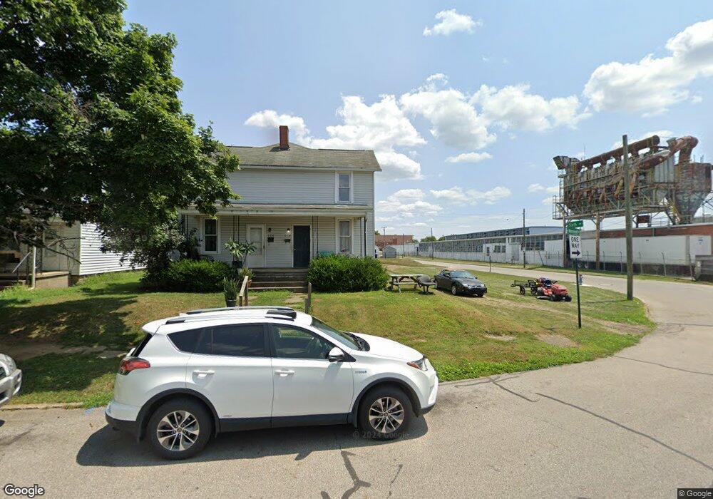
604 N Roosevelt Ave Lancaster, OH 43130
Estimated Value: $130,000 - $147,397
2
Beds
1
Bath
2,145
Sq Ft
$65/Sq Ft
Est. Value
About This Home
This home is located at 604 N Roosevelt Ave, Lancaster, OH 43130 and is currently estimated at $138,849, approximately $64 per square foot. 604 N Roosevelt Ave is a home located in Fairfield County with nearby schools including General Sherman Junior High School, Lancaster High School, and St Mary Elementary School.
Ownership History
Date
Name
Owned For
Owner Type
Purchase Details
Closed on
Feb 2, 2007
Sold by
Hazelwood Shelley Jean
Bought by
Miller Donald W and Miller Robert W
Current Estimated Value
Purchase Details
Closed on
Oct 17, 2005
Sold by
Wolfe Shirley J
Bought by
Hazelwood Shelley Jean
Purchase Details
Closed on
Dec 16, 1992
Sold by
Fricker Robert Leroy
Bought by
Wolfe Lewis C
Create a Home Valuation Report for This Property
The Home Valuation Report is an in-depth analysis detailing your home's value as well as a comparison with similar homes in the area
Home Values in the Area
Average Home Value in this Area
Purchase History
| Date | Buyer | Sale Price | Title Company |
|---|---|---|---|
| Miller Donald W | $60,000 | Attorney | |
| Hazelwood Shelley Jean | -- | -- | |
| Wolfe Shirley J | -- | -- | |
| Wolfe Lewis C | $30,500 | -- |
Source: Public Records
Tax History Compared to Growth
Tax History
| Year | Tax Paid | Tax Assessment Tax Assessment Total Assessment is a certain percentage of the fair market value that is determined by local assessors to be the total taxable value of land and additions on the property. | Land | Improvement |
|---|---|---|---|---|
| 2024 | $3,423 | $38,070 | $5,820 | $32,250 |
| 2023 | $1,450 | $38,070 | $5,820 | $32,250 |
| 2022 | $1,454 | $38,070 | $5,820 | $32,250 |
| 2021 | $1,160 | $28,310 | $5,820 | $22,490 |
| 2020 | $1,114 | $28,310 | $5,820 | $22,490 |
| 2019 | $1,062 | $28,310 | $5,820 | $22,490 |
| 2018 | $1,042 | $30,920 | $5,820 | $25,100 |
| 2017 | $1,043 | $26,900 | $5,820 | $21,080 |
| 2016 | $1,016 | $26,900 | $5,820 | $21,080 |
| 2015 | $1,041 | $27,010 | $5,820 | $21,190 |
| 2014 | $993 | $27,010 | $5,820 | $21,190 |
| 2013 | $993 | $27,010 | $5,820 | $21,190 |
Source: Public Records
Map
Nearby Homes
- 401 Busby Ave
- 1422 Graylock St
- 404 Garfield Ave
- 1628 W Fair Ave
- 429 Harrison Ave
- 628 Harrison Ave
- 844 Washington Ave
- 943 Garfield Ave
- 941 Beacon St
- 317 Harrison Ave
- 140 Sherman Ave
- 664 N Shoshone Dr
- 136 Sherman Ave
- 132 N Pierce Ave
- 936 Harrison Ave
- 461 N Shoshone Dr
- 1511 Cedar Hill Rd
- 1318 Cedar Hill Rd
- 530 W 6th Ave
- 1000 Goodwin Ave
- 610 N Roosevelt Ave
- 612 N Roosevelt Ave
- 618 N Roosevelt Ave
- 603 Mckinley Ave
- 609 Mckinley Ave
- 601 Mckinley Ave
- 611 Mckinley Ave
- 617 Mckinley Ave
- 620 N Roosevelt Ave
- 619 Mckinley Ave
- 619 N Roosevelt Ave
- 624 N Roosevelt Ave
- 621 Mckinley Ave
- 623 Mckinley Ave
- 632 N Roosevelt Ave
- 621 N Roosevelt Ave
- 625 Mckinley Ave
- 636 N Roosevelt Ave
- 625 Mc Kinley Ave
- 635 N Roosevelt Ave