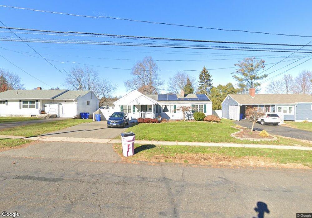
604 Nott St Wethersfield, CT 06109
Estimated Value: $313,000 - $346,000
3
Beds
1
Bath
1,341
Sq Ft
$248/Sq Ft
Est. Value
About This Home
This home is located at 604 Nott St, Wethersfield, CT 06109 and is currently estimated at $333,226, approximately $248 per square foot. 604 Nott St is a home located in Hartford County with nearby schools including Emerson-Williams School, Silas Deane Middle School, and Wethersfield High School.
Create a Home Valuation Report for This Property
The Home Valuation Report is an in-depth analysis detailing your home's value as well as a comparison with similar homes in the area
Home Values in the Area
Average Home Value in this Area
Tax History
| Year | Tax Paid | Tax Assessment Tax Assessment Total Assessment is a certain percentage of the fair market value that is determined by local assessors to be the total taxable value of land and additions on the property. | Land | Improvement |
|---|---|---|---|---|
| 2025 | $8,023 | $194,640 | $69,970 | $124,670 |
| 2024 | $5,577 | $129,030 | $61,600 | $67,430 |
| 2023 | $5,391 | $129,030 | $61,600 | $67,430 |
| 2022 | $5,301 | $129,030 | $61,600 | $67,430 |
| 2021 | $5,248 | $129,030 | $61,600 | $67,430 |
| 2020 | $5,250 | $129,030 | $61,600 | $67,430 |
| 2019 | $5,257 | $129,030 | $61,600 | $67,430 |
| 2018 | $5,770 | $141,500 | $59,000 | $82,500 |
| 2017 | $5,627 | $141,500 | $59,000 | $82,500 |
| 2016 | $5,453 | $141,500 | $59,000 | $82,500 |
| 2015 | $5,396 | $141,300 | $59,000 | $82,300 |
| 2014 | $5,191 | $141,300 | $59,000 | $82,300 |
Source: Public Records
Map
Nearby Homes
- 55 Rutledge Rd
- 144 Brown St
- 295 Ridge Rd Unit 8
- 1 Bristol St
- 19 Albert Ave
- 1 Brussels Ave
- 273 Forest Dr
- 173 Timber Trail
- 63 Wells Farm Dr
- 20 Forest Dr
- 192 Wolcott Hill Rd
- 129 Goff Rd
- 764 Ridge Rd
- 219-221 Jordan Ln
- 62 Schoolhouse Crossing
- 15 Potter Crossing
- 23 Hillcrest Ave
- 25 Tinsmith Crossing
- 158 Dix Rd
- 146 Dudley Rd
Your Personal Tour Guide
Ask me questions while you tour the home.